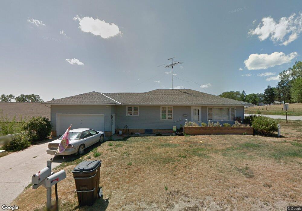
215 Jones St Winside, NE 68790
Estimated Value: $151,000 - $186,291
3
Beds
1
Bath
1,395
Sq Ft
$122/Sq Ft
Est. Value
About This Home
This home is located at 215 Jones St, Winside, NE 68790 and is currently estimated at $169,823, approximately $121 per square foot. 215 Jones St is a home located in Wayne County with nearby schools including Winside Elementary School and Winside High School.
Ownership History
Date
Name
Owned For
Owner Type
Purchase Details
Closed on
Mar 6, 2008
Sold by
Troutman Dorothy and Troutman Darrell C
Bought by
Gubbels Marshawn and Gubbels James F
Current Estimated Value
Home Financials for this Owner
Home Financials are based on the most recent Mortgage that was taken out on this home.
Original Mortgage
$76,050
Outstanding Balance
$47,327
Interest Rate
5.72%
Mortgage Type
New Conventional
Estimated Equity
$122,496
Create a Home Valuation Report for This Property
The Home Valuation Report is an in-depth analysis detailing your home's value as well as a comparison with similar homes in the area
Purchase History
| Date | Buyer | Sale Price | Title Company |
|---|---|---|---|
| Gubbels Marshawn | $85,000 | -- |
Source: Public Records
Mortgage History
| Date | Status | Borrower | Loan Amount |
|---|---|---|---|
| Open | Gubbels Marshawn | $76,050 |
Source: Public Records
Tax History
| Year | Tax Paid | Tax Assessment Tax Assessment Total Assessment is a certain percentage of the fair market value that is determined by local assessors to be the total taxable value of land and additions on the property. | Land | Improvement |
|---|---|---|---|---|
| 2025 | $1,786 | $156,450 | $7,500 | $148,950 |
| 2024 | $1,786 | $139,660 | $4,455 | $135,205 |
| 2023 | $2,234 | $131,705 | $4,455 | $127,250 |
| 2022 | $2,227 | $123,755 | $4,455 | $119,300 |
| 2021 | $1,960 | $107,845 | $4,455 | $103,390 |
| 2020 | $1,712 | $97,180 | $4,455 | $92,725 |
| 2019 | $1,572 | $91,910 | $4,455 | $87,455 |
| 2018 | $1,442 | $91,910 | $4,455 | $87,455 |
| 2017 | $1,474 | $86,000 | $4,455 | $81,545 |
| 2016 | $1,482 | $0 | $0 | $0 |
| 2015 | $1,499 | $86,000 | $4,455 | $81,545 |
| 2014 | -- | $80,930 | $4,455 | $76,475 |
| 2013 | -- | $81,515 | $4,455 | $77,060 |
Source: Public Records
Map
Nearby Homes
Your Personal Tour Guide
Ask me questions while you tour the home.