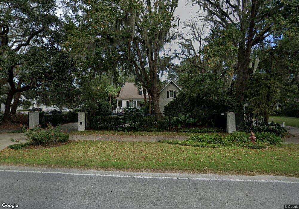
215 Kings Way Saint Simons Island, GA 31522
Estimated Value: $1,408,000 - $1,903,000
4
Beds
4
Baths
2,963
Sq Ft
$550/Sq Ft
Est. Value
About This Home
This home is located at 215 Kings Way, Saint Simons Island, GA 31522 and is currently estimated at $1,630,179, approximately $550 per square foot. 215 Kings Way is a home located in Glynn County with nearby schools including St. Simons Elementary School, Glynn Middle School, and Glynn Academy.
Ownership History
Date
Name
Owned For
Owner Type
Purchase Details
Closed on
Sep 20, 2006
Sold by
Bluestein Inc
Bought by
St Simons Presbyterian Church
Current Estimated Value
Purchase Details
Closed on
Feb 28, 2006
Sold by
Stewart George H
Bought by
Duncan M Sean and Duncan Jeffri B
Purchase Details
Closed on
Jan 10, 2006
Sold by
Stewart George H
Bought by
Bluestein Inc
Create a Home Valuation Report for This Property
The Home Valuation Report is an in-depth analysis detailing your home's value as well as a comparison with similar homes in the area
Home Values in the Area
Average Home Value in this Area
Purchase History
| Date | Buyer | Sale Price | Title Company |
|---|---|---|---|
| St Simons Presbyterian Church | $490,000 | -- | |
| Duncan M Sean | $400,000 | -- | |
| Bluestein Inc | $380,000 | -- |
Source: Public Records
Tax History Compared to Growth
Tax History
| Year | Tax Paid | Tax Assessment Tax Assessment Total Assessment is a certain percentage of the fair market value that is determined by local assessors to be the total taxable value of land and additions on the property. | Land | Improvement |
|---|---|---|---|---|
| 2025 | $12,629 | $503,560 | $141,000 | $362,560 |
| 2024 | $12,411 | $494,880 | $141,000 | $353,880 |
| 2023 | $12,286 | $494,880 | $141,000 | $353,880 |
| 2022 | $10,273 | $404,640 | $118,440 | $286,200 |
| 2021 | $7,321 | $278,280 | $118,440 | $159,840 |
| 2020 | $7,391 | $278,280 | $118,440 | $159,840 |
| 2019 | $7,060 | $265,600 | $105,760 | $159,840 |
| 2018 | $6,935 | $265,600 | $105,760 | $159,840 |
| 2017 | $6,935 | $265,600 | $105,760 | $159,840 |
| 2016 | $5,309 | $221,200 | $47,960 | $173,240 |
| 2015 | $4,098 | $170,040 | $47,960 | $122,080 |
| 2014 | $4,098 | $170,040 | $47,960 | $122,080 |
Source: Public Records
Map
Nearby Homes
- 213 Magnolia Ave
- 533 Timmons St
- 536 Delegal St
- 1044 Village Oaks Ln
- 1060 Village Oaks Ln
- 1035 Village Oaks Ln
- 425 Magnolia Ave Unit C
- 416 Magnolia Ave
- 424 Magnolia Ave Unit 6
- 805 Mallery St Unit E
- 400 Ocean Blvd Unit 2207
- 400 Ocean Blvd Unit 2100
- 400 Ocean Blvd Unit 2307
- 400 Ocean Blvd Unit 2306
- 800 Mallery St Unit 52
- 800 Mallery St Unit 90
- 800 Mallery St Unit C-30
- 800 Mallery St Unit J-89
- 413 Ashantilly Ave
- 119 Florence St
- 217 Kingsway
- 217 Kings Way
- LOT 72 Delegal Dr
- 74 Delegal Dr
- lot 10 Delegal
- 212 Magnolia Ave
- 220 Magnolia Ave
- 216 Magnolia Ave
- 224 Magnolia Ave
- 224 Magnolia Ave
- 228 Magnolia Ave
- 223 Kings Way
- 225 Kings Way
- 218 Kings Way
- 217 Magnolia Ave
- Site 35 Timmons Dr
- Site 29 Timmons Dr
- Site 35 Timmon Dr
- 221 Magnolia Ave
- 220 Kings Way