Estimated Value: $270,000 - $287,000
3
Beds
2
Baths
1,760
Sq Ft
$158/Sq Ft
Est. Value
About This Home
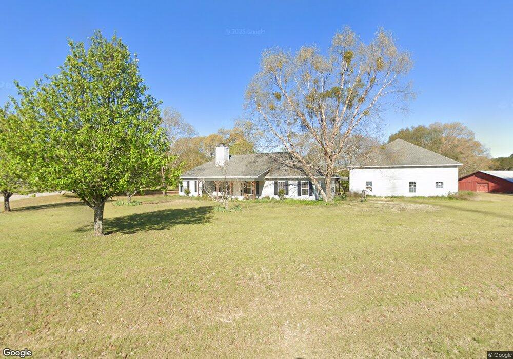
This home is located at 215 Lillian Dr, Byron, GA 31008 and is currently estimated at $277,287, approximately $157 per square foot. 215 Lillian Dr is a home located in Peach County with nearby schools including Kay Road Elementary School, Fort Valley Middle School, and Peach County High School.
Ownership History
Date
Name
Owned For
Owner Type
Purchase Details
Closed on
Nov 22, 2002
Sold by
Y & Y Enterprises Inc Dba Cent
Bought by
Clements Ronald Owen and Clements Elsie
Current Estimated Value
Purchase Details
Closed on
Aug 28, 2002
Sold by
Lake Francisco Plaza Inc Dba
Bought by
Y & Y Enterprises Inc Dba Centurion
Purchase Details
Closed on
Oct 26, 2000
Sold by
English John Alva Etal
Bought by
Lake Francisco Plaza Inc Dba
Purchase Details
Closed on
Dec 30, 1998
Sold by
Powersville Land
Bought by
English John Alva Etal
Purchase Details
Closed on
Apr 13, 1995
Bought by
Powersville Land Development Co
Create a Home Valuation Report for This Property
The Home Valuation Report is an in-depth analysis detailing your home's value as well as a comparison with similar homes in the area
Home Values in the Area
Average Home Value in this Area
Purchase History
| Date | Buyer | Sale Price | Title Company |
|---|---|---|---|
| Clements Ronald Owen | $112,500 | -- | |
| Y & Y Enterprises Inc Dba Centurion | -- | -- | |
| Lake Francisco Plaza Inc Dba | -- | -- | |
| English John Alva Etal | -- | -- | |
| Powersville Land Development Co | -- | -- |
Source: Public Records
Tax History Compared to Growth
Tax History
| Year | Tax Paid | Tax Assessment Tax Assessment Total Assessment is a certain percentage of the fair market value that is determined by local assessors to be the total taxable value of land and additions on the property. | Land | Improvement |
|---|---|---|---|---|
| 2025 | $2,028 | $74,360 | $10,160 | $64,200 |
| 2024 | $2,085 | $72,480 | $10,480 | $62,000 |
| 2023 | $2,136 | $73,760 | $10,480 | $63,280 |
| 2022 | $1,846 | $63,000 | $10,480 | $52,520 |
| 2021 | $1,841 | $54,440 | $10,480 | $43,960 |
| 2020 | $2,045 | $60,960 | $10,480 | $50,480 |
| 2019 | $1,994 | $59,040 | $10,480 | $48,560 |
| 2018 | $2,003 | $59,040 | $10,480 | $48,560 |
| 2017 | $2,012 | $59,040 | $10,480 | $48,560 |
| 2016 | $2,004 | $59,040 | $10,480 | $48,560 |
| 2015 | $2,007 | $59,040 | $10,480 | $48,560 |
| 2014 | $2,010 | $59,040 | $10,480 | $48,560 |
| 2013 | -- | $59,040 | $10,480 | $48,560 |
Source: Public Records
Map
Nearby Homes
- 39 English Ct
- 161 Rowland Cir
- 0 Barker Rd Unit 243030
- 0 Barker Rd Unit 14258525
- 0 Barker Rd Unit 175053
- 107 Red Tail Cir
- 109 Red Tail Cir
- 119 Early Dr
- 115 Early Dr
- 211 Serenity Ct
- Lot 6 Trojan Way
- Lot 2 Trojan Way
- Lot 5 Trojan Way
- 81 Idell Ct
- Lot 1 Trojan Way
- 19C Crown Ct
- 510 Southland Trail
- 3355 Housers Mill Rd
- 538 Southland Trail
- 408 Dixieland Dr