Estimated Value: $325,000 - $370,000
5
Beds
3
Baths
3,086
Sq Ft
$111/Sq Ft
Est. Value
About This Home
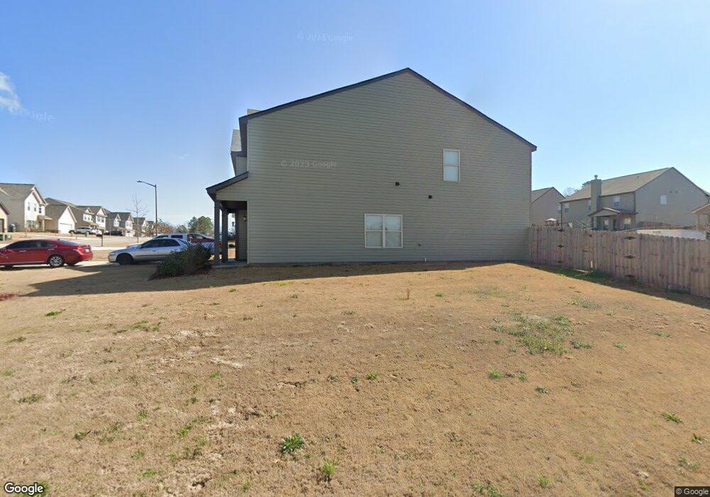
This home is located at 215 Longbridge Way Unit 65-Everest, Perry, GA 31069 and is currently estimated at $341,425, approximately $110 per square foot. 215 Longbridge Way Unit 65-Everest is a home located in Houston County with nearby schools including Morningside Elementary School, Perry Middle School, and Perry High School.
Ownership History
Date
Name
Owned For
Owner Type
Purchase Details
Closed on
Jan 8, 2021
Sold by
Stanley Jeremy D
Bought by
Rivera Ivan M and Rivera Jeanette
Current Estimated Value
Home Financials for this Owner
Home Financials are based on the most recent Mortgage that was taken out on this home.
Original Mortgage
$236,000
Outstanding Balance
$209,140
Interest Rate
2.7%
Mortgage Type
VA
Estimated Equity
$132,285
Purchase Details
Closed on
Jun 12, 2020
Sold by
Ameris Bank
Bought by
Builders Professional Group Llc
Purchase Details
Closed on
Dec 13, 2019
Sold by
Builders Professional Group Llc
Bought by
Stanley Jeremy D
Home Financials for this Owner
Home Financials are based on the most recent Mortgage that was taken out on this home.
Original Mortgage
$225,834
Interest Rate
3.7%
Mortgage Type
FHA
Create a Home Valuation Report for This Property
The Home Valuation Report is an in-depth analysis detailing your home's value as well as a comparison with similar homes in the area
Home Values in the Area
Average Home Value in this Area
Purchase History
| Date | Buyer | Sale Price | Title Company |
|---|---|---|---|
| Rivera Ivan M | $236,000 | None Available | |
| Builders Professional Group Llc | -- | None Listed On Document | |
| Stanley Jeremy D | $230,000 | None Available |
Source: Public Records
Mortgage History
| Date | Status | Borrower | Loan Amount |
|---|---|---|---|
| Open | Rivera Ivan M | $236,000 | |
| Previous Owner | Stanley Jeremy D | $225,834 |
Source: Public Records
Tax History Compared to Growth
Tax History
| Year | Tax Paid | Tax Assessment Tax Assessment Total Assessment is a certain percentage of the fair market value that is determined by local assessors to be the total taxable value of land and additions on the property. | Land | Improvement |
|---|---|---|---|---|
| 2024 | $4,634 | $126,120 | $8,000 | $118,120 |
| 2023 | $4,087 | $110,480 | $8,000 | $102,480 |
| 2022 | $2,171 | $99,560 | $8,000 | $91,560 |
| 2021 | $2,161 | $95,480 | $8,000 | $87,480 |
| 2020 | $2,075 | $91,320 | $8,000 | $83,320 |
| 2019 | $126 | $5,440 | $5,440 | $0 |
| 2018 | $93 | $5,440 | $5,440 | $0 |
| 2017 | $95 | $4,080 | $4,080 | $0 |
| 2016 | $95 | $4,080 | $4,080 | $0 |
| 2015 | $95 | $4,080 | $4,080 | $0 |
| 2014 | -- | $4,080 | $4,080 | $0 |
| 2013 | -- | $6,000 | $6,000 | $0 |
Source: Public Records
Map
Nearby Homes
- 118 Farmers Way
- 311 Rusty Plow Ln Unit 16
- 307 Rusty Plow Ln
- 104 Red Barn Ct
- 102 Kanza Trail
- 307 Rusty Plow Ln Unit 14
- 108 Christine Cir
- 107 Lighterknot Trail
- 106 Raspberry Trail
- 500 Legacy Park Dr
- 110 Gwendolyn Ave
- 204 Susanne's Retreat
- 1008 Ridge Cir S
- 412 Legacy Park Dr
- 2111 N Us Hwy 41
- 0 Perimeter Roads Unit 20145464
- 309 Charles Gray Blvd
- 314 Waxmyrtle Way
- 0 Perimeter Rd Unit 236479
- 0 Perimeter Rd Unit 20145467
- 215 Longbridge Way
- 215 Longbridge Way Unit 65-EverestII
- 213 Longbridge Way
- 213 Longbridge Way Unit 67-Patriot
- 213 Longbridge Way Unit 86-Patriot
- 214 Tyndall Way Unit 66-Everest II
- 211 Longbridge Way
- 211 Longbridge Way Unit 69-EverestII
- 211 Longbridge Way Unit 69-Everest
- 301 Longbridge Way Unit 39-Everest II
- 212 Tyndall Way Unit 72-Everest III
- 212 Tyndall Way Unit 68-EverestIII
- 300 Tyndall Way Unit 40-Layla
- 214 Longbridge Way Unit 82-EverestII
- 214 Longbridge Way Unit 82-Everest
- 210 Tyndall Way Unit 70-Westin
- 212 Longbridge Way Unit 84-Kendall I
- 212 Longbridge Way
- 212 Longbridge Way Unit 84- Kendall
- 209 Longbridge Way Unit 71-Westin