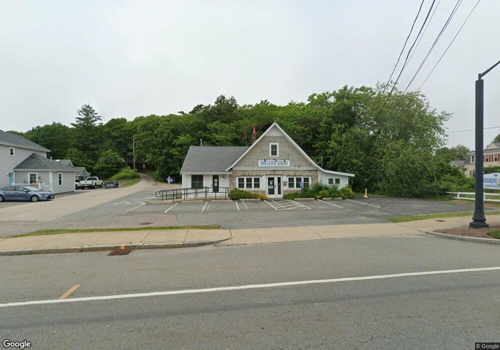
215 Main St Bourne, MA 2532
Buzzards Bay NeighborhoodEstimated Value: $574,109
--
Bed
--
Bath
1,794
Sq Ft
$320/Sq Ft
Est. Value
About This Home
This home is located at 215 Main St, Bourne, MA 2532 and is currently estimated at $574,109, approximately $320 per square foot. 215 Main St is a home located in Barnstable County with nearby schools including Bourne High School and St Margaret Regional School.
Ownership History
Date
Name
Owned For
Owner Type
Purchase Details
Closed on
Sep 6, 2005
Sold by
Mary E Abrahani Lt and Abrahani
Bought by
Saltbox Properties Llc
Current Estimated Value
Home Financials for this Owner
Home Financials are based on the most recent Mortgage that was taken out on this home.
Original Mortgage
$240,000
Interest Rate
5.81%
Mortgage Type
Commercial
Purchase Details
Closed on
Nov 29, 1995
Sold by
Citizens Bk Mass
Bought by
Kaps Rt and Abrahani M S
Purchase Details
Closed on
Nov 18, 1994
Sold by
Balboni Leon H and Judge James C
Bought by
Plymouth 5 Cents Sb
Purchase Details
Closed on
May 18, 1988
Sold by
Delaura Thomas M
Bought by
Balboni Leon H
Home Financials for this Owner
Home Financials are based on the most recent Mortgage that was taken out on this home.
Original Mortgage
$170,000
Interest Rate
10.13%
Mortgage Type
Commercial
Create a Home Valuation Report for This Property
The Home Valuation Report is an in-depth analysis detailing your home's value as well as a comparison with similar homes in the area
Home Values in the Area
Average Home Value in this Area
Purchase History
| Date | Buyer | Sale Price | Title Company |
|---|---|---|---|
| Saltbox Properties Llc | $300,000 | -- | |
| Saltbox Properties Llc | $300,000 | -- | |
| Kaps Rt | $60,000 | -- | |
| Kaps Rt | $60,000 | -- | |
| Plymouth 5 Cents Sb | $80,000 | -- | |
| Plymouth 5 Cents Sb | $80,000 | -- | |
| Balboni Leon H | $170,000 | -- |
Source: Public Records
Mortgage History
| Date | Status | Borrower | Loan Amount |
|---|---|---|---|
| Open | Balboni Leon H | $200,000 | |
| Closed | Saltbox Properties Llc | $240,000 | |
| Previous Owner | Balboni Leon H | $170,000 |
Source: Public Records
Tax History Compared to Growth
Tax History
| Year | Tax Paid | Tax Assessment Tax Assessment Total Assessment is a certain percentage of the fair market value that is determined by local assessors to be the total taxable value of land and additions on the property. | Land | Improvement |
|---|---|---|---|---|
| 2025 | $3,370 | $431,500 | $258,100 | $173,400 |
| 2024 | $3,295 | $410,900 | $245,800 | $165,100 |
| 2023 | $3,480 | $395,000 | $236,300 | $158,700 |
| 2022 | $3,660 | $362,700 | $222,200 | $140,500 |
| 2021 | $3,786 | $351,500 | $215,700 | $135,800 |
| 2020 | $3,709 | $345,300 | $211,500 | $133,800 |
| 2019 | $3,591 | $341,700 | $207,400 | $134,300 |
| 2018 | $3,452 | $327,500 | $199,400 | $128,100 |
| 2017 | $3,214 | $312,000 | $185,800 | $126,200 |
| 2016 | $2,819 | $277,500 | $185,800 | $91,700 |
| 2015 | $2,794 | $277,500 | $185,800 | $91,700 |
Source: Public Records
Map
Nearby Homes
- 46 Holt Rd
- 46 Holt Rd Unit A
- 151 - 153 Main St
- 17 Maple St
- 304 Main St
- 38 Old Bridge Rd
- 34 Washington Ave
- 162 Puritan Rd
- 171 Puritan Rd
- 41 Lewis Point Rd
- 3 Wolf Rd
- 60 Sandwich Rd
- 0 Lewis Point Rd
- 65 Lewis Point Rd
- 90-92 Sandwich Rd Unit 2
- 56 Rip Van Winkle Way
- 44 Cotuit Rd
- 73 Lewis Point Rd
- 4 Knob Ln
- 90-92 Sandwich Rd Unit 9C