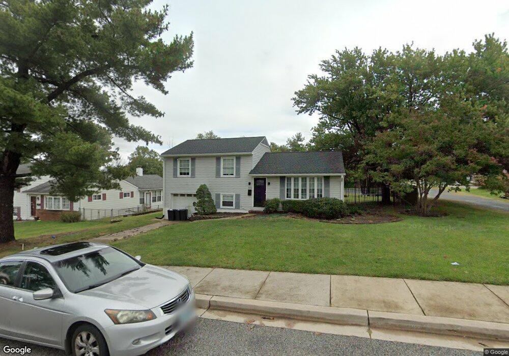
215 Mansion Rd Linthicum Heights, MD 21090
Estimated Value: $405,000 - $443,892
3
Beds
2
Baths
2,232
Sq Ft
$188/Sq Ft
Est. Value
About This Home
This home is located at 215 Mansion Rd, Linthicum Heights, MD 21090 and is currently estimated at $418,723, approximately $187 per square foot. 215 Mansion Rd is a home located in Anne Arundel County with nearby schools including Overlook Elementary School, Lindale Middle School, and North County High School.
Ownership History
Date
Name
Owned For
Owner Type
Purchase Details
Closed on
May 31, 2019
Sold by
Homes For Arundel Inc
Bought by
Homes For Greater Baltimore Lp
Current Estimated Value
Home Financials for this Owner
Home Financials are based on the most recent Mortgage that was taken out on this home.
Original Mortgage
$2,399,015
Outstanding Balance
$2,109,321
Interest Rate
4.1%
Mortgage Type
Construction
Estimated Equity
-$1,690,598
Purchase Details
Closed on
Mar 29, 2010
Sold by
Beneficial Maryland Inc
Bought by
Homes For Arundel Inc
Purchase Details
Closed on
Aug 22, 2002
Sold by
Mccarthy James T
Bought by
Mccarthy Sandra C
Create a Home Valuation Report for This Property
The Home Valuation Report is an in-depth analysis detailing your home's value as well as a comparison with similar homes in the area
Home Values in the Area
Average Home Value in this Area
Purchase History
| Date | Buyer | Sale Price | Title Company |
|---|---|---|---|
| Homes For Greater Baltimore Lp | $267,862 | Chicago Title Insurance Co | |
| Homes For Arundel Inc | $207,000 | -- | |
| Beneficial Maryland Inc | $202,384 | -- | |
| Mccarthy Sandra C | -- | -- |
Source: Public Records
Mortgage History
| Date | Status | Borrower | Loan Amount |
|---|---|---|---|
| Open | Homes For Greater Baltimore Lp | $2,399,015 | |
| Closed | Homes For Greater Baltimore Lp | $500,000 |
Source: Public Records
Tax History Compared to Growth
Tax History
| Year | Tax Paid | Tax Assessment Tax Assessment Total Assessment is a certain percentage of the fair market value that is determined by local assessors to be the total taxable value of land and additions on the property. | Land | Improvement |
|---|---|---|---|---|
| 2025 | $4,040 | $336,200 | $148,800 | $187,400 |
| 2024 | $4,040 | $323,033 | $0 | $0 |
| 2023 | $3,857 | $309,867 | $0 | $0 |
| 2022 | $3,531 | $296,700 | $133,800 | $162,900 |
| 2021 | $3,467 | $290,567 | $0 | $0 |
| 2020 | $3,362 | $284,433 | $0 | $0 |
| 2019 | $3,301 | $278,300 | $106,300 | $172,000 |
| 2018 | $2,787 | $274,833 | $0 | $0 |
| 2017 | $3,148 | $271,367 | $0 | $0 |
| 2016 | -- | $267,900 | $0 | $0 |
| 2015 | -- | $266,133 | $0 | $0 |
| 2014 | -- | $264,367 | $0 | $0 |
Source: Public Records
Map
Nearby Homes
- 302 Regency Cir
- 6 Mountain Rd
- 405 Laura Ave
- 306 John Ave
- 404 Carl Ave
- 0 Laurel Rd
- 6846 Baltimore Annapolis Blvd
- 902 Wanda Rd
- 300 Twin Oaks Rd
- 305 Berlin Ave
- 307 Key Ave
- 217 Berlin Ave
- 102 Catalpa Rd
- 0 Key Ave
- 5904 Belle Grove Rd
- 107 Michael Ave
- 308 Hoffman Ave
- 331 E Maple Rd
- 145 Shenandoah Ave
- 701 E Maple Rd