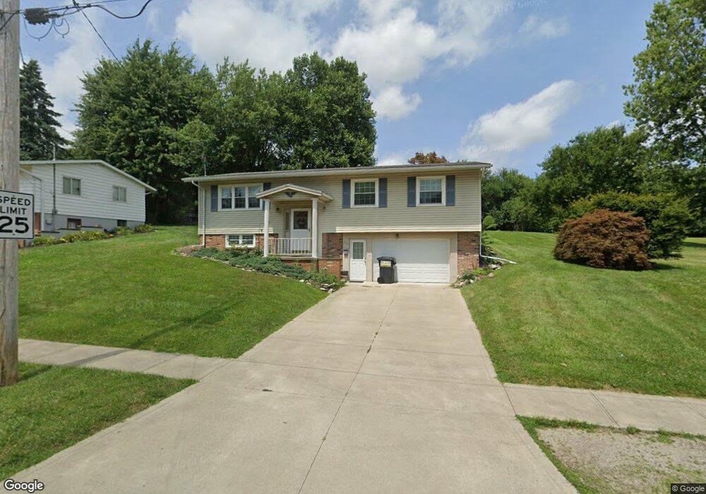
215 Maple St Bellevue, OH 44811
Estimated Value: $144,000 - $216,000
3
Beds
2
Baths
1,866
Sq Ft
$99/Sq Ft
Est. Value
About This Home
This home is located at 215 Maple St, Bellevue, OH 44811 and is currently estimated at $185,148, approximately $99 per square foot. 215 Maple St is a home located in Sandusky County with nearby schools including Bellevue Elementary School, Bellevue Middle School, and Bellevue High School.
Ownership History
Date
Name
Owned For
Owner Type
Purchase Details
Closed on
Apr 25, 2024
Sold by
Veith Gail N and Veith Franklin A
Bought by
Veith Gail N
Current Estimated Value
Purchase Details
Closed on
Oct 11, 2022
Sold by
Irma M Ramsey Revocable Trust
Bought by
Veith Franklin A and Veith Gail N
Purchase Details
Closed on
Mar 29, 2022
Sold by
Smola Annette L
Bought by
Veith Franklin A and Veith Gail N
Create a Home Valuation Report for This Property
The Home Valuation Report is an in-depth analysis detailing your home's value as well as a comparison with similar homes in the area
Home Values in the Area
Average Home Value in this Area
Purchase History
| Date | Buyer | Sale Price | Title Company |
|---|---|---|---|
| Veith Gail N | -- | None Listed On Document | |
| Veith Franklin A | -- | -- | |
| Veith Franklin A | $2,600 | -- |
Source: Public Records
Tax History
| Year | Tax Paid | Tax Assessment Tax Assessment Total Assessment is a certain percentage of the fair market value that is determined by local assessors to be the total taxable value of land and additions on the property. | Land | Improvement |
|---|---|---|---|---|
| 2024 | $1,940 | $55,480 | $10,190 | $45,290 |
| 2023 | $1,954 | $42,920 | $6,970 | $35,950 |
| 2022 | $1,564 | $42,920 | $6,970 | $35,950 |
| 2021 | $1,577 | $42,920 | $6,970 | $35,950 |
| 2020 | $1,427 | $37,980 | $6,970 | $31,010 |
| 2019 | $1,411 | $37,980 | $6,970 | $31,010 |
| 2018 | $1,418 | $37,980 | $6,970 | $31,010 |
| 2017 | $1,176 | $33,120 | $6,970 | $26,150 |
| 2016 | $1,137 | $33,120 | $6,970 | $26,150 |
| 2015 | $1,146 | $33,120 | $6,970 | $26,150 |
| 2014 | $1,243 | $34,060 | $6,790 | $27,270 |
| 2013 | $1,239 | $34,060 | $6,790 | $27,270 |
Source: Public Records
Map
Nearby Homes
- 0 Oakwood Dr
- 408 W Main St
- 100 Winfield Ct
- 0 County Road 308
- 140 Crystal Ct
- 135 Attwood Terrace
- 132 Hamilton St
- 111 Flat Rock Rd Unit 34
- 630 Gardner St
- 209 Pleasant St
- 311 N Sandusky St
- 1085 W Main St
- 303 Moore Ave
- 308 E Center St
- 432 High St
- 221 Broad St
- 0 Hartland Dr
- 400 Southwest St
- 128 East St
- 0 St Rt 4 - B
Your Personal Tour Guide
Ask me questions while you tour the home.