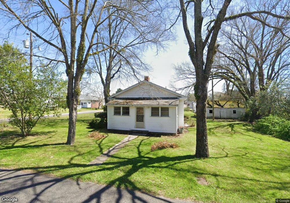
215 Mccarty St Gardendale, AL 35071
Estimated Value: $79,000 - $215,000
3
Beds
1
Bath
1,176
Sq Ft
$135/Sq Ft
Est. Value
About This Home
This home is located at 215 Mccarty St, Gardendale, AL 35071 and is currently estimated at $159,096, approximately $135 per square foot. 215 Mccarty St is a home located in Jefferson County with nearby schools including Snow Rogers Elementary School, Bragg Middle School, and Gardendale High School.
Ownership History
Date
Name
Owned For
Owner Type
Purchase Details
Closed on
Mar 3, 2022
Sold by
Rogers Marigwen
Bought by
Upgrade Home And Commercial Improvements
Current Estimated Value
Home Financials for this Owner
Home Financials are based on the most recent Mortgage that was taken out on this home.
Original Mortgage
$99,749
Interest Rate
3.89%
Mortgage Type
Mortgage Modification
Purchase Details
Closed on
Aug 30, 2001
Sold by
Day Bobbie Lee and Rogers Marigwen Day
Bought by
Rogers Marigwen Day
Create a Home Valuation Report for This Property
The Home Valuation Report is an in-depth analysis detailing your home's value as well as a comparison with similar homes in the area
Home Values in the Area
Average Home Value in this Area
Purchase History
| Date | Buyer | Sale Price | Title Company |
|---|---|---|---|
| Upgrade Home And Commercial Improvements | $70,000 | -- | |
| Rogers Marigwen Day | -- | -- |
Source: Public Records
Mortgage History
| Date | Status | Borrower | Loan Amount |
|---|---|---|---|
| Closed | Upgrade Home And Commercial Improvements | $99,749 |
Source: Public Records
Tax History Compared to Growth
Tax History
| Year | Tax Paid | Tax Assessment Tax Assessment Total Assessment is a certain percentage of the fair market value that is determined by local assessors to be the total taxable value of land and additions on the property. | Land | Improvement |
|---|---|---|---|---|
| 2024 | $1,359 | $22,620 | -- | -- |
| 2022 | $1,284 | $21,360 | $18,120 | $3,240 |
| 2021 | $1,284 | $21,360 | $18,120 | $3,240 |
| 2020 | $1,284 | $21,360 | $18,120 | $3,240 |
| 2019 | $1,284 | $21,360 | $0 | $0 |
| 2018 | $0 | $20,780 | $0 | $0 |
| 2017 | $0 | $9,140 | $0 | $0 |
| 2016 | $0 | $7,320 | $0 | $0 |
| 2015 | -- | $7,320 | $0 | $0 |
| 2014 | $367 | $7,320 | $0 | $0 |
| 2013 | $367 | $7,320 | $0 | $0 |
Source: Public Records
Map
Nearby Homes
- 420 Redmayne Rd
- 164 Summit Blvd
- 304 Fieldstown Rd
- 1031 Mount Olive Ave Unit 17/18
- 216 Howard Dr
- 220 Payne Rd
- 520 Parks Rd
- 411 Albert Dr
- 408 Albert Dr
- 304 Mozelle Cir
- 1515 Clover Ave
- 309 Catherine Ct
- 346 Gowins Dr
- 200 Watson Way
- 716 Kerr Dr
- 4362 Shivas Way Unit 238
- 4355 Shivas Way Unit 243
- 4358 Shivas Way Unit 239
- 4354 Shivas Way Unit 240
- 4351 Shivas Way Unit 242
- 1236 Mansfield Ave
- 1226 Mansfield Ave
- 1232 Mansfield Ave
- 1220 Mansfield Ave
- 213 Mccarty St
- 1238 Mansfield Ave
- 211 Redmayne Rd
- 320 Day St
- 1240 Main St
- 1194 Forest Dr
- 215 Redmayne Rd
- 1244 Main St
- 330 Day St
- 9181 Sharit Ave Unit 1
- 300 Westview Rd
- 210 Redmayne Rd
- 313 Redmayne Rd
- 312 Westview Rd
- 331 Day St
- 1304 Main St