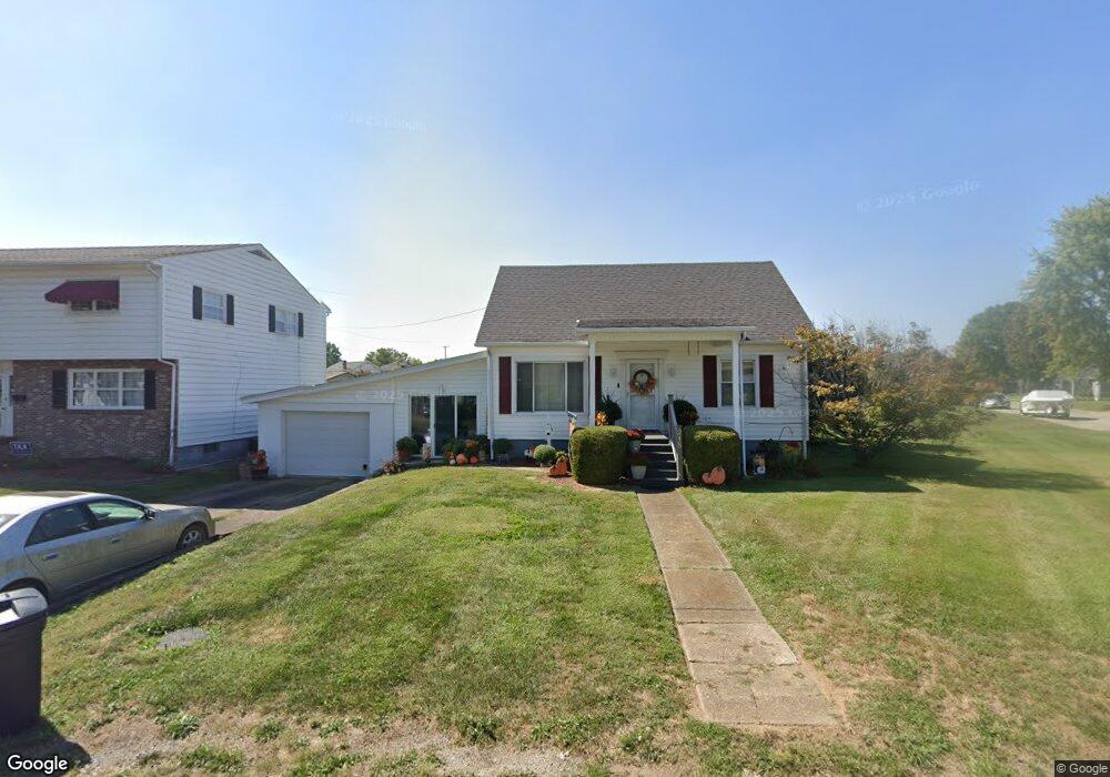
215 Means St Ironton, OH 45638
Estimated Value: $127,000 - $180,000
2
Beds
1
Bath
1,780
Sq Ft
$82/Sq Ft
Est. Value
About This Home
This home is located at 215 Means St, Ironton, OH 45638 and is currently estimated at $146,390, approximately $82 per square foot. 215 Means St is a home located in Lawrence County with nearby schools including Ironton Elementary School, Ironton Middle School, and Ironton High School.
Ownership History
Date
Name
Owned For
Owner Type
Purchase Details
Closed on
Oct 13, 2006
Sold by
Bartram Steven F and Bartram Luanne
Bought by
Davis Cynthia
Current Estimated Value
Home Financials for this Owner
Home Financials are based on the most recent Mortgage that was taken out on this home.
Original Mortgage
$96,000
Outstanding Balance
$57,253
Interest Rate
6.45%
Mortgage Type
New Conventional
Estimated Equity
$89,137
Purchase Details
Closed on
Oct 30, 2003
Sold by
Hummell William Chester
Bought by
Bartram Steven F
Purchase Details
Closed on
Apr 24, 1989
Sold by
Price Nellie Gladys
Bought by
Hummell William Chester
Create a Home Valuation Report for This Property
The Home Valuation Report is an in-depth analysis detailing your home's value as well as a comparison with similar homes in the area
Home Values in the Area
Average Home Value in this Area
Purchase History
| Date | Buyer | Sale Price | Title Company |
|---|---|---|---|
| Davis Cynthia | $96,000 | None Available | |
| Bartram Steven F | $74,000 | -- | |
| Hummell William Chester | -- | -- |
Source: Public Records
Mortgage History
| Date | Status | Borrower | Loan Amount |
|---|---|---|---|
| Open | Davis Cynthia | $96,000 |
Source: Public Records
Tax History Compared to Growth
Tax History
| Year | Tax Paid | Tax Assessment Tax Assessment Total Assessment is a certain percentage of the fair market value that is determined by local assessors to be the total taxable value of land and additions on the property. | Land | Improvement |
|---|---|---|---|---|
| 2024 | -- | $36,530 | $3,300 | $33,230 |
| 2023 | $1,316 | $36,530 | $3,300 | $33,230 |
| 2022 | $1,314 | $36,530 | $3,300 | $33,230 |
| 2021 | $1,280 | $34,060 | $2,760 | $31,300 |
| 2020 | $1,295 | $34,060 | $2,760 | $31,300 |
| 2019 | $1,290 | $34,060 | $2,760 | $31,300 |
| 2018 | $1,188 | $30,970 | $2,510 | $28,460 |
| 2017 | $1,185 | $30,970 | $2,510 | $28,460 |
| 2016 | $1,112 | $30,970 | $2,510 | $28,460 |
| 2015 | $980 | $26,300 | $2,760 | $23,540 |
| 2014 | $946 | $26,300 | $2,760 | $23,540 |
| 2013 | $981 | $27,370 | $2,760 | $24,610 |
Source: Public Records
Map
Nearby Homes