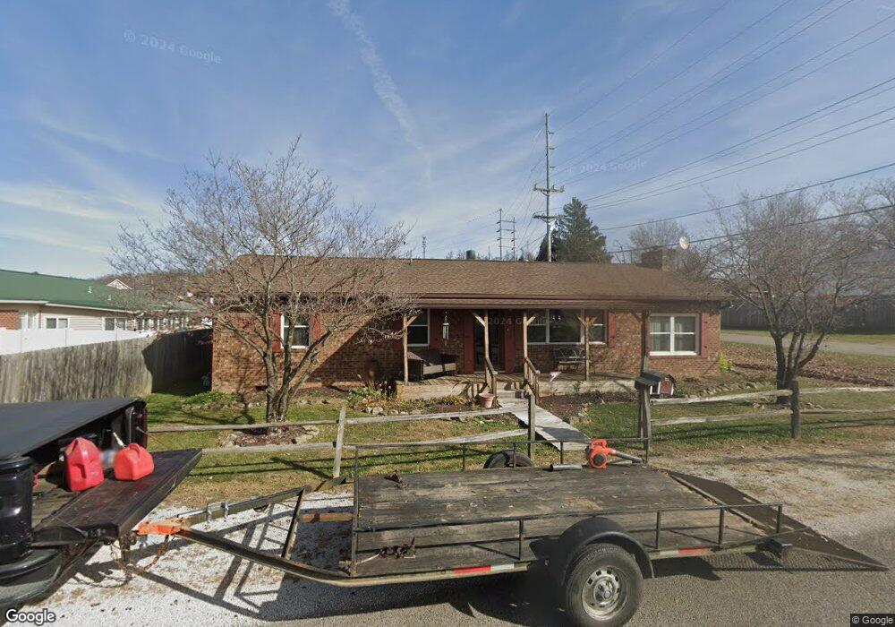
215 Michael St South Point, OH 45680
Estimated Value: $178,000 - $231,000
3
Beds
2
Baths
1,572
Sq Ft
$129/Sq Ft
Est. Value
About This Home
This home is located at 215 Michael St, South Point, OH 45680 and is currently estimated at $203,523, approximately $129 per square foot. 215 Michael St is a home located in Lawrence County with nearby schools including South Point High School.
Ownership History
Date
Name
Owned For
Owner Type
Purchase Details
Closed on
Jan 16, 2009
Sold by
Wilmoth Ford S and Wilmoth Loretta
Bought by
Gibson Jerry A and Gibson Mary J
Current Estimated Value
Home Financials for this Owner
Home Financials are based on the most recent Mortgage that was taken out on this home.
Original Mortgage
$105,552
Outstanding Balance
$66,396
Interest Rate
5.09%
Mortgage Type
FHA
Estimated Equity
$137,127
Purchase Details
Closed on
Oct 5, 2001
Sold by
Griffith Rickey Lee And
Bought by
Wilmoth Ford S and Wilmoth Lorett
Purchase Details
Closed on
Mar 14, 1988
Sold by
Simpkins David Byron
Bought by
Griffith Rickey Lee And
Create a Home Valuation Report for This Property
The Home Valuation Report is an in-depth analysis detailing your home's value as well as a comparison with similar homes in the area
Home Values in the Area
Average Home Value in this Area
Purchase History
| Date | Buyer | Sale Price | Title Company |
|---|---|---|---|
| Gibson Jerry A | $107,500 | Bestitle | |
| Wilmoth Ford S | $93,000 | -- | |
| Griffith Rickey Lee And | $46,000 | -- |
Source: Public Records
Mortgage History
| Date | Status | Borrower | Loan Amount |
|---|---|---|---|
| Open | Gibson Jerry A | $105,552 |
Source: Public Records
Tax History Compared to Growth
Tax History
| Year | Tax Paid | Tax Assessment Tax Assessment Total Assessment is a certain percentage of the fair market value that is determined by local assessors to be the total taxable value of land and additions on the property. | Land | Improvement |
|---|---|---|---|---|
| 2024 | -- | $48,010 | $6,620 | $41,390 |
| 2023 | $1,337 | $48,010 | $6,620 | $41,390 |
| 2022 | $1,347 | $48,010 | $6,620 | $41,390 |
| 2021 | $1,221 | $42,260 | $5,580 | $36,680 |
| 2020 | $1,235 | $42,260 | $5,580 | $36,680 |
| 2019 | $1,544 | $42,260 | $5,580 | $36,680 |
| 2018 | $1,110 | $38,420 | $5,070 | $33,350 |
| 2017 | $1,107 | $38,420 | $5,070 | $33,350 |
| 2016 | $1,037 | $38,420 | $5,070 | $33,350 |
| 2015 | $980 | $35,010 | $5,070 | $29,940 |
| 2014 | $978 | $35,010 | $5,070 | $29,940 |
| 2013 | $884 | $35,010 | $5,070 | $29,940 |
Source: Public Records
Map
Nearby Homes
- 205 Michael St
- 105 Orchard Dr
- 119 Meadow Ln
- 408 Brubaker Dr
- 609 4th St E
- 101 Henray Dr
- 0 Twp R 135
- 00 County Road 1
- 404 Township Road 135
- 0 Township Road 135
- 102 Park Ave
- 110 Kitts Ln
- 1524 Beech St
- 217 17th St
- 304 15th St
- 1104 Beech St
- 312 13th St
- 1184 County Road 18
- 2708 Panola St
- 0 Township Road 161 Unit 182331
- 213 Michael St
- 601 N Kenova Rd
- 211 Michael St
- 102 Franklin St
- 603 N Kenova Rd
- 214 Michael St
- 111 Kathy Ct
- 506 N Kenova Rd
- 506 N Kenova Rd
- 506 N Kenova Rd Unit B
- 506 N Kenova Rd
- 506 N Kenova Rd Unit C
- 212 Michael St
- 104 Franklin St
- 209 Michael St
- 112 Kathy Ct
- 103 Franklin St
- 210 Michael St
- 208 Michael St
- 511 N Kenova Rd