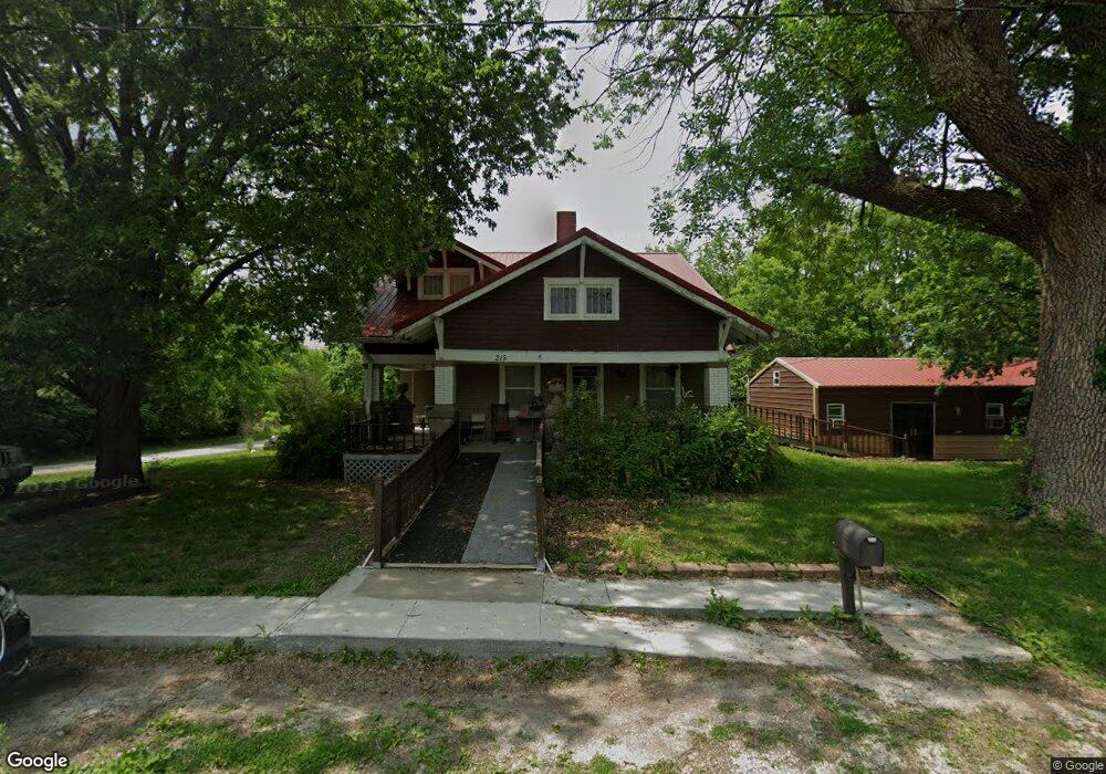
215 N Stringer St Humphreys, MO 64646
Estimated Value: $107,000 - $183,122
4
Beds
1
Bath
1,557
Sq Ft
$99/Sq Ft
Est. Value
About This Home
This home is located at 215 N Stringer St, Humphreys, MO 64646 and is currently estimated at $153,781, approximately $98 per square foot. 215 N Stringer St is a home located in Sullivan County with nearby schools including Grundy County Elementary School and Grundy County High School.
Ownership History
Date
Name
Owned For
Owner Type
Purchase Details
Closed on
Jul 21, 2022
Sold by
Rogers Lewis H
Bought by
Lewis H Rogers And Mabel I Rogers Revocable L
Current Estimated Value
Purchase Details
Closed on
Oct 18, 2019
Sold by
Rogers Lewis H and Rogers Mabel I
Bought by
Rogers Lewis H and Rogers Mabel I
Home Financials for this Owner
Home Financials are based on the most recent Mortgage that was taken out on this home.
Original Mortgage
$50,875
Interest Rate
4.37%
Mortgage Type
FHA
Create a Home Valuation Report for This Property
The Home Valuation Report is an in-depth analysis detailing your home's value as well as a comparison with similar homes in the area
Purchase History
| Date | Buyer | Sale Price | Title Company |
|---|---|---|---|
| Lewis H Rogers And Mabel I Rogers Revocable L | -- | -- | |
| Rogers Lewis H | -- | -- | |
| Rogers Leiws H | -- | -- |
Source: Public Records
Mortgage History
| Date | Status | Borrower | Loan Amount |
|---|---|---|---|
| Previous Owner | Rogers Leiws H | $50,875 |
Source: Public Records
Tax History
| Year | Tax Paid | Tax Assessment Tax Assessment Total Assessment is a certain percentage of the fair market value that is determined by local assessors to be the total taxable value of land and additions on the property. | Land | Improvement |
|---|---|---|---|---|
| 2024 | $907 | $7,430 | $0 | $0 |
| 2023 | $867 | $7,430 | $0 | $0 |
| 2022 | $867 | $7,430 | $0 | $0 |
| 2021 | $867 | $7,430 | $0 | $0 |
| 2020 | $867 | $7,430 | $0 | $0 |
| 2019 | $865 | $7,430 | $0 | $0 |
| 2018 | $865 | $7,430 | $0 | $0 |
| 2017 | $863 | $7,430 | $0 | $0 |
| 2016 | $480 | $4,146 | $0 | $0 |
| 2015 | -- | $4,146 | $0 | $0 |
| 2014 | -- | $4,146 | $0 | $0 |
| 2013 | -- | $4,146 | $0 | $0 |
Source: Public Records
Map
Nearby Homes
- 0 Humphreys St
- 304 4th St
- 44578 Missouri 6
- E Mo-139
- 0 Missouri 6
- NE 105 Ave
- 0 Violet Rd
- Highway 6 Unit LotWP002
- NE 82nd St
- 0 Winter Rd
- Highway Z Unit LotWP001
- 45869 E Hwy
- 0 NE 63rd Ave Unit MIS24009796
- 0 Autumn Rd
- 51008 Trout Rd
- Tbd Austin Rd
- 48451 Club Rd
- Tbd Ne 63rd Ave
- 50825 Trout Rd
- 48532 Club Dr
- 220 N Stringer St
- 125 N Stringer St
- 190 Stringer St
- 170 N Stringer St
- 135 Stringer St
- 190 N Stringer St
- 190&220 N Stringer St
- 110 S Stringer St
- 105 S Stringer St
- 460 N Humphreys St
- 104 Main St
- 106 Main St
- 108 N Humphreys St
- North Missouri 6
- XX Missouri 6
- 240 N Humphreys St
- 488 Highway 6
- 380 N Stringer St
- 375 N Stringer St
- 355 N Humphreys St
Your Personal Tour Guide
Ask me questions while you tour the home.