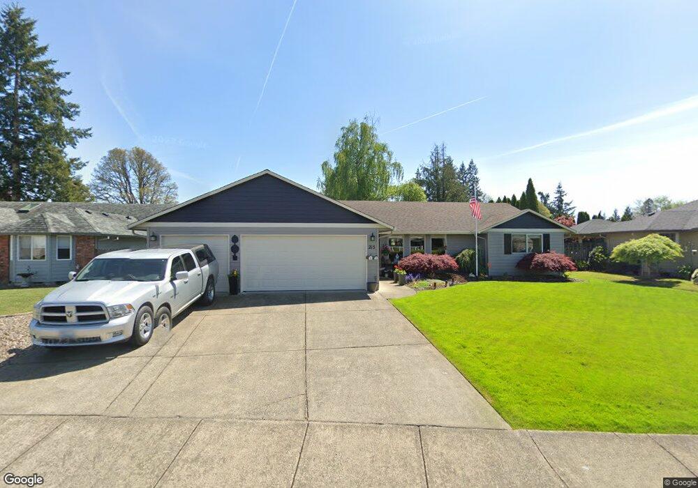
215 NW 10th St Battle Ground, WA 98604
Estimated Value: $514,000 - $550,000
3
Beds
2
Baths
1,684
Sq Ft
$315/Sq Ft
Est. Value
About This Home
This home is located at 215 NW 10th St, Battle Ground, WA 98604 and is currently estimated at $529,893, approximately $314 per square foot. 215 NW 10th St is a home located in Clark County with nearby schools including Captain Strong Primary School, Chief Umtuch Middle School, and Battle Ground High School.
Ownership History
Date
Name
Owned For
Owner Type
Purchase Details
Closed on
Jul 13, 2018
Sold by
Cunningham Michael A and Cunningham Margaret L
Bought by
Currie Douglas R and Currie Dennise A
Current Estimated Value
Home Financials for this Owner
Home Financials are based on the most recent Mortgage that was taken out on this home.
Original Mortgage
$221,400
Outstanding Balance
$191,876
Interest Rate
4.5%
Mortgage Type
New Conventional
Estimated Equity
$338,017
Purchase Details
Closed on
Feb 27, 2007
Sold by
Correy James T and Correy Anita J
Bought by
Cunningham Michael A and Cunningham Margaret L
Home Financials for this Owner
Home Financials are based on the most recent Mortgage that was taken out on this home.
Original Mortgage
$120,000
Interest Rate
6.21%
Mortgage Type
Purchase Money Mortgage
Purchase Details
Closed on
Feb 17, 1998
Sold by
Deshirlia Frank J and Deshirlia Suzanne M
Bought by
Correy James T and Correy Anita J
Create a Home Valuation Report for This Property
The Home Valuation Report is an in-depth analysis detailing your home's value as well as a comparison with similar homes in the area
Home Values in the Area
Average Home Value in this Area
Purchase History
| Date | Buyer | Sale Price | Title Company |
|---|---|---|---|
| Currie Douglas R | $372,000 | Fidelity National Title | |
| Cunningham Michael A | $294,400 | Stewart Title | |
| Correy James T | -- | Chicago Title Insurance Co |
Source: Public Records
Mortgage History
| Date | Status | Borrower | Loan Amount |
|---|---|---|---|
| Open | Currie Douglas R | $221,400 | |
| Previous Owner | Cunningham Michael A | $120,000 |
Source: Public Records
Tax History Compared to Growth
Tax History
| Year | Tax Paid | Tax Assessment Tax Assessment Total Assessment is a certain percentage of the fair market value that is determined by local assessors to be the total taxable value of land and additions on the property. | Land | Improvement |
|---|---|---|---|---|
| 2025 | $3,967 | $488,076 | $155,000 | $333,076 |
| 2024 | $3,412 | $486,502 | $155,000 | $331,502 |
| 2023 | $3,649 | $475,996 | $155,000 | $320,996 |
| 2022 | $3,658 | $464,209 | $130,500 | $333,709 |
| 2021 | $3,661 | $404,409 | $112,500 | $291,909 |
| 2020 | $3,070 | $371,192 | $103,500 | $267,692 |
| 2019 | $2,572 | $352,657 | $106,200 | $246,457 |
| 2018 | $3,158 | $345,716 | $0 | $0 |
| 2017 | $2,566 | $311,999 | $0 | $0 |
| 2016 | $2,554 | $276,049 | $0 | $0 |
| 2015 | $2,494 | $252,119 | $0 | $0 |
| 2014 | -- | $233,548 | $0 | $0 |
| 2013 | -- | $209,247 | $0 | $0 |
Source: Public Records
Map
Nearby Homes
- 715 NW 3rd Ave
- 902 N Parkway Ave
- 17 NE 12th St
- 907 NE 1st Ave
- 709 NW 6th Ave
- 123 NE 14th St
- 1320 NE Clark Ave
- 1334 NE Clark Ave
- 1342 NE Clark Ave
- 951 NE 14th St
- 970 NE 14th St
- 741 NE 13th St
- 743 NE 13th St
- 1313 NE Clark Ave
- 745 NE 13th St
- 1329 NE Clark Ave
- 747 NE 13th St
- 749 NE 13th St
- 751 NE 13th St
- 1316 NE 8th Ave
- 213 NW 10th St
- 305 NW 10th St
- 216 NW 9th St
- 309 NW 10th St
- 216 NW 10th St
- 214 NW 10th St
- 211 NW 10th St
- 212 NW 9th St
- 302 NW 10th St
- 1008 NW 2nd Ave
- 311 NW 10th St
- 1011 NW 3rd Ct
- 1010 NW 3rd Ct Unit 5
- 1010 NW 3rd Ct
- 206 NW 9th St
- 1003 NW 2nd Ave
- 306 NW 9th St
- 306 NW 10th St
- 1012 NW 3rd Ct
- 1013 NW 3rd Ct