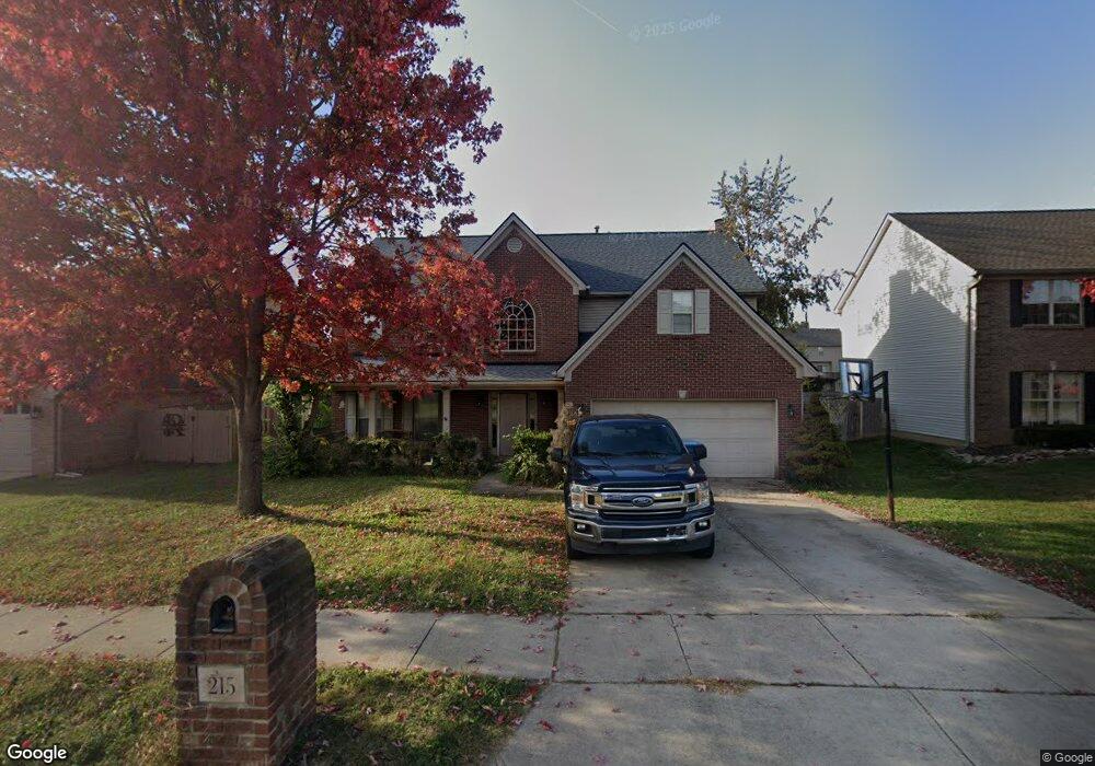
215 Ransom Trace Georgetown, KY 40324
Bradford Place NeighborhoodEstimated Value: $377,655 - $390,000
4
Beds
3
Baths
2,542
Sq Ft
$151/Sq Ft
Est. Value
About This Home
This home is located at 215 Ransom Trace, Georgetown, KY 40324 and is currently estimated at $384,664, approximately $151 per square foot. 215 Ransom Trace is a home located in Scott County with nearby schools including Southern Elementary School, Georgetown Middle School, and Scott County High School.
Ownership History
Date
Name
Owned For
Owner Type
Purchase Details
Closed on
Feb 16, 2007
Sold by
Southworth Troy
Bought by
Green Andrew A and Green Linda T
Current Estimated Value
Home Financials for this Owner
Home Financials are based on the most recent Mortgage that was taken out on this home.
Original Mortgage
$204,200
Outstanding Balance
$119,818
Interest Rate
6.16%
Mortgage Type
New Conventional
Estimated Equity
$264,846
Purchase Details
Closed on
Apr 29, 2005
Sold by
Brock Robert D and Brock Lisa M
Bought by
Southworth Troy
Home Financials for this Owner
Home Financials are based on the most recent Mortgage that was taken out on this home.
Original Mortgage
$41,000
Interest Rate
5.26%
Mortgage Type
Unknown
Create a Home Valuation Report for This Property
The Home Valuation Report is an in-depth analysis detailing your home's value as well as a comparison with similar homes in the area
Home Values in the Area
Average Home Value in this Area
Purchase History
| Date | Buyer | Sale Price | Title Company |
|---|---|---|---|
| Green Andrew A | $215,000 | None Available | |
| Southworth Troy | $204,000 | None Available |
Source: Public Records
Mortgage History
| Date | Status | Borrower | Loan Amount |
|---|---|---|---|
| Open | Green Andrew A | $204,200 | |
| Previous Owner | Southworth Troy | $41,000 | |
| Previous Owner | Southworth Troy | $163,000 |
Source: Public Records
Tax History
| Year | Tax Paid | Tax Assessment Tax Assessment Total Assessment is a certain percentage of the fair market value that is determined by local assessors to be the total taxable value of land and additions on the property. | Land | Improvement |
|---|---|---|---|---|
| 2025 | $3,004 | $337,300 | $0 | $0 |
| 2024 | $2,800 | $311,400 | $0 | $0 |
| 2023 | $2,683 | $295,900 | $42,000 | $253,900 |
| 2022 | $2,029 | $238,600 | $35,000 | $203,600 |
| 2021 | $2,082 | $221,000 | $35,000 | $186,000 |
| 2020 | $1,812 | $210,900 | $35,000 | $175,900 |
| 2019 | $1,775 | $203,400 | $0 | $0 |
| 2018 | $1,700 | $195,868 | $0 | $0 |
| 2017 | $1,708 | $195,868 | $0 | $0 |
| 2016 | $1,577 | $195,868 | $0 | $0 |
| 2015 | $1,517 | $189,600 | $0 | $0 |
| 2014 | $1,572 | $189,600 | $0 | $0 |
| 2011 | $125 | $202,200 | $0 | $0 |
Source: Public Records
Map
Nearby Homes
- 113 Walden Cove Unit 3I
- 115 Victor Place
- 512 Pocahontas Trail
- 232 W Showalter Dr
- 106 Ransom Trace
- 104 Bronte Place
- 206 Hiawatha Trail
- 1117 Pawnee Trail
- 251 W Showalter Dr
- 106 Somerset Cove
- 107 Oconner Ct
- 264 W Showalter Dr
- 1010 Walker Way
- 1003 Parkside Dr
- 1026 Parkside Dr
- 164 Stapleton Way
- 108 Pinwheel Ct
- 140 Magellan Ln
- 144 Magellan Ln
- 110 Capella Way
- 213 Ransom Trail
- 213 Ransom Trace
- 217 Ransom Trace
- 219 Ransom Trace
- 216 Ransom Trace
- 211 Ransom Trace
- 214 Ransom Trace
- 218 Ransom Trace
- 220 Ransom Trace
- 212 Ransom Trace
- 209 Ransom Trace
- 117 Walden Cove
- 119 Walden Cove
- 207 Ransom Trace
- 222 Ransom Trace
- 223 Ransom Trace
- 210 Ransom Trace
- 139 Irving Ln Unit 5
- 116 Brahms Ct
- 137 Irving Ln
Your Personal Tour Guide
Ask me questions while you tour the home.