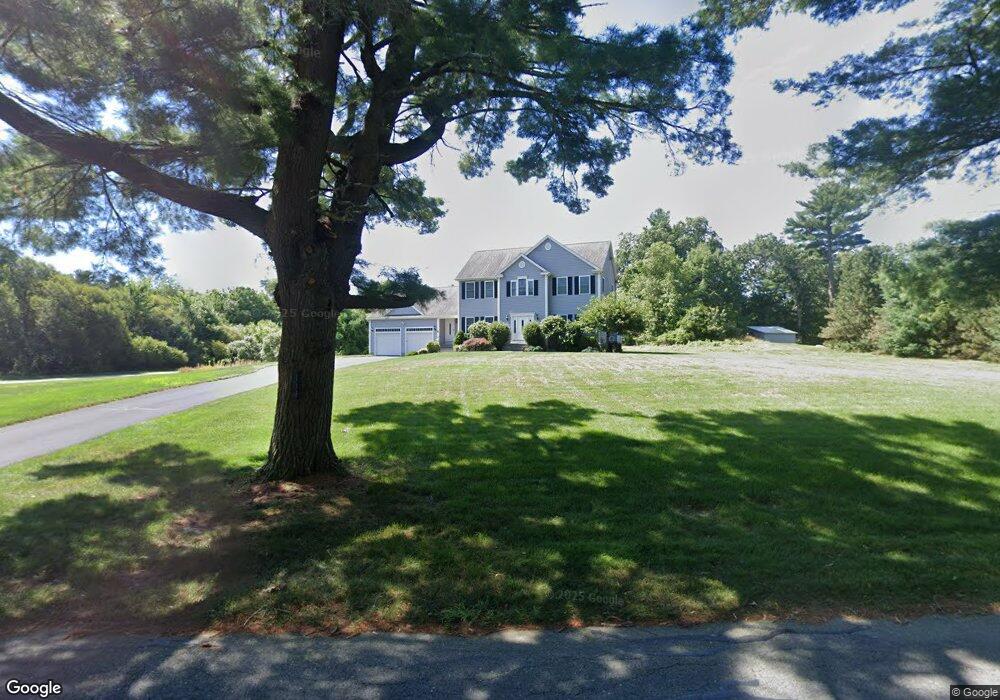
215 Read St Seekonk, MA 02771
Estimated Value: $806,000 - $919,000
4
Beds
3
Baths
2,300
Sq Ft
$375/Sq Ft
Est. Value
About This Home
This home is located at 215 Read St, Seekonk, MA 02771 and is currently estimated at $861,974, approximately $374 per square foot. 215 Read St is a home located in Bristol County with nearby schools including Seekonk High School, St Margaret School, and The Wolf School.
Ownership History
Date
Name
Owned For
Owner Type
Purchase Details
Closed on
Oct 19, 2007
Sold by
Connors Charles W
Bought by
Ho Nelson and Ho Fean
Current Estimated Value
Home Financials for this Owner
Home Financials are based on the most recent Mortgage that was taken out on this home.
Original Mortgage
$417,000
Outstanding Balance
$261,992
Interest Rate
6.51%
Mortgage Type
Purchase Money Mortgage
Estimated Equity
$599,982
Purchase Details
Closed on
Apr 25, 2005
Sold by
Lawrence W Howson Rt and Anderson Pearl E
Bought by
Anderson Nt and Anderson Pearl E
Create a Home Valuation Report for This Property
The Home Valuation Report is an in-depth analysis detailing your home's value as well as a comparison with similar homes in the area
Home Values in the Area
Average Home Value in this Area
Purchase History
| Date | Buyer | Sale Price | Title Company |
|---|---|---|---|
| Ho Nelson | $574,900 | -- | |
| Anderson Nt | -- | -- |
Source: Public Records
Mortgage History
| Date | Status | Borrower | Loan Amount |
|---|---|---|---|
| Open | Ho Nelson | $417,000 |
Source: Public Records
Tax History Compared to Growth
Tax History
| Year | Tax Paid | Tax Assessment Tax Assessment Total Assessment is a certain percentage of the fair market value that is determined by local assessors to be the total taxable value of land and additions on the property. | Land | Improvement |
|---|---|---|---|---|
| 2025 | $9,028 | $731,000 | $206,700 | $524,300 |
| 2024 | $8,609 | $697,100 | $206,700 | $490,400 |
| 2023 | $8,338 | $636,000 | $188,900 | $447,100 |
| 2022 | $7,536 | $564,900 | $182,800 | $382,100 |
| 2021 | $7,337 | $540,700 | $166,200 | $374,500 |
| 2020 | $6,993 | $531,000 | $166,000 | $365,000 |
| 2019 | $6,666 | $510,400 | $166,000 | $344,400 |
| 2018 | $6,574 | $492,400 | $166,000 | $326,400 |
| 2017 | $6,264 | $465,400 | $158,900 | $306,500 |
| 2016 | $6,150 | $458,600 | $158,900 | $299,700 |
| 2015 | $5,988 | $452,600 | $158,900 | $293,700 |
Source: Public Records
Map
Nearby Homes
- 52 Walker St
- 50 Dexter Ave
- 90 Ellis St
- 245 Manton St
- 91 Seabiscuit Place
- 14 Field St
- 242 Manton #41 St
- 1150 Newman Ave
- 242 Manton St
- 0 Arcade Ave Unit 73446971
- 38 E Point Dr Unit 5
- 16 Salisbury St
- 224 Arcade Ave
- 46 Lowell Ave
- 38 Lowell Ave
- 40 Camac St
- 50 Redland Ave
- 124 Ferris Ave
- 331 Newman Ave Unit 333
- 0 Patterson St Unit 73348933