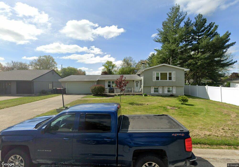
215 Rochelle Ave Lincoln, IL 62656
Estimated Value: $160,206 - $213,000
3
Beds
--
Bath
1,350
Sq Ft
$139/Sq Ft
Est. Value
About This Home
This home is located at 215 Rochelle Ave, Lincoln, IL 62656 and is currently estimated at $188,052, approximately $139 per square foot. 215 Rochelle Ave is a home located in Logan County with nearby schools including Adams Elementary School, Central Elementary School, and Lincoln Junior High School.
Ownership History
Date
Name
Owned For
Owner Type
Purchase Details
Closed on
May 21, 2010
Sold by
Utley Jill R
Bought by
John Alan and John Marlene E
Current Estimated Value
Home Financials for this Owner
Home Financials are based on the most recent Mortgage that was taken out on this home.
Original Mortgage
$117,700
Outstanding Balance
$79,198
Interest Rate
5.13%
Mortgage Type
Stand Alone First
Estimated Equity
$108,854
Create a Home Valuation Report for This Property
The Home Valuation Report is an in-depth analysis detailing your home's value as well as a comparison with similar homes in the area
Home Values in the Area
Average Home Value in this Area
Purchase History
| Date | Buyer | Sale Price | Title Company |
|---|---|---|---|
| John Alan | $123,900 | -- |
Source: Public Records
Mortgage History
| Date | Status | Borrower | Loan Amount |
|---|---|---|---|
| Open | John Alan | $117,700 |
Source: Public Records
Tax History Compared to Growth
Tax History
| Year | Tax Paid | Tax Assessment Tax Assessment Total Assessment is a certain percentage of the fair market value that is determined by local assessors to be the total taxable value of land and additions on the property. | Land | Improvement |
|---|---|---|---|---|
| 2024 | $3,646 | $48,120 | $9,950 | $38,170 |
| 2023 | $4,109 | $44,550 | $9,210 | $35,340 |
| 2022 | $4,109 | $41,640 | $8,610 | $33,030 |
| 2021 | $1,657 | $39,980 | $8,270 | $31,710 |
| 2020 | $3,312 | $39,390 | $8,150 | $31,240 |
| 2019 | $3,231 | $38,620 | $7,990 | $30,630 |
| 2018 | $3,194 | $37,860 | $7,830 | $30,030 |
| 2017 | $318 | $37,860 | $7,830 | $30,030 |
| 2016 | $1,466 | $37,820 | $7,820 | $30,000 |
| 2015 | $2,983 | $41,880 | $7,550 | $34,330 |
| 2014 | $2,983 | $41,880 | $7,550 | $34,330 |
| 2013 | $2,983 | $39,760 | $7,170 | $32,590 |
| 2012 | $2,983 | $40,480 | $7,300 | $33,180 |
Source: Public Records
Map
Nearby Homes
- 1431 N Ottawa St
- 1503 N Kankakee St
- 1204 N Ottawa St
- 1208 N Kankakee St
- 1107 N Kankakee St
- 6 Meadow Ln
- 311 Davenport St
- 180 Regent St
- 1019 N Mclean St
- 530 Grand Ave
- 403 Grand Ave
- 145 Half Moon St
- 703 Grand Ave
- 330 Water St
- 515 Oglesby Ave
- 104 Tremont St
- 417 N Union St
- 620 Tremont St
- 306 Woodlawn Rd
- 915 Peoria St
- 225 Rochelle Ave
- 1501 Rutledge Dr
- 1290 Richland Ave
- 1280 Richland Ave
- 1270 Richland Ave
- 216 Rochelle Ave
- 222 Rochelle Ave
- 226 Rochelle Ave
- 1421 Rutledge Dr
- 1507 Rutledge Dr
- 1413 Rutledge Dr
- 234 Rochelle Ave
- 1260 Richland Ave
- 1513 Rutledge Dr
- 1306 Richland Ave
- 1281 Richland Ave
- 1316 Richland Ave
- 1271 Richland Ave
- 1401 Rutledge Dr
- 1428 Rutledge Dr