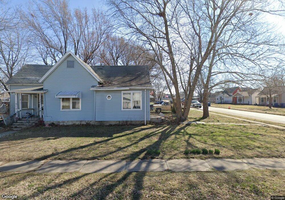
215 S Cedar Cir Webb City, MO 64870
Estimated Value: $120,558 - $176,000
--
Bed
1
Bath
1,276
Sq Ft
$117/Sq Ft
Est. Value
About This Home
This home is located at 215 S Cedar Cir, Webb City, MO 64870 and is currently estimated at $149,640, approximately $117 per square foot. 215 S Cedar Cir is a home with nearby schools including Webb City High School and Thomas Jefferson Independent Day School.
Ownership History
Date
Name
Owned For
Owner Type
Purchase Details
Closed on
Jan 31, 2014
Sold by
Secretary Of Hud
Bought by
Leiva Helio A
Current Estimated Value
Purchase Details
Closed on
Sep 16, 2013
Sold by
Wells Fargo Bank Na
Bought by
Secretary Of Hud
Purchase Details
Closed on
Aug 20, 2013
Sold by
Mosley Michael C and Mosley Darlene K
Bought by
Wells Fargo Bank Na
Purchase Details
Closed on
Apr 11, 2008
Sold by
Vogel Stephen G and Vogel Sheryll
Bought by
Mosley Michael C and Mosley Darlene K
Home Financials for this Owner
Home Financials are based on the most recent Mortgage that was taken out on this home.
Original Mortgage
$68,921
Interest Rate
6.19%
Mortgage Type
Purchase Money Mortgage
Create a Home Valuation Report for This Property
The Home Valuation Report is an in-depth analysis detailing your home's value as well as a comparison with similar homes in the area
Home Values in the Area
Average Home Value in this Area
Purchase History
| Date | Buyer | Sale Price | Title Company |
|---|---|---|---|
| Leiva Helio A | -- | Fatco | |
| Secretary Of Hud | -- | None Available | |
| Wells Fargo Bank Na | $42,332 | None Available | |
| Mosley Michael C | -- | Jct |
Source: Public Records
Mortgage History
| Date | Status | Borrower | Loan Amount |
|---|---|---|---|
| Previous Owner | Mosley Michael C | $68,921 |
Source: Public Records
Tax History Compared to Growth
Tax History
| Year | Tax Paid | Tax Assessment Tax Assessment Total Assessment is a certain percentage of the fair market value that is determined by local assessors to be the total taxable value of land and additions on the property. | Land | Improvement |
|---|---|---|---|---|
| 2024 | $548 | $11,780 | $1,320 | $10,460 |
| 2023 | $548 | $11,780 | $1,320 | $10,460 |
| 2022 | $535 | $11,550 | $1,320 | $10,230 |
| 2021 | $530 | $11,550 | $1,320 | $10,230 |
| 2020 | $497 | $10,640 | $1,320 | $9,320 |
| 2019 | $498 | $10,640 | $1,320 | $9,320 |
| 2018 | $486 | $10,400 | $0 | $0 |
| 2017 | $487 | $10,400 | $0 | $0 |
| 2016 | $487 | $10,440 | $0 | $0 |
| 2015 | $486 | $10,440 | $0 | $0 |
| 2014 | $486 | $10,440 | $0 | $0 |
Source: Public Records
Map
Nearby Homes
- 1121 W Broadway St
- 1127 W Broadway St
- 719 S Jefferson Ave
- 1301 W Broadway St
- 1112 W Austin St
- 1202 W Austin St
- 7 S Oronogo St
- 1401 W Broadway St
- TBD Crestwood Dr
- 1329 W Daugherty St
- 1005 Nelson St
- 717 S Madison St
- 1207 W 7th St
- 719 S Madison St
- TBD
- 1301 Nelson St
- 22 S Pennsylvania Ave
- 332 S Pennsylvania St
- 1621 Crestwood Dr
- 509 N Ash St
- 233 S Cedar Cir
- 128 S Madison St
- 153 S Cedar Cir
- 218 S Madison St
- 233 S Cedar Ave
- 216 S Cedar Ave
- 216 S Cedar Cir
- 224 S Madison St
- 145 S Cedar Cir
- 239 S Cedar Cir Unit 1
- 239 S Cedar Cir
- 932 W 2nd St
- 1016 W 1st St
- 1018 W 1st St
- 226 S Madison St
- 933 W 2nd St
- 1060/1100 S Madison St
- 928 W 2nd St
- 1024 W 1st St
- 1006 W 1st St