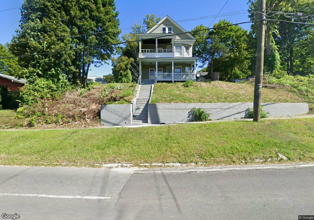
215 Springside Ave Pittsfield, MA 01201
Estimated Value: $198,000 - $259,000
4
Beds
2
Baths
2,244
Sq Ft
$107/Sq Ft
Est. Value
About This Home
This home is located at 215 Springside Ave, Pittsfield, MA 01201 and is currently estimated at $240,229, approximately $107 per square foot. 215 Springside Ave is a home located in Berkshire County with nearby schools including Morningside Community School, Theodore Herberg Middle School, and Pittsfield High School.
Ownership History
Date
Name
Owned For
Owner Type
Purchase Details
Closed on
Aug 4, 2020
Sold by
Naula Manuel
Bought by
Naumanu Investments Llc
Current Estimated Value
Purchase Details
Closed on
Oct 16, 2018
Sold by
Bruno Shirley A
Bought by
Naula Manuel
Purchase Details
Closed on
Jul 30, 1982
Bought by
Bruno Shirley A
Create a Home Valuation Report for This Property
The Home Valuation Report is an in-depth analysis detailing your home's value as well as a comparison with similar homes in the area
Home Values in the Area
Average Home Value in this Area
Purchase History
| Date | Buyer | Sale Price | Title Company |
|---|---|---|---|
| Naumanu Investments Llc | -- | None Available | |
| Naumanu Investments Llc | -- | None Available | |
| Naumanu Investments Llc | -- | None Available | |
| Naula Manuel | $122,000 | -- | |
| Bruno Shirley A | $29,500 | -- |
Source: Public Records
Tax History Compared to Growth
Tax History
| Year | Tax Paid | Tax Assessment Tax Assessment Total Assessment is a certain percentage of the fair market value that is determined by local assessors to be the total taxable value of land and additions on the property. | Land | Improvement |
|---|---|---|---|---|
| 2025 | $3,407 | $189,900 | $66,200 | $123,700 |
| 2024 | $3,164 | $171,500 | $66,200 | $105,300 |
| 2023 | $2,876 | $157,000 | $61,200 | $95,800 |
| 2022 | $2,812 | $151,500 | $61,200 | $90,300 |
| 2021 | $2,851 | $148,100 | $61,200 | $86,900 |
| 2020 | $2,623 | $133,100 | $49,200 | $83,900 |
| 2019 | $2,208 | $113,700 | $41,200 | $72,500 |
| 2018 | $2,211 | $110,200 | $41,200 | $69,000 |
| 2017 | $2,195 | $111,800 | $39,200 | $72,600 |
| 2016 | $2,129 | $113,500 | $39,200 | $74,300 |
| 2015 | $2,050 | $113,500 | $39,200 | $74,300 |
Source: Public Records
Map
Nearby Homes
- 41 Perrine Ave
- LOT 20 Plunkett St
- 40 Roland St
- 24 Glenwood Ave
- 29 Glenwood Ave
- 156 Draper Ave
- 52 Brown St
- 11 Stanley Ave
- 48 Brown St
- 81 Dartmouth St Unit 205
- 81 Dartmouth St Unit 102
- 26 Springside Ave
- 9 Myrtle St
- 98 Lincoln St
- 68 Orchard St
- 34 Lenox Ave
- 46 Bossidy Dr
- 52 Bossidy Dr
- 71 Maplewood Ave
- 762 East St
- 15 Draper Ave
- 213 Springside Ave
- 0 Draper
- 8 Scammell Ave
- 19 Draper Ave
- 225 Springside Ave
- 216 Springside Ave
- 20 Draper Ave
- 222 Springside Ave
- 206 Springside Ave
- 25 Draper Ave
- 210 Springside Ave
- 123 Parker St
- 235 Springside Ave
- 232 Springside Ave
- 207 Springside Ave
- 120 Parker St
- 31 Draper Ave
- 204 Springside Ave
- 21 Sadler Ave