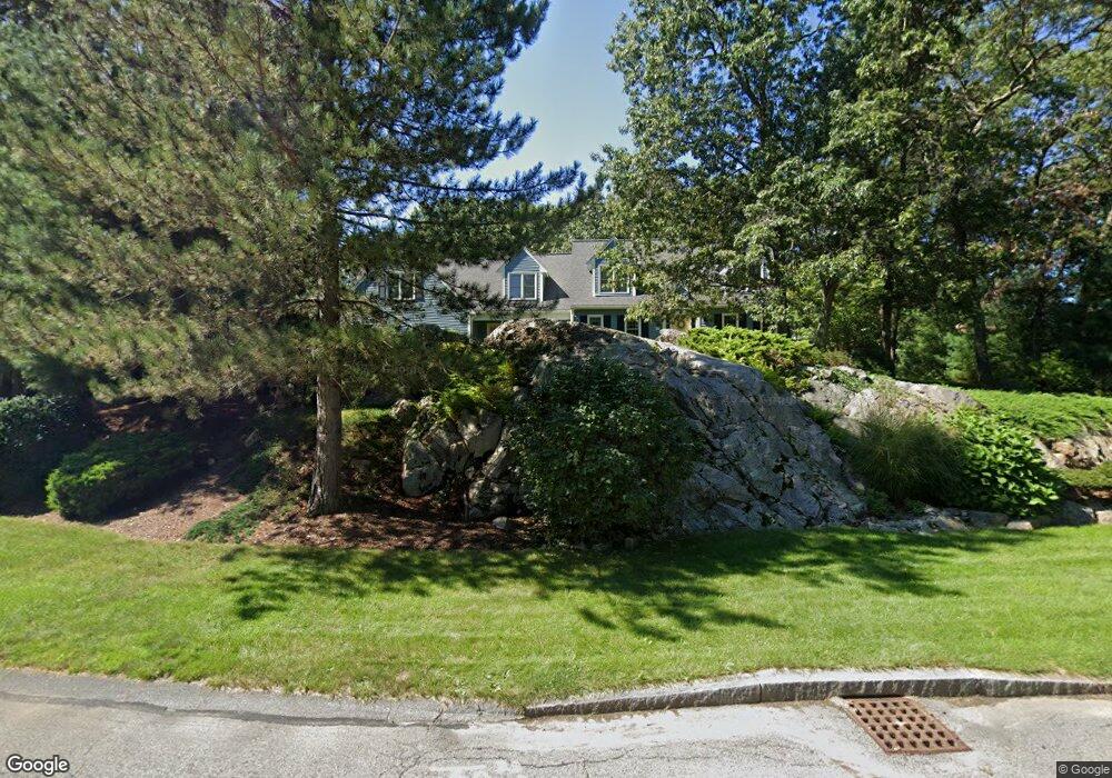
215 Tilting Rock Rd Wrentham, MA 02093
Estimated Value: $884,000 - $948,000
4
Beds
3
Baths
2,650
Sq Ft
$347/Sq Ft
Est. Value
About This Home
This home is located at 215 Tilting Rock Rd, Wrentham, MA 02093 and is currently estimated at $919,604, approximately $347 per square foot. 215 Tilting Rock Rd is a home located in Norfolk County with nearby schools including Delaney Elementary School, Charles E Roderick, and The Sage School.
Ownership History
Date
Name
Owned For
Owner Type
Purchase Details
Closed on
Dec 13, 2017
Sold by
Benson Sarah J
Bought by
Sarah J Benson Lt
Current Estimated Value
Purchase Details
Closed on
Feb 25, 1998
Sold by
Fraser Stuart P and Fraser Dorothy S
Bought by
Benson Grant N and Benson Sarah J
Home Financials for this Owner
Home Financials are based on the most recent Mortgage that was taken out on this home.
Original Mortgage
$170,000
Interest Rate
6.85%
Mortgage Type
Purchase Money Mortgage
Purchase Details
Closed on
Feb 28, 1996
Sold by
Lorusso Tr Gerard C
Bought by
Fraser Stuart P and Fraser Dorothy S
Home Financials for this Owner
Home Financials are based on the most recent Mortgage that was taken out on this home.
Original Mortgage
$130,000
Interest Rate
7.02%
Mortgage Type
Purchase Money Mortgage
Create a Home Valuation Report for This Property
The Home Valuation Report is an in-depth analysis detailing your home's value as well as a comparison with similar homes in the area
Home Values in the Area
Average Home Value in this Area
Purchase History
| Date | Buyer | Sale Price | Title Company |
|---|---|---|---|
| Sarah J Benson Lt | -- | -- | |
| Benson Grant N | $317,500 | -- | |
| Fraser Stuart P | $262,500 | -- |
Source: Public Records
Mortgage History
| Date | Status | Borrower | Loan Amount |
|---|---|---|---|
| Previous Owner | Fraser Stuart P | $170,000 | |
| Previous Owner | Fraser Stuart P | $130,000 |
Source: Public Records
Tax History Compared to Growth
Tax History
| Year | Tax Paid | Tax Assessment Tax Assessment Total Assessment is a certain percentage of the fair market value that is determined by local assessors to be the total taxable value of land and additions on the property. | Land | Improvement |
|---|---|---|---|---|
| 2025 | $8,572 | $739,600 | $299,600 | $440,000 |
| 2024 | $8,252 | $687,700 | $299,600 | $388,100 |
| 2023 | $8,193 | $649,200 | $272,400 | $376,800 |
| 2022 | $7,901 | $578,000 | $254,000 | $324,000 |
| 2021 | $7,450 | $529,500 | $221,700 | $307,800 |
| 2020 | $7,718 | $541,600 | $197,200 | $344,400 |
| 2019 | $7,626 | $540,100 | $213,600 | $326,500 |
| 2018 | $7,257 | $509,600 | $213,700 | $295,900 |
| 2017 | $7,111 | $499,000 | $209,600 | $289,400 |
| 2016 | $6,959 | $487,300 | $203,500 | $283,800 |
| 2015 | $6,760 | $451,300 | $180,600 | $270,700 |
| 2014 | $6,648 | $434,200 | $173,700 | $260,500 |
Source: Public Records
Map
Nearby Homes
- 319 Taunton St
- 10 Nature View Dr
- 15 Nature View Dr
- 362 East St
- 1 Lorraine Metcalf Dr
- 270 Dedham St
- 11 Earle Stewart Ln
- 131 Creek St Unit 7
- Lot 3 - 14 Earle Stewart Ln
- Lot 1 - Blueberry 2 Car Plan at King Philip Estates
- Lot 8 - Blueberry 2 Car Plan at King Philip Estates
- Lot 5 - Hughes 2 car Plan at King Philip Estates
- Lot 6 - Blueberry 3 Car Plan at King Philip Estates
- Lot 2 - Camden 2 Car Plan at King Philip Estates
- Lot 7 - Cedar Plan at King Philip Estates
- Lot 4 - Hemingway 2 Car Plan at King Philip Estates
- Lot 3 - Blueberry 2 Car Plan at King Philip Estates
- 120 Hawes St
- 65 Pond St
- 483 Thurston St
- 235 Tilting Rock Rd
- 240 Tilting Rock Rd
- 195 Tilting Rock Rd
- 250 Tilting Rock Rd
- 230 Tilting Rock Rd
- 55 Tilting Rock Rd
- 210 Tilting Rock Rd
- 220 Tilting Rock Rd
- 65 Tilting Rock Rd
- 200 Tilting Rock Rd
- 45 Tilting Rock Rd
- 60 Tilting Rock Rd
- 180 Tilting Rock Rd
- 190 Tilting Rock Rd
- 95 Tilting Rock Rd
- 165 Tilting Rock Rd
- 35 Tilting Rock Rd
- 50 Tilting Rock Rd
- 75 Tilting Rock Rd
- 70 Tilting Rock Rd