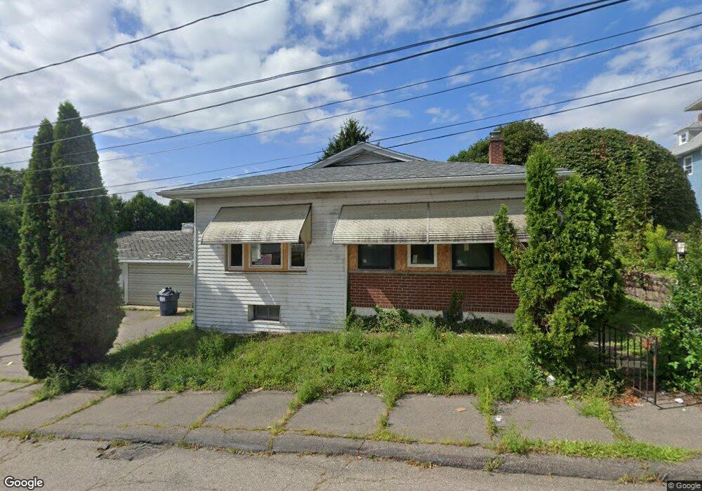
215 W 10th St Hazleton, PA 18201
Estimated Value: $153,022 - $224,000
--
Bed
--
Bath
1,305
Sq Ft
$138/Sq Ft
Est. Value
About This Home
This home is located at 215 W 10th St, Hazleton, PA 18201 and is currently estimated at $180,006, approximately $137 per square foot. 215 W 10th St is a home located in Luzerne County with nearby schools including Hazleton Area High School, Immanuel Christian School, and Holy Family Academy.
Ownership History
Date
Name
Owned For
Owner Type
Purchase Details
Closed on
Mar 21, 2024
Sold by
Sheriff Of Luzerne County
Bought by
Clearfield Investment
Current Estimated Value
Purchase Details
Closed on
Apr 29, 2005
Sold by
Perez Evelyn
Bought by
Guzman Ana M
Purchase Details
Closed on
Feb 18, 2005
Sold by
Saleeba Mary A
Bought by
Potence Michael D and Potence Mary Rose
Home Financials for this Owner
Home Financials are based on the most recent Mortgage that was taken out on this home.
Original Mortgage
$71,200
Interest Rate
6%
Mortgage Type
Assumption
Create a Home Valuation Report for This Property
The Home Valuation Report is an in-depth analysis detailing your home's value as well as a comparison with similar homes in the area
Home Values in the Area
Average Home Value in this Area
Purchase History
| Date | Buyer | Sale Price | Title Company |
|---|---|---|---|
| Clearfield Investment | $30,000 | None Listed On Document | |
| Guzman Ana M | $110,000 | None Available | |
| Potence Michael D | $89,000 | None Available |
Source: Public Records
Mortgage History
| Date | Status | Borrower | Loan Amount |
|---|---|---|---|
| Previous Owner | Potence Michael D | $71,200 |
Source: Public Records
Tax History Compared to Growth
Tax History
| Year | Tax Paid | Tax Assessment Tax Assessment Total Assessment is a certain percentage of the fair market value that is determined by local assessors to be the total taxable value of land and additions on the property. | Land | Improvement |
|---|---|---|---|---|
| 2025 | $2,620 | $91,200 | $22,100 | $69,100 |
| 2024 | $2,454 | $91,200 | $22,100 | $69,100 |
| 2023 | $2,295 | $91,200 | $22,100 | $69,100 |
| 2022 | $2,278 | $91,200 | $22,100 | $69,100 |
| 2021 | $2,225 | $91,200 | $22,100 | $69,100 |
| 2020 | $1,988 | $91,200 | $22,100 | $69,100 |
| 2019 | $648 | $91,200 | $22,100 | $69,100 |
| 2018 | $1,981 | $91,200 | $22,100 | $69,100 |
| 2017 | $1,827 | $91,200 | $22,100 | $69,100 |
| 2016 | $913 | $91,200 | $22,100 | $69,100 |
| 2015 | -- | $91,200 | $22,100 | $69,100 |
| 2014 | -- | $91,200 | $22,100 | $69,100 |
Source: Public Records
Map
Nearby Homes
- 739 N Church St
- 714 Alter St
- 738 N Manhattan Ct
- 827 N Vine St
- 19 W 14th St
- 572 N Vine St
- 837 N Laurel St
- 14 W 5th St
- 530 N Lee Ct
- 523 N Laurel St
- 127 W Diamond Ave
- 782 N James St
- 756 Seybert St
- 882 N Locust St
- 1087 N Rear Locust St
- 538 Carson St Unit 40
- ER.126 W Aspen St
- 756 Peace St
- 163 N Church St
- 522 N James St
- 712 N Church St
- 216 W 10th St Unit 218
- 700 N Church St
- 719 N Vine St
- 699 N Vine St
- 709 N Vine St
- 713 N Vine St
- 722 N Church St
- 690 N Church St
- 695 N Vine St
- 221 W 9th St
- 693 N Vine St
- 705 N Vine St
- 223 W 9th St
- 689 N Vine St
- 697 N Vine St
- 717 N Vine St
- 0 N Sherman Ct Unit PM-102126
- 1017-1019 N Church St
- 685 N Vine St