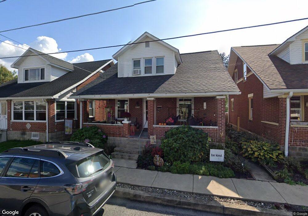
215 W Chestnut St Selinsgrove, PA 17870
Estimated Value: $149,533 - $252,000
--
Bed
--
Bath
--
Sq Ft
4,356
Sq Ft Lot
About This Home
This home is located at 215 W Chestnut St, Selinsgrove, PA 17870 and is currently estimated at $211,133. 215 W Chestnut St is a home located in Snyder County with nearby schools including Selinsgrove Area Elementary School, Selinsgrove Intermediate School, and Selinsgrove Area Middle School.
Ownership History
Date
Name
Owned For
Owner Type
Purchase Details
Closed on
May 26, 2010
Sold by
Mitchell Corey A and Mitchell Heather
Bought by
Stark Craig A and Stark Victoria E
Current Estimated Value
Home Financials for this Owner
Home Financials are based on the most recent Mortgage that was taken out on this home.
Original Mortgage
$111,498
Outstanding Balance
$75,238
Interest Rate
5.11%
Mortgage Type
Purchase Money Mortgage
Estimated Equity
$135,895
Purchase Details
Closed on
May 5, 2006
Sold by
Beaver Keith A and Beaver Theresa
Bought by
Mitchell Corey A and Mitchell Heather M
Home Financials for this Owner
Home Financials are based on the most recent Mortgage that was taken out on this home.
Original Mortgage
$85,845
Interest Rate
6.42%
Mortgage Type
Purchase Money Mortgage
Create a Home Valuation Report for This Property
The Home Valuation Report is an in-depth analysis detailing your home's value as well as a comparison with similar homes in the area
Home Values in the Area
Average Home Value in this Area
Purchase History
| Date | Buyer | Sale Price | Title Company |
|---|---|---|---|
| Stark Craig A | $113,000 | -- | |
| Mitchell Corey A | $88,500 | -- |
Source: Public Records
Mortgage History
| Date | Status | Borrower | Loan Amount |
|---|---|---|---|
| Open | Stark Craig A | $111,498 | |
| Previous Owner | Mitchell Corey A | $85,845 |
Source: Public Records
Tax History Compared to Growth
Tax History
| Year | Tax Paid | Tax Assessment Tax Assessment Total Assessment is a certain percentage of the fair market value that is determined by local assessors to be the total taxable value of land and additions on the property. | Land | Improvement |
|---|---|---|---|---|
| 2025 | $1,465 | $12,250 | $1,320 | $10,930 |
| 2024 | $1,376 | $12,250 | $1,320 | $10,930 |
| 2023 | $549 | $12,250 | $1,320 | $10,930 |
| 2022 | $1,321 | $12,250 | $1,320 | $10,930 |
| 2021 | $1,308 | $12,250 | $1,320 | $10,930 |
| 2020 | $1,302 | $12,250 | $1,320 | $10,930 |
| 2019 | $1,296 | $12,250 | $1,320 | $10,930 |
| 2018 | $1,284 | $12,250 | $1,320 | $10,930 |
| 2017 | $1,272 | $12,250 | $1,320 | $10,930 |
| 2016 | $684 | $12,250 | $1,320 | $10,930 |
| 2015 | $45,095 | $12,250 | $1,320 | $10,930 |
| 2014 | $45,095 | $12,250 | $1,320 | $10,930 |
Source: Public Records
Map
Nearby Homes
- 207 Orange St Unit 209
- 211 W Pine St
- 500 N Orange St
- 511 N 10th St
- 00 S Market St
- 223 E Pine St
- 722 N 8th St
- Lot 1 522 Route S
- 321 Pleasant Dr
- 20 Quarry Rd
- 12 Minton Dr
- 0 Wedgewood Dr
- 456 State School Rd
- 9130 State Route 147
- 1262 N Old Trail
- 85 Old Colony Rd
- 732 Salem Rd
- 34 Oakmont Ct
- 0 Mill Rd
- 594 Augusta Dr
- 217 W Chestnut St
- 219 W Chestnut St
- 57 N Broad St
- 212 W Pine St
- 210 W Pine St
- 214 W Chestnut St
- 218 W Pine St
- 210 W Chestnut St
- 216 W Chestnut St Unit 218
- 203 W Chestnut St
- 206 W Pine St
- 208 W Chestnut St
- 220 W Chestnut St
- 222 W Pine St
- 202 W Chestnut St
- 222 W Chestnut St
- 7 N Orange St
- 300 W Pine St
- 56 N Broad St
- 54 N Broad St