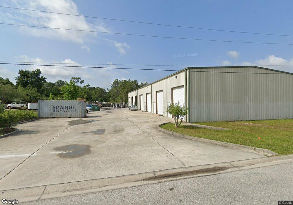
215 W Davis Industrial Dr St. Augustine, FL 32084
Marketplace NeighborhoodEstimated Value: $1,043,387
Studio
--
Bath
9,300
Sq Ft
$112/Sq Ft
Est. Value
About This Home
This home is located at 215 W Davis Industrial Dr, St. Augustine, FL 32084 and is currently estimated at $1,043,387, approximately $112 per square foot. 215 W Davis Industrial Dr is a home located in St. Johns County with nearby schools including Webster Elementary School, R J Murray Middle School, and St. Augustine High School.
Ownership History
Date
Name
Owned For
Owner Type
Purchase Details
Closed on
Sep 1, 2021
Sold by
Boutros Investments Llc
Bought by
Eureka Commercial Properties Llc
Current Estimated Value
Home Financials for this Owner
Home Financials are based on the most recent Mortgage that was taken out on this home.
Original Mortgage
$1,350,000
Outstanding Balance
$1,226,566
Interest Rate
2.7%
Mortgage Type
Credit Line Revolving
Estimated Equity
-$183,179
Purchase Details
Closed on
Feb 6, 2006
Sold by
Rdfah Inc
Bought by
Boutros Investments Llc
Home Financials for this Owner
Home Financials are based on the most recent Mortgage that was taken out on this home.
Original Mortgage
$185,000
Interest Rate
4.25%
Mortgage Type
Seller Take Back
Create a Home Valuation Report for This Property
The Home Valuation Report is an in-depth analysis detailing your home's value as well as a comparison with similar homes in the area
Home Values in the Area
Average Home Value in this Area
Purchase History
| Date | Buyer | Sale Price | Title Company |
|---|---|---|---|
| Eureka Commercial Properties Llc | $900,000 | Estate Ttl Of St Augustine I | |
| Boutros Investments Llc | $250,000 | Estate Title Of St Augustine | |
| Rdfah Inc | $200,000 | Estate Title Of St Augustine |
Source: Public Records
Mortgage History
| Date | Status | Borrower | Loan Amount |
|---|---|---|---|
| Open | Eureka Commercial Properties Llc | $1,350,000 | |
| Previous Owner | Rdfah Inc | $185,000 | |
| Previous Owner | Boutros Investments Llc | $225,000 |
Source: Public Records
Tax History
| Year | Tax Paid | Tax Assessment Tax Assessment Total Assessment is a certain percentage of the fair market value that is determined by local assessors to be the total taxable value of land and additions on the property. | Land | Improvement |
|---|---|---|---|---|
| 2025 | $9,780 | $825,800 | $264,840 | $524,210 |
| 2024 | $9,780 | $778,006 | $264,840 | $513,166 |
| 2023 | $9,780 | $771,187 | $244,977 | $526,210 |
| 2022 | $8,926 | $694,235 | $244,977 | $449,258 |
| 2021 | $7,162 | $605,020 | $0 | $0 |
| 2020 | $6,861 | $594,762 | $0 | $0 |
| 2019 | $6,200 | $492,016 | $0 | $0 |
| 2018 | $5,246 | $369,789 | $0 | $0 |
| 2017 | $5,266 | $373,019 | $148,972 | $224,047 |
| 2016 | $4,801 | $321,191 | $0 | $0 |
| 2015 | $4,706 | $307,733 | $0 | $0 |
| 2014 | $4,566 | $294,991 | $0 | $0 |
Source: Public Records
Map
Nearby Homes
- 1611 Brian Way
- 1704 County Road 214
- 1880A County Road 214
- 1412 Century Cir
- 0 Carter South Rd
- 1758 Carter Rd
- 2900 Gray Jay Dr
- 1089 W 15th St Unit 1
- 290 S Holmes Blvd
- 1046 Collier Blvd
- 1148 Kerri Lynn Rd
- 2204 Whippoorwill Dr
- 932 Puryear St
- 1167 W King St
- 137 Arbor Alcove Ln
- 1050 S Volusia St
- 0 Collier Blvd Unit 260523
- 111 Hurst St
- 874 Collier Blvd
- 0 S Volusia St
- 225 W Davis Industrial Dr
- 1606 Brian Way
- 105 E Davis Industrial Dr
- 105 E Davis Industrial Dr Unit 2
- 105 E Davis Industrial Dr Unit 4-5
- 0 E Davis Industrial Dr
- 1624 Brian Way
- 425 N Bracbound Dr
- 205 W Davis Industrial Dr
- 205 W Davis Industrial Dr Unit 3
- 205 W Davis Industrial Dr Unit 3
- 1617 Brian Way
- 1630 Brian Way
- 1617 Brian Ct
- 1629 Brian Ct
- 135 E Davis Industrial Dr
- 135 E Davis Industrial Dr Unit 2
- 1623 Brian Ct
- 1627 Brian Ct
- 1673 Brian Way
Your Personal Tour Guide
Ask me questions while you tour the home.