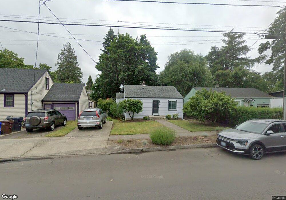
215 W Gloucester St Gladstone, OR 97027
Estimated Value: $354,223 - $400,000
2
Beds
2
Baths
916
Sq Ft
$418/Sq Ft
Est. Value
About This Home
This home is located at 215 W Gloucester St, Gladstone, OR 97027 and is currently estimated at $383,306, approximately $418 per square foot. 215 W Gloucester St is a home located in Clackamas County with nearby schools including John Wetten Elementary School, Walter L Kraxberger Middle School, and Gladstone High School.
Ownership History
Date
Name
Owned For
Owner Type
Purchase Details
Closed on
Aug 8, 2008
Sold by
Bank Of New York
Bought by
Mcintosh Zoe R
Current Estimated Value
Home Financials for this Owner
Home Financials are based on the most recent Mortgage that was taken out on this home.
Original Mortgage
$173,589
Outstanding Balance
$112,919
Interest Rate
6.32%
Mortgage Type
FHA
Estimated Equity
$270,387
Purchase Details
Closed on
Mar 9, 1999
Sold by
Davis Lauren M
Bought by
Gisby Gregg J and Gisby Cathryn A
Create a Home Valuation Report for This Property
The Home Valuation Report is an in-depth analysis detailing your home's value as well as a comparison with similar homes in the area
Home Values in the Area
Average Home Value in this Area
Purchase History
| Date | Buyer | Sale Price | Title Company |
|---|---|---|---|
| Mcintosh Zoe R | $176,314 | First American Title Insuran | |
| Gisby Gregg J | $5,000 | -- |
Source: Public Records
Mortgage History
| Date | Status | Borrower | Loan Amount |
|---|---|---|---|
| Open | Mcintosh Zoe R | $173,589 |
Source: Public Records
Tax History
| Year | Tax Paid | Tax Assessment Tax Assessment Total Assessment is a certain percentage of the fair market value that is determined by local assessors to be the total taxable value of land and additions on the property. | Land | Improvement |
|---|---|---|---|---|
| 2025 | $3,165 | $157,061 | -- | -- |
| 2024 | $3,077 | $152,487 | -- | -- |
| 2023 | $3,077 | $148,046 | $0 | $0 |
| 2022 | $2,861 | $143,734 | $0 | $0 |
| 2021 | $2,756 | $139,548 | $0 | $0 |
| 2020 | $2,691 | $135,484 | $0 | $0 |
| 2019 | $2,659 | $131,538 | $0 | $0 |
| 2018 | $2,563 | $127,707 | $0 | $0 |
| 2017 | $2,486 | $123,987 | $0 | $0 |
| 2016 | $2,404 | $120,376 | $0 | $0 |
Source: Public Records
Map
Nearby Homes
- 232 W Hereford St
- 330 W Dartmouth St
- 115 E Jersey St
- 117 E Jersey St
- 119 E Jersey St
- 162 Alli Ct
- 441 W Gloucester St
- 445 W Exeter St
- 390 W Arlington St
- 825 Yale Ave
- 330 Patricia Dr
- 325 E Arlington St
- 515 E Hereford St
- 19605 River Rd Unit 104
- 945 Cornell Ave
- 1460 Cornell Ave
- 19319 SE River Rd
- 18303 Portland Ave
- 1065 Columbia Ave
- 19643 SE Jay St
- 205 W Gloucester St
- 225 W Gloucester St
- 235 W Gloucester St
- 200 W Fairfield St
- 210 W Fairfield St
- 220 W Fairfield St
- 230 W Fairfield St
- 245 W Gloucester St
- 220 W Gloucester St
- 175 W Gloucester St
- 200 W Gloucester St
- 230 W Gloucester St
- 234 W Fairfield St
- 180 W Fairfield St
- 255 W Gloucester St
- 240 W Gloucester St
- 165 W Gloucester St
- 190 W Gloucester St
- 265 W Gloucester St
- 250 W Gloucester St
Your Personal Tour Guide
Ask me questions while you tour the home.