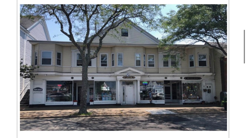
215 W Main St Barnstable, MA 02601
Hyannis Neighborhood
1
Bed
--
Bath
600
Sq Ft
9,583
Sq Ft Lot
About This Home
Property Id: 816931
1 year lease
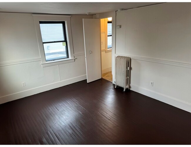
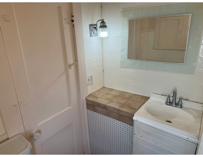
1 bedroom w/ kitchen, and bath.
Utilities included heat/hot water/ electric
2ND Floor- approximately 600 sq ft located on main st Hyannis.
RTA bus route, across from bus/train station. Amenities minutes away.
NO PETS, NO SMOKING, NO CULTIVATING.
First months rent, and Security equal to one months rent due at signing.
Tenant must have good references/rental history.
First + Security
Please text or email for an application.
Ownership History
Date
Name
Owned For
Owner Type
Purchase Details
Closed on
Apr 30, 2025
Sold by
Noyes Jeffrey S and Francis Susan
Bought by
West Main St Two Llc
Home Financials for this Owner
Home Financials are based on the most recent Mortgage that was taken out on this home.
Original Mortgage
$690,000
Outstanding Balance
$690,000
Interest Rate
6.67%
Mortgage Type
Commercial
Create a Home Valuation Report for This Property
The Home Valuation Report is an in-depth analysis detailing your home's value as well as a comparison with similar homes in the area
Home Values in the Area
Average Home Value in this Area
Purchase History
Date | Buyer | Sale Price | Title Company |
---|---|---|---|
West Main St Two Llc | $700,000 | None Available |
Source: Public Records
Mortgage History
Date | Status | Borrower | Loan Amount |
---|---|---|---|
Open | West Main St Two Llc | $690,000 |
Source: Public Records
Property History
Date | Event | Price | Change | Sq Ft Price |
---|---|---|---|---|
03/15/2025 03/15/25 | Off Market | $1,788 | -- | -- |
02/09/2025 02/09/25 | For Rent | $1,788 | -- | -- |
Tax History Compared to Growth
Tax History
Year | Tax Paid | Tax Assessment Tax Assessment Total Assessment is a certain percentage of the fair market value that is determined by local assessors to be the total taxable value of land and additions on the property. | Land | Improvement |
---|---|---|---|---|
2025 | $5,354 | $544,700 | $183,800 | $360,900 |
2024 | $5,267 | $540,200 | $183,800 | $356,400 |
2023 | $5,678 | $540,200 | $183,800 | $356,400 |
2022 | $5,885 | $459,800 | $183,800 | $276,000 |
2021 | $5,885 | $459,800 | $183,800 | $276,000 |
2020 | $4,613 | $350,500 | $161,400 | $189,100 |
2019 | $4,736 | $350,800 | $161,400 | $189,400 |
2018 | $4,502 | $346,300 | $161,400 | $184,900 |
2017 | $4,301 | $341,900 | $161,400 | $180,500 |
2016 | $4,199 | $341,900 | $161,400 | $180,500 |
2015 | $3,976 | $331,300 | $155,000 | $176,300 |
Source: Public Records
Map
Nearby Homes
- 307 W Main St Unit 7
- 31 Arbor Way
- 110 W Main St Unit 30
- 24 Bettys Pond Rd Unit K
- 24 Betty's Pond Rd Unit 1K
- 155 Mitchells Way
- 113 Briarwood Ave
- 6 Harrington Way
- 20 Sunset Terrace
- 27 & 54 Circle Dr
- 48 Smith St
- 174 Bristol Ave
- 144 Sudbury Ln
- 48 Kennedy Cir
- 86 Seabrook Rd
- 155 Mitchell Ln
- 50 Jennifer Ln
- 187 Sea St
- 15 Oak Neck Rd Unit 2 (12)
- 39 Alden Way
- 215 W Main St
- 215 W Main St Unit 1,3,4,5
- 215 W Main St
- 0 Town House Terrace Unit 72
- 4 Town House Ct Unit 4
- 16 Town House Ct
- 14 Town House Ct
- 14 Townhouse Ct Unit 14
- 6 Townhouse Ct Unit 6
- 16 Townhouse Ct
- 16 Townhouse Ct Unit U-16
- 10 Townhouse Ct Unit 10
- 12 Townhouse Ct
- 4 Townhouse Ct Unit 4
- 2 Townhouse Ct Unit 2
- 2 Town House Ct
- 4 Town House Ct
- 6 Town House Ct
- 8 Town House Ct
- 8 Town House Ct Unit 8