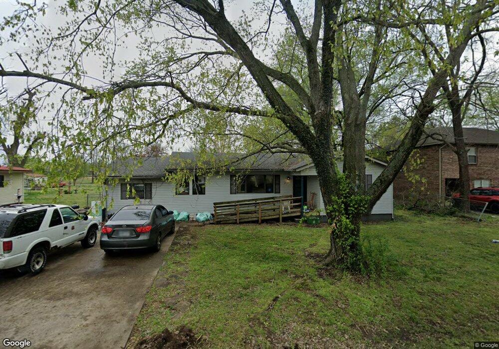
215 W Thurman St Prairie Grove, AR 72753
Estimated Value: $173,000 - $243,000
2
Beds
1
Bath
1,340
Sq Ft
$156/Sq Ft
Est. Value
About This Home
This home is located at 215 W Thurman St, Prairie Grove, AR 72753 and is currently estimated at $208,990, approximately $155 per square foot. 215 W Thurman St is a home located in Washington County with nearby schools including Prairie Grove Elementary School, Prairie Grove Middle School, and Prairie Grove Junior High School.
Ownership History
Date
Name
Owned For
Owner Type
Purchase Details
Closed on
Jan 26, 2007
Sold by
Patterson James and Allen Jennifer G
Bought by
Raymond Julia A
Current Estimated Value
Purchase Details
Closed on
Mar 31, 1987
Bought by
Sager Jack and Sager Thelma
Purchase Details
Closed on
Apr 25, 1986
Bought by
Buysse Thomas D and Buysse Patricia A
Purchase Details
Closed on
Apr 12, 1978
Bought by
Cohea Atlas and Cohea Fannie
Create a Home Valuation Report for This Property
The Home Valuation Report is an in-depth analysis detailing your home's value as well as a comparison with similar homes in the area
Home Values in the Area
Average Home Value in this Area
Purchase History
| Date | Buyer | Sale Price | Title Company |
|---|---|---|---|
| Raymond Julia A | $100,000 | Lenders Title Company | |
| Sager Jack | -- | -- | |
| Buysse Thomas D | $4,000 | -- | |
| Cohea Atlas | -- | -- |
Source: Public Records
Tax History Compared to Growth
Tax History
| Year | Tax Paid | Tax Assessment Tax Assessment Total Assessment is a certain percentage of the fair market value that is determined by local assessors to be the total taxable value of land and additions on the property. | Land | Improvement |
|---|---|---|---|---|
| 2025 | $343 | $32,480 | $11,900 | $20,580 |
| 2024 | $416 | $32,480 | $11,900 | $20,580 |
| 2023 | $483 | $32,480 | $11,900 | $20,580 |
| 2022 | $490 | $21,500 | $4,900 | $16,600 |
| 2021 | $453 | $21,500 | $4,900 | $16,600 |
| 2020 | $412 | $21,500 | $4,900 | $16,600 |
| 2019 | $383 | $13,930 | $3,600 | $10,330 |
| 2018 | $408 | $13,930 | $3,600 | $10,330 |
| 2017 | $401 | $13,930 | $3,600 | $10,330 |
| 2016 | $401 | $13,930 | $3,600 | $10,330 |
| 2015 | $401 | $13,930 | $3,600 | $10,330 |
| 2014 | $438 | $14,620 | $3,600 | $11,020 |
Source: Public Records
Map
Nearby Homes
- 4.66 +/- AC Tract 5 Hwy 62 & S Mock St
- 601 Westwood Ave
- 211 Boston St
- 110 Cypress St
- 703 Grant Ave
- 311 S Mock St
- Lot 2 Holmes St
- TBD Kate Smith St
- 661 Summer Ln
- 601 Pennington Ave
- 208 N Neal St
- 106 S Ozark St
- 806 Grant Ave
- 600 Kendra St
- 621 Kendra St
- 740 Kendra St
- 807 Sedgwick Dr
- 107 S Ozark St
- 304 S Summit St
- 308 S Summit St
- 213 W Thurman St
- 219 W Thurman St
- 214 W Thurman St
- 218 W Butler St
- 210 W Thurman St
- 303 W Thurman St
- 206 Hickory St
- 117.97 AC W Butler St
- 0 W Butler St
- 300 W Thurman St
- 208 W Thurman St
- 203 W Thurman St
- 207 Walnut St
- 306 W Thurman St
- 311 W Thurman St
- 205 Hickory St
- 217 W Cleveland St
- 201 E Thurman St
- 201 W Thurman St
- 200 W Thurman St