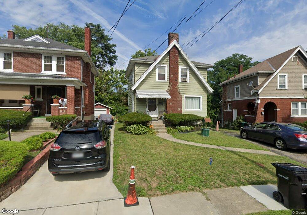
2150 Crane Ave Cincinnati, OH 45207
Evanston NeighborhoodEstimated Value: $150,000 - $243,000
3
Beds
2
Baths
1,192
Sq Ft
$173/Sq Ft
Est. Value
About This Home
This home is located at 2150 Crane Ave, Cincinnati, OH 45207 and is currently estimated at $205,770, approximately $172 per square foot. 2150 Crane Ave is a home located in Hamilton County with nearby schools including Evanston Academy Elementary School, Clark Montessori High School, and Shroder High School.
Ownership History
Date
Name
Owned For
Owner Type
Purchase Details
Closed on
Jun 14, 2004
Sold by
Triggs Teresa and Triggs George
Bought by
Triggs George and Triggs Teresa
Current Estimated Value
Home Financials for this Owner
Home Financials are based on the most recent Mortgage that was taken out on this home.
Original Mortgage
$103,500
Outstanding Balance
$58,808
Interest Rate
8.5%
Mortgage Type
New Conventional
Estimated Equity
$146,962
Purchase Details
Closed on
Jan 5, 1999
Sold by
Phillips Karla R and Phillips Trevor K
Bought by
Daniel Teresa and Triggs George
Home Financials for this Owner
Home Financials are based on the most recent Mortgage that was taken out on this home.
Original Mortgage
$74,594
Interest Rate
6.76%
Mortgage Type
FHA
Create a Home Valuation Report for This Property
The Home Valuation Report is an in-depth analysis detailing your home's value as well as a comparison with similar homes in the area
Home Values in the Area
Average Home Value in this Area
Purchase History
| Date | Buyer | Sale Price | Title Company |
|---|---|---|---|
| Triggs George | -- | -- | |
| Daniel Teresa | $75,000 | -- |
Source: Public Records
Mortgage History
| Date | Status | Borrower | Loan Amount |
|---|---|---|---|
| Open | Triggs George | $103,500 | |
| Closed | Daniel Teresa | $74,594 | |
| Closed | Daniel Teresa | $2,500 |
Source: Public Records
Tax History Compared to Growth
Tax History
| Year | Tax Paid | Tax Assessment Tax Assessment Total Assessment is a certain percentage of the fair market value that is determined by local assessors to be the total taxable value of land and additions on the property. | Land | Improvement |
|---|---|---|---|---|
| 2024 | $2,246 | $37,468 | $6,906 | $30,562 |
| 2023 | $2,296 | $37,468 | $6,906 | $30,562 |
| 2022 | $1,239 | $18,043 | $5,016 | $13,027 |
| 2021 | $1,191 | $18,043 | $5,016 | $13,027 |
| 2020 | $1,224 | $18,043 | $5,016 | $13,027 |
| 2019 | $1,227 | $16,556 | $4,603 | $11,953 |
| 2018 | $1,229 | $16,556 | $4,603 | $11,953 |
| 2017 | $1,167 | $16,556 | $4,603 | $11,953 |
| 2016 | $1,070 | $14,945 | $4,984 | $9,961 |
| 2015 | $964 | $14,945 | $4,984 | $9,961 |
| 2014 | $971 | $14,945 | $4,984 | $9,961 |
| 2013 | $1,008 | $15,250 | $5,086 | $10,164 |
Source: Public Records
Map
Nearby Homes
- 2177 Crane Ave
- 3511 Evanston Ave
- 2197 Crane Ave
- 2217 Crane Ave
- 3533 Evanston Ave
- 3501 Bevis Ave
- 2235 Crane Ave
- 3517 Bevis Ave
- 3414 Bevis Ave
- 3520 Trimble Ave
- 3339 Hewitt Crescent St
- 3423 Bevis Ave
- 3568 Bevis Ave
- 2014 Clarion Ave
- 2002 Clarion Ave
- 3552 Trimble Ave
- 3422 Trimble Ave
- 1932 Clarion Ave
- 3618 Wabash Ave
- 3610 Bevis Ave
- 2140 Crane Ave
- 2152 Crane Ave
- 2138 Crane Ave
- 2154 Crane Ave
- 3472 Evanston Ave
- 3470 Evanston Ave
- 3474 Evanston Ave
- 2132 Crane Ave
- 3476 Evanston Ave
- 3468 Evanston Ave
- 2149 Crane Ave
- 2156 Crane Ave
- 3464 Evanston Ave
- 3478 Evanston Ave
- 2153 Crane Ave
- 2128 Crane Ave
- 2137 Crane Ave
- 2133 Crane Ave
- 2160 Crane Ave
- 3480 Evanston Ave