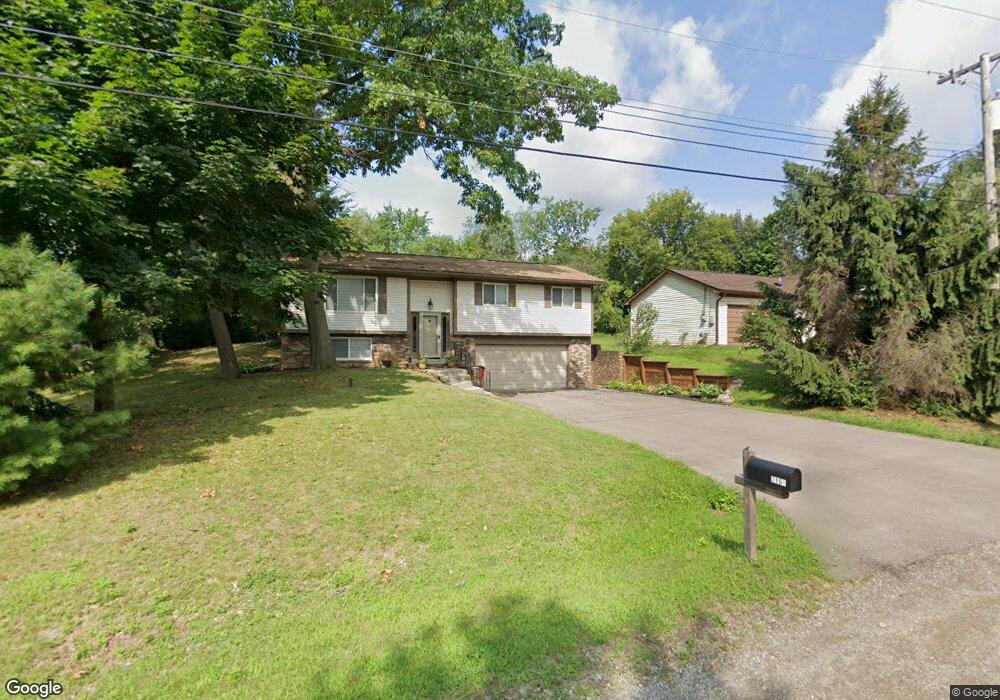
2150 Mapesbury Dr Unit Bldg-Unit West Bloomfield, MI 48324
Estimated Value: $339,000 - $512,000
3
Beds
3
Baths
1,636
Sq Ft
$245/Sq Ft
Est. Value
About This Home
This home is located at 2150 Mapesbury Dr Unit Bldg-Unit, West Bloomfield, MI 48324 and is currently estimated at $400,223, approximately $244 per square foot. 2150 Mapesbury Dr Unit Bldg-Unit is a home located in Oakland County with nearby schools including Waterford Montessori Academy, Our Lady Of Refuge School, and Lakecrest Baptist School.
Ownership History
Date
Name
Owned For
Owner Type
Purchase Details
Closed on
Jul 21, 2020
Sold by
El Zein Mucheal and Gibson Stefanie
Bought by
Lwantale Maria
Current Estimated Value
Home Financials for this Owner
Home Financials are based on the most recent Mortgage that was taken out on this home.
Original Mortgage
$237,405
Outstanding Balance
$209,088
Interest Rate
3.1%
Mortgage Type
Unknown
Estimated Equity
$191,135
Purchase Details
Closed on
Sep 23, 2016
Sold by
Mondo Roberta A and Mondo Michael R
Bought by
El Zein Michael and Gibson Stefanie
Home Financials for this Owner
Home Financials are based on the most recent Mortgage that was taken out on this home.
Original Mortgage
$235,000
Interest Rate
2.87%
Mortgage Type
Adjustable Rate Mortgage/ARM
Create a Home Valuation Report for This Property
The Home Valuation Report is an in-depth analysis detailing your home's value as well as a comparison with similar homes in the area
Home Values in the Area
Average Home Value in this Area
Purchase History
| Date | Buyer | Sale Price | Title Company |
|---|---|---|---|
| Lwantale Maria | $249,900 | None Available | |
| El Zein Michael | $235,000 | Sterling Title Agency |
Source: Public Records
Mortgage History
| Date | Status | Borrower | Loan Amount |
|---|---|---|---|
| Open | Lwantale Maria | $237,405 | |
| Previous Owner | El Zein Michael | $235,000 |
Source: Public Records
Tax History Compared to Growth
Tax History
| Year | Tax Paid | Tax Assessment Tax Assessment Total Assessment is a certain percentage of the fair market value that is determined by local assessors to be the total taxable value of land and additions on the property. | Land | Improvement |
|---|---|---|---|---|
| 2024 | $5,397 | $144,810 | $0 | $0 |
| 2022 | $4,971 | $117,200 | $32,540 | $84,660 |
| 2021 | $5,935 | $109,730 | $0 | $0 |
| 2020 | $2,550 | $107,670 | $32,540 | $75,130 |
| 2018 | $3,812 | $96,420 | $30,060 | $66,360 |
| 2015 | -- | $74,220 | $0 | $0 |
| 2014 | -- | $67,560 | $0 | $0 |
| 2011 | -- | $61,880 | $0 | $0 |
Source: Public Records
Map
Nearby Homes
- 5149 Latimer St
- 1883 Poppleton Dr
- 5492 Charrington Ct
- 1859 Poppleton Dr
- 2115 Aldwin Dr
- 2110 Peachtree Ct
- 1844 Poppleton Dr
- 4900 Lakeview Ave
- 1753 Dawncrest Dr
- 2140 Timberridge Ct
- 4796 Dow Ridge Rd
- 2800 Hiller Rd
- Lot 94 Hiller Rd
- 2112 Keylon Dr
- 5190 Westcombe Ln
- 2311 Keylon Dr
- 1805 Auburndale Ave
- 2745 Lari Ct
- VAC Daron Ln
- 1522 Oregon Ct
- 2150 Mapesbury Dr
- 2150 Mapesbury Dr
- 2140 Mapesbury Dr
- 2162 Mapesbury Dr
- 2174 Mapesbury Dr
- 2159 Mapesbury Dr
- 5255 Greer Rd
- 2145 Mapesbury Dr
- 2169 Mapesbury Dr
- 2181 Mapesbury Dr Unit Bldg-Unit
- 2181 Mapesbury Dr
- 2186 Mapesbury Dr
- 2105 Mapesbury Dr
- 2130 Moorgate Dr
- 5216 Latimer St
- 2150 Moorgate Dr
- 5235 Greer Rd
- 2110 Moorgate Dr
- 5250 Latimer St
- 5208 Latimer St