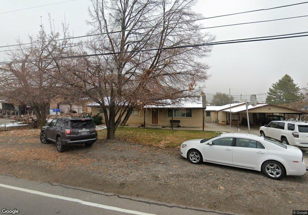
2150 N 600 W Unit 5 Pleasant Grove, UT 84062
Estimated Value: $720,000 - $905,000
--
Bed
4
Baths
2,362
Sq Ft
$341/Sq Ft
Est. Value
About This Home
This home is located at 2150 N 600 W Unit 5, Pleasant Grove, UT 84062 and is currently estimated at $806,541, approximately $341 per square foot. 2150 N 600 W Unit 5 is a home located in Utah County with nearby schools including Manila Elementary School, Pleasant Grove Junior High School, and Pleasant Grove High School.
Ownership History
Date
Name
Owned For
Owner Type
Purchase Details
Closed on
Jun 5, 2024
Sold by
Nielson Michael
Bought by
Mjnnn Asset Protection Trust and Nielson
Current Estimated Value
Home Financials for this Owner
Home Financials are based on the most recent Mortgage that was taken out on this home.
Original Mortgage
$543,750
Outstanding Balance
$537,008
Interest Rate
7.17%
Mortgage Type
New Conventional
Estimated Equity
$269,533
Purchase Details
Closed on
Jul 12, 2017
Sold by
Kohler Glenna Elaine and Faux Susan Willetta
Bought by
Faux Susan K and The Heritage Asset Protection
Create a Home Valuation Report for This Property
The Home Valuation Report is an in-depth analysis detailing your home's value as well as a comparison with similar homes in the area
Home Values in the Area
Average Home Value in this Area
Purchase History
| Date | Buyer | Sale Price | Title Company |
|---|---|---|---|
| Mjnnn Asset Protection Trust | -- | Fidelity National Title | |
| Nielson Michael | -- | Masters Title | |
| Faux Susan K | -- | None Available |
Source: Public Records
Mortgage History
| Date | Status | Borrower | Loan Amount |
|---|---|---|---|
| Open | Nielson Michael | $543,750 |
Source: Public Records
Tax History Compared to Growth
Tax History
| Year | Tax Paid | Tax Assessment Tax Assessment Total Assessment is a certain percentage of the fair market value that is determined by local assessors to be the total taxable value of land and additions on the property. | Land | Improvement |
|---|---|---|---|---|
| 2025 | $2,898 | $348,150 | $309,000 | $324,000 |
| 2024 | $2,898 | $346,280 | $0 | $0 |
| 2023 | $2,973 | $363,165 | $0 | $0 |
| 2022 | $3,022 | $367,400 | $0 | $0 |
| 2021 | $2,512 | $464,900 | $194,000 | $270,900 |
| 2020 | $2,312 | $419,500 | $173,200 | $246,300 |
| 2019 | $2,184 | $409,900 | $163,600 | $246,300 |
| 2018 | $2,202 | $390,700 | $144,400 | $246,300 |
| 2017 | $2,676 | $252,780 | $0 | $0 |
| 2016 | $2,483 | $226,490 | $0 | $0 |
| 2015 | $2,623 | $226,490 | $0 | $0 |
| 2014 | $2,576 | $220,385 | $0 | $0 |
Source: Public Records
Map
Nearby Homes
- 532 W 2000 N
- 1897 N 900 W
- 980 W 1800 N
- 1727 N Siena Cir Unit 4
- 674 W 1590 N Unit 11
- 731 W 1590 N Unit 15
- 1726 N Siena Cir Unit 10
- 1656 N Siena Cir Unit 7
- 1534 N 750 W Unit 16
- Konlee Plan at Makin Dreams
- Alexa Plan at Makin Dreams
- Callahan Plan at Makin Dreams
- Hailey Plan at Makin Dreams
- Alydia Plan at Makin Dreams
- Addison Plan at Makin Dreams
- Julia Plan at Makin Dreams
- 1531 N 750 W Unit 4
- Aaron Plan at Makin Dreams
- Amie Plan at Makin Dreams
- Nora Plan at Makin Dreams
- 2150 N 600 W
- 2150 N 600 W Unit 4
- 2150 N 600 W Unit 6
- 2160 N 600 W
- 2124 N 600 W
- 2208 N 600 W
- 2161 N 600 W
- 2161 N 600 W Unit 2
- 2179 N 600 W
- 2179 N 600 W Unit 1
- 2119 N 600 W
- 2175 Verona Cir
- 2211 N 600 W
- 2165 Verona Cir
- 640 W 2100 N
- 503 Glendon Way
- 2251 N 600 W
- 2155 N 600 W
- 2155 N 600 W Unit 2
- 619 W 2100 N