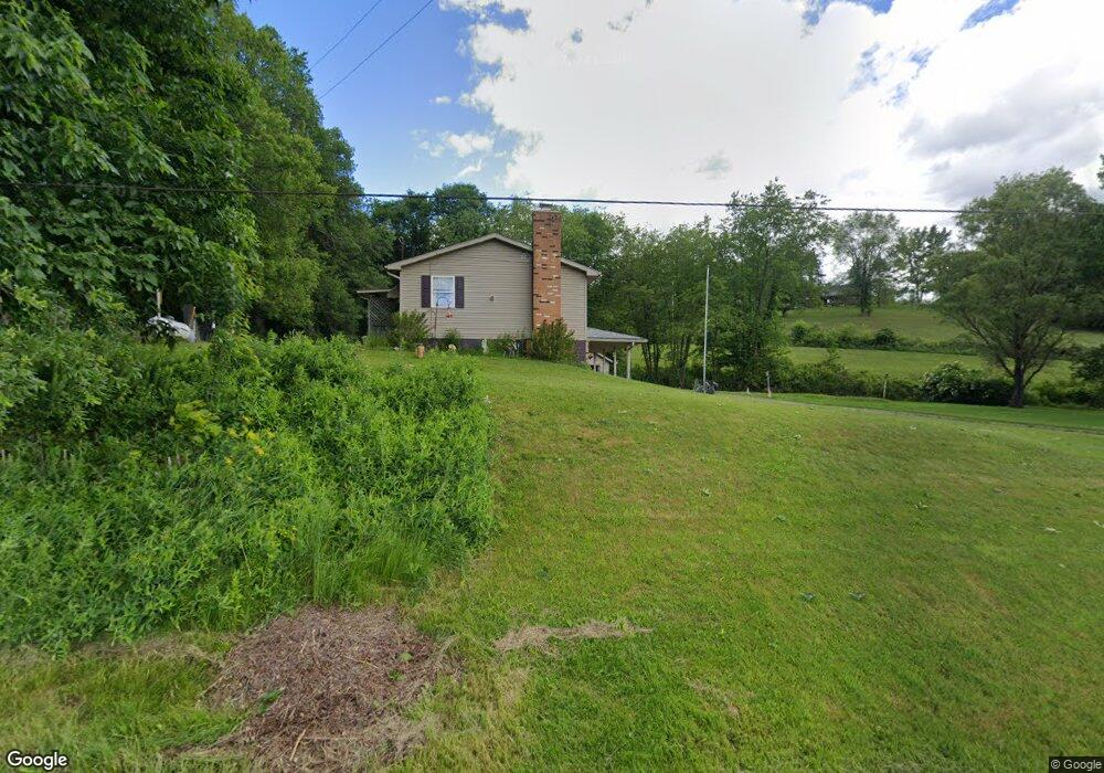
2151 Roswell Rd SW Unit 13 Carrollton, OH 44615
Estimated Value: $176,000 - $317,000
3
Beds
1
Bath
1,512
Sq Ft
$148/Sq Ft
Est. Value
About This Home
This home is located at 2151 Roswell Rd SW Unit 13, Carrollton, OH 44615 and is currently estimated at $223,187, approximately $147 per square foot. 2151 Roswell Rd SW Unit 13 is a home located in Carroll County with nearby schools including Carrollton High School and Carroll County Christian Academy.
Ownership History
Date
Name
Owned For
Owner Type
Purchase Details
Closed on
Oct 23, 2025
Sold by
Dobos Loretta Mae
Bought by
Loretta Mae Dobos Revocable Living Trust and Dobos
Current Estimated Value
Purchase Details
Closed on
Jul 5, 2013
Sold by
Borchart David Albert and Dobos Loretta Mae
Bought by
Borchart David Albert and Dobos Loretta Mae
Home Financials for this Owner
Home Financials are based on the most recent Mortgage that was taken out on this home.
Original Mortgage
$28,926
Interest Rate
4.38%
Mortgage Type
New Conventional
Purchase Details
Closed on
Dec 10, 2007
Sold by
Borchart David A and Dobos Loretta M
Bought by
Borchart David Albert and Dobos Loretta Mae
Purchase Details
Closed on
Jun 8, 2002
Bought by
Borchart Dobos Revocable
Create a Home Valuation Report for This Property
The Home Valuation Report is an in-depth analysis detailing your home's value as well as a comparison with similar homes in the area
Home Values in the Area
Average Home Value in this Area
Purchase History
| Date | Buyer | Sale Price | Title Company |
|---|---|---|---|
| Loretta Mae Dobos Revocable Living Trust | -- | None Listed On Document | |
| Dobos Loretta Mae | -- | None Listed On Document | |
| Borchart David Albert | -- | None Available | |
| Borchart David Albert | -- | None Available | |
| Borchart Dobos Revocable | -- | -- |
Source: Public Records
Mortgage History
| Date | Status | Borrower | Loan Amount |
|---|---|---|---|
| Previous Owner | Borchart David Albert | $28,926 |
Source: Public Records
Tax History Compared to Growth
Tax History
| Year | Tax Paid | Tax Assessment Tax Assessment Total Assessment is a certain percentage of the fair market value that is determined by local assessors to be the total taxable value of land and additions on the property. | Land | Improvement |
|---|---|---|---|---|
| 2024 | $988 | $41,210 | $7,210 | $34,000 |
| 2023 | $1,000 | $41,210 | $7,210 | $34,000 |
| 2022 | $997 | $34,210 | $5,990 | $28,220 |
| 2021 | $795 | $34,210 | $5,990 | $28,220 |
| 2020 | $752 | $34,210 | $5,990 | $28,220 |
| 2019 | $760 | $34,202 | $5,985 | $28,217 |
| 2018 | $669 | $30,490 | $5,080 | $25,410 |
| 2017 | $669 | $30,490 | $5,080 | $25,410 |
| 2016 | $592 | $27,970 | $4,660 | $23,310 |
| 2015 | $592 | $27,970 | $4,660 | $23,310 |
| 2014 | $592 | $27,970 | $4,660 | $23,310 |
| 2013 | $587 | $27,970 | $4,660 | $23,310 |
Source: Public Records
Map
Nearby Homes
- 144 Arrow Rd SW Unit 19
- 2081 Antigua Rd SW Unit 17
- 819 Courtview Dr SW Unit 81
- 2245 Scroll Rd SW Unit 17
- 307 Lincoln Ave NW Unit 36
- 238 High St SW Unit 3A
- 615 Longhorn St NW Unit 20B
- 208 2nd St SW Unit 5
- 424 Avalon Rd SW Unit 31
- 2173 Arrow Rd NW Unit 22
- 10 S Ohio St
- 17 West St
- 2081 Waynesburg Rd NW Unit 16
- 928 Overlook Ln NE
- 1344 Meadowbrook Ln NE Unit 82
- 0 Mayham Rd NE
- 3044 Jasmine Rd NW Unit 11
- 1188 Brenner Rd NE Unit 33A
- 121 Waynesburg Rd NW Unit 4A
- 1121 Center St SW
- 2129 Roswell Rd SW Unit 13
- 2117 Roswell Rd SW Unit 13
- 2107 Roswell Rd SW Unit 13
- 2185 Roswell Rd SW Unit 13
- 2182 Roswell Rd SW Unit 13
- 2224 Roswell Rd SW Unit 13
- 2234 Roswell Rd SW
- 2236 Roswell Rd SW
- 2213 Roswell Rd SW Unit 13
- 2040 Roswell Rd SW Unit 13
- 2017 Roswell Rd SW
- 2146 Folsam Rd NW
- 2146 Folsam Rd NW Unit 13
- 2186 Folsam Rd NW Unit 13
- 2198 Folsam Rd NW Unit 13
- 2166 Folsam Rd NW Unit 13
- 2011 Roswell Rd SW Unit 13
- 2040 Folsam Rd NW Unit 13
- 2297 Roswell Rd SW
- 94 Arrow Rd SW Unit 19
