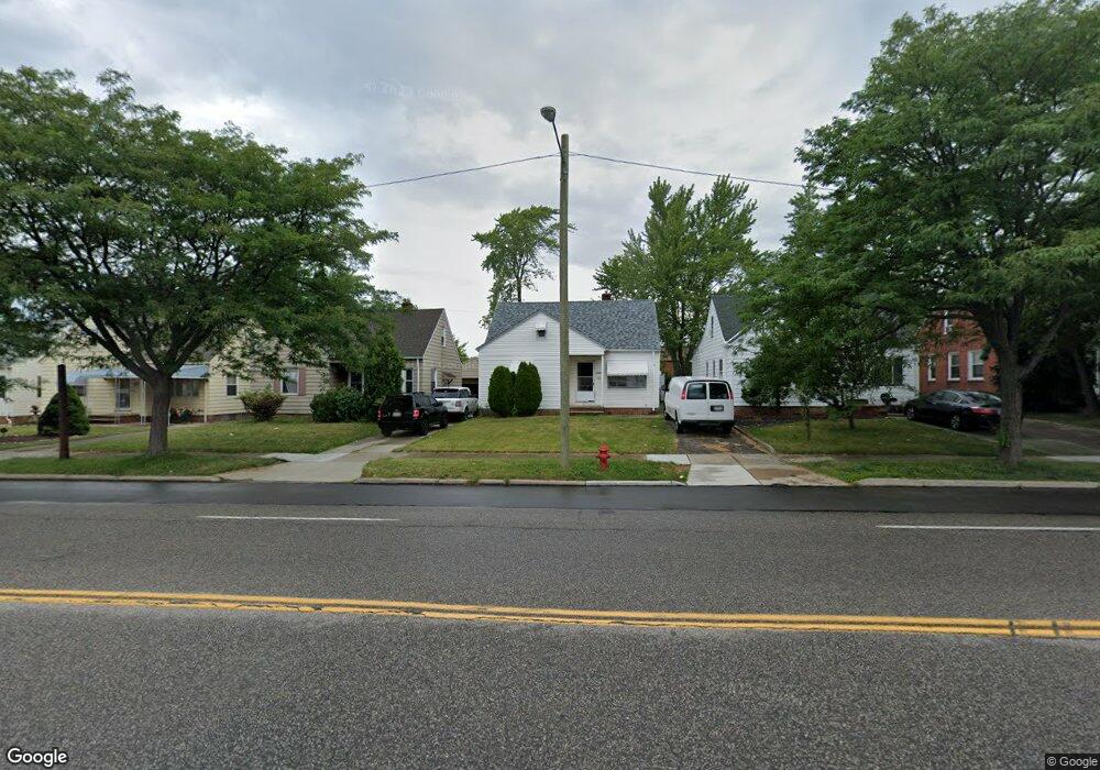
21515 Libby Rd Maple Heights, OH 44137
Estimated Value: $82,974 - $119,000
3
Beds
1
Bath
940
Sq Ft
$111/Sq Ft
Est. Value
About This Home
This home is located at 21515 Libby Rd, Maple Heights, OH 44137 and is currently estimated at $104,494, approximately $111 per square foot. 21515 Libby Rd is a home located in Cuyahoga County with nearby schools including Abraham Lincoln Elementary School, Rockside/ J.F. Kennedy School, and Barack Obama School.
Ownership History
Date
Name
Owned For
Owner Type
Purchase Details
Closed on
Oct 27, 2022
Sold by
Patel Sanjay H and Patel Madhvi
Bought by
Silver Real Estate Llc
Current Estimated Value
Purchase Details
Closed on
Aug 19, 2010
Sold by
Davoudi Enterprises Llc
Bought by
Patel Sanjay H
Purchase Details
Closed on
Aug 18, 2010
Sold by
Northcoast Real Estate Management Ltd
Bought by
Davoudi Enterprises Inc
Purchase Details
Closed on
Sep 30, 2009
Sold by
The Loan Place
Bought by
Davoudi Enterprises Inc
Purchase Details
Closed on
Jul 1, 2009
Sold by
Stonecrest Investment Llc
Bought by
The Loan Place
Purchase Details
Closed on
Feb 26, 2009
Sold by
Wells Fargo Bank Na
Bought by
Stonecrest Investments Llc
Purchase Details
Closed on
Oct 27, 2008
Sold by
Green Darek and Lembo David
Bought by
Wells Fargo Bank Na
Purchase Details
Closed on
Jan 23, 2006
Sold by
Northcoast Real Estate Management Ltd
Bought by
Green Darek
Home Financials for this Owner
Home Financials are based on the most recent Mortgage that was taken out on this home.
Original Mortgage
$100,000
Interest Rate
6.21%
Mortgage Type
Balloon
Purchase Details
Closed on
Dec 28, 2000
Sold by
Lembo David
Bought by
Northcoast Real Estate Management Ltd and Trust #21515 Libby Rd Land Trust
Purchase Details
Closed on
Aug 13, 1999
Sold by
Sec Of Hud
Bought by
Lembo David
Home Financials for this Owner
Home Financials are based on the most recent Mortgage that was taken out on this home.
Original Mortgage
$65,100
Interest Rate
8.62%
Purchase Details
Closed on
Apr 29, 1987
Bought by
Kolin David A
Purchase Details
Closed on
Oct 22, 1979
Sold by
Hunziker Glenn G
Bought by
Trade Mark Rlty
Purchase Details
Closed on
Nov 28, 1978
Sold by
Emily Randazzo
Bought by
Hunziker Glenn G
Purchase Details
Closed on
Aug 31, 1977
Sold by
Randazzo Charles A and Randazzo E
Bought by
Emily Randazzo
Purchase Details
Closed on
Jan 1, 1975
Bought by
Randazzo Charles A and Randazzo E
Create a Home Valuation Report for This Property
The Home Valuation Report is an in-depth analysis detailing your home's value as well as a comparison with similar homes in the area
Home Values in the Area
Average Home Value in this Area
Purchase History
| Date | Buyer | Sale Price | Title Company |
|---|---|---|---|
| Silver Real Estate Llc | $44,000 | Titleco Title Agency | |
| Patel Sanjay H | $18,000 | Resource Title Agency | |
| Davoudi Enterprises Inc | -- | Resource Title Agency | |
| Davoudi Enterprises Inc | $4,000 | None Available | |
| The Loan Place | $1,000 | None Available | |
| Stonecrest Investments Llc | $1,576 | None Available | |
| Wells Fargo Bank Na | $16,000 | None Available | |
| Green Darek | $100,000 | Suntrust Title Agency | |
| Northcoast Real Estate Management Ltd | -- | Gateway Title Agency Inc | |
| Lembo David | $46,000 | Gateway Title Agency Inc | |
| Kolin David A | $45,700 | -- | |
| Trade Mark Rlty | $30,000 | -- | |
| Hunziker Glenn G | $39,900 | -- | |
| Emily Randazzo | -- | -- | |
| Randazzo Charles A | -- | -- |
Source: Public Records
Mortgage History
| Date | Status | Borrower | Loan Amount |
|---|---|---|---|
| Previous Owner | Green Darek | $100,000 | |
| Previous Owner | Lembo David | $65,100 |
Source: Public Records
Tax History
| Year | Tax Paid | Tax Assessment Tax Assessment Total Assessment is a certain percentage of the fair market value that is determined by local assessors to be the total taxable value of land and additions on the property. | Land | Improvement |
|---|---|---|---|---|
| 2024 | $2,792 | $29,575 | $5,390 | $24,185 |
| 2023 | $2,123 | $18,970 | $3,640 | $15,330 |
| 2022 | $2,267 | $18,970 | $3,640 | $15,330 |
| 2021 | $2,253 | $18,970 | $3,640 | $15,330 |
| 2020 | $1,933 | $14,390 | $2,770 | $11,620 |
| 2019 | $1,923 | $41,100 | $7,900 | $33,200 |
| 2018 | $1,813 | $14,390 | $2,770 | $11,620 |
| 2017 | $1,854 | $13,550 | $2,590 | $10,960 |
| 2016 | $1,794 | $13,550 | $2,590 | $10,960 |
| 2015 | $1,788 | $13,550 | $2,590 | $10,960 |
| 2014 | $1,788 | $14,880 | $2,840 | $12,040 |
Source: Public Records
Map
Nearby Homes
- 21607 Libby Rd
- 21202 Gardenview Dr
- 21202 Hillgrove Ave
- 21860 Louis Rd
- 21600 Franklin Rd
- 20905 Clare Ave
- 21207 Franklin Rd
- 20806 Clare Ave
- 5147 Warrensville Center Rd
- 20715 Watson Rd
- 5424 Fairtree Rd
- 20517 Raymond St
- 20600 Watson Rd
- 20705 Hansen Rd
- 20648 Donny Brook Rd
- 5385 Bartlett Rd
- 19931 Raymond St
- 0 Miles Rd Unit 5188561
- 19289 Stafford Ave
- 19520 Maple Heights Blvd
- 21519 Libby Rd
- 21511 Libby Rd
- 21603 Libby Rd
- 21507 Libby Rd
- 21512 Gardenview Dr
- 21503 Libby Rd
- 21516 Gardenview Dr
- 21504 Gardenview Dr
- 21600 Gardenview Dr
- 21419 Libby Rd
- 21500 Gardenview Dr
- 21604 Gardenview Dr
- 21416 Gardenview Dr
- 21415 Libby Rd
- 21414 Gardenview Dr
- 21411 Libby Rd
- 21410 Gardenview Dr
- 21513 Gardenview 3afb
- 21513 Gardenview Dr
- 21517 Gardenview Dr
Your Personal Tour Guide
Ask me questions while you tour the home.