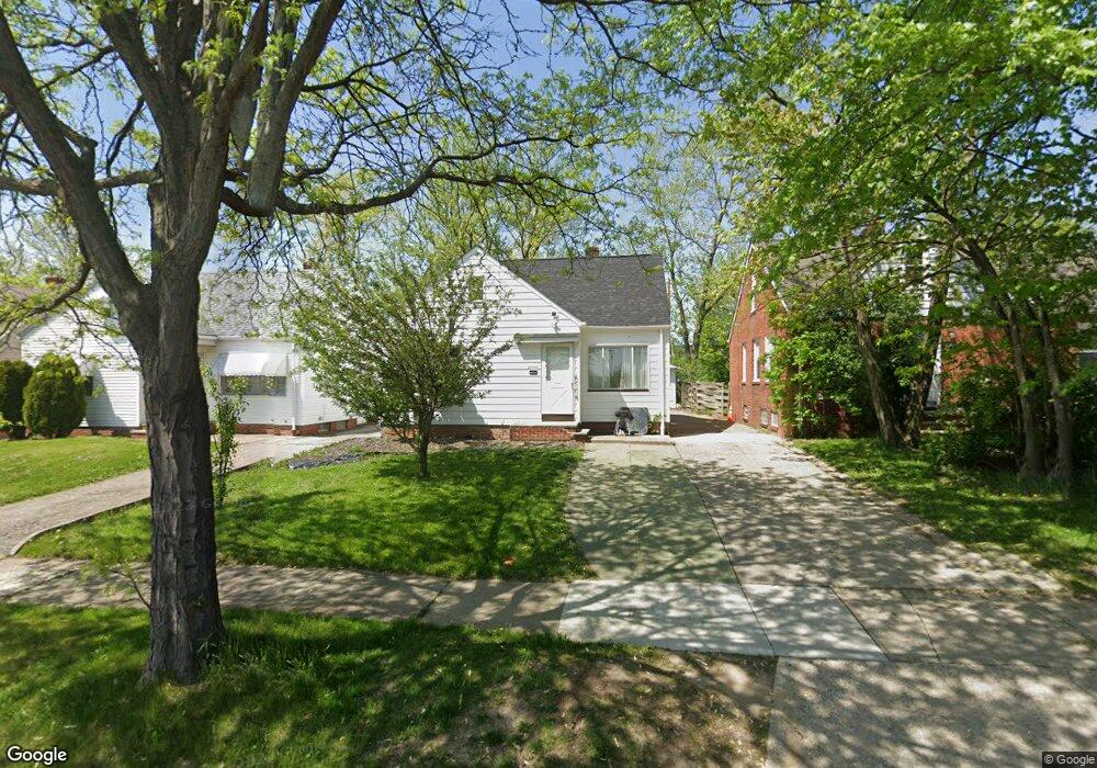
21519 Libby Rd Maple Heights, OH 44137
Estimated Value: $114,000 - $132,000
3
Beds
1
Bath
1,414
Sq Ft
$85/Sq Ft
Est. Value
About This Home
This home is located at 21519 Libby Rd, Maple Heights, OH 44137 and is currently estimated at $120,785, approximately $85 per square foot. 21519 Libby Rd is a home located in Cuyahoga County with nearby schools including Abraham Lincoln Elementary School, Rockside/ J.F. Kennedy School, and Barack Obama School.
Ownership History
Date
Name
Owned For
Owner Type
Purchase Details
Closed on
Mar 10, 2021
Sold by
Cuyahoga Development Group
Bought by
L & L Flynn Properties Llc
Current Estimated Value
Home Financials for this Owner
Home Financials are based on the most recent Mortgage that was taken out on this home.
Original Mortgage
$1,102,020
Interest Rate
3.69%
Mortgage Type
New Conventional
Purchase Details
Closed on
Mar 18, 2019
Sold by
Ruffo Evalyn Inez and Treasurer Of Cuyahoga County
Bought by
Cuyahoga Development Group Llc
Purchase Details
Closed on
Aug 12, 2005
Sold by
Ruffo Evalyn Inez
Bought by
Ruffo Samuel and Ruffo Evalyn Inez
Purchase Details
Closed on
Jan 1, 1975
Bought by
Ruffo Evalyn I
Create a Home Valuation Report for This Property
The Home Valuation Report is an in-depth analysis detailing your home's value as well as a comparison with similar homes in the area
Home Values in the Area
Average Home Value in this Area
Purchase History
| Date | Buyer | Sale Price | Title Company |
|---|---|---|---|
| L & L Flynn Properties Llc | $1,515,890 | Chicago Title | |
| Cuyahoga Development Group Llc | $17,116 | None Available | |
| Ruffo Samuel | -- | -- | |
| Ruffo Evalyn I | -- | -- |
Source: Public Records
Mortgage History
| Date | Status | Borrower | Loan Amount |
|---|---|---|---|
| Previous Owner | L & L Flynn Properties Llc | $1,102,020 |
Source: Public Records
Tax History
| Year | Tax Paid | Tax Assessment Tax Assessment Total Assessment is a certain percentage of the fair market value that is determined by local assessors to be the total taxable value of land and additions on the property. | Land | Improvement |
|---|---|---|---|---|
| 2024 | $2,892 | $30,800 | $4,830 | $25,970 |
| 2023 | $2,181 | $19,600 | $3,290 | $16,310 |
| 2022 | $2,173 | $19,600 | $3,290 | $16,310 |
| 2021 | $2,316 | $19,600 | $3,290 | $16,310 |
| 2020 | $1,984 | $14,840 | $2,490 | $12,360 |
| 2019 | $1,818 | $42,400 | $7,100 | $35,300 |
| 2018 | $1,921 | $14,840 | $2,490 | $12,360 |
| 2017 | $1,846 | $13,830 | $2,310 | $11,520 |
| 2016 | $1,786 | $13,830 | $2,310 | $11,520 |
| 2015 | $3,675 | $13,830 | $2,310 | $11,520 |
| 2014 | $3,675 | $15,200 | $2,560 | $12,640 |
Source: Public Records
Map
Nearby Homes
- 21607 Libby Rd
- 21860 Louis Rd
- 21600 Franklin Rd
- 21202 Hillgrove Ave
- 21207 Franklin Rd
- 20737 Bowling Green Rd
- 20806 Clare Ave
- 20732 Applegate Rd
- 5345 Fairtree Rd
- 5424 Fairtree Rd
- 5147 Warrensville Center Rd
- 20715 Watson Rd
- 20517 Raymond St
- 5385 Bartlett Rd
- 19812 Stockton Ave
- 19931 Raymond St
- 33 Meadowgate Blvd
- 19289 Stafford Ave
- 19520 Maple Heights Blvd
- 19113 Watercrest Ave
- 21603 Libby Rd
- 21515 Libby Rd
- 21511 Libby Rd
- 21516 Gardenview Dr
- 21507 Libby Rd
- 21600 Gardenview Dr
- 21512 Gardenview Dr
- 21604 Gardenview Dr
- 21503 Libby Rd
- 21504 Gardenview Dr
- 21500 Gardenview Dr
- 21419 Libby Rd
- 21416 Gardenview Dr
- 21415 Libby Rd
- 21414 Gardenview Dr
- 21411 Libby Rd
- 21513 Gardenview 3afb
- 21517 Gardenview Dr
- 21601 Gardenview Dr
- 21513 Gardenview Dr