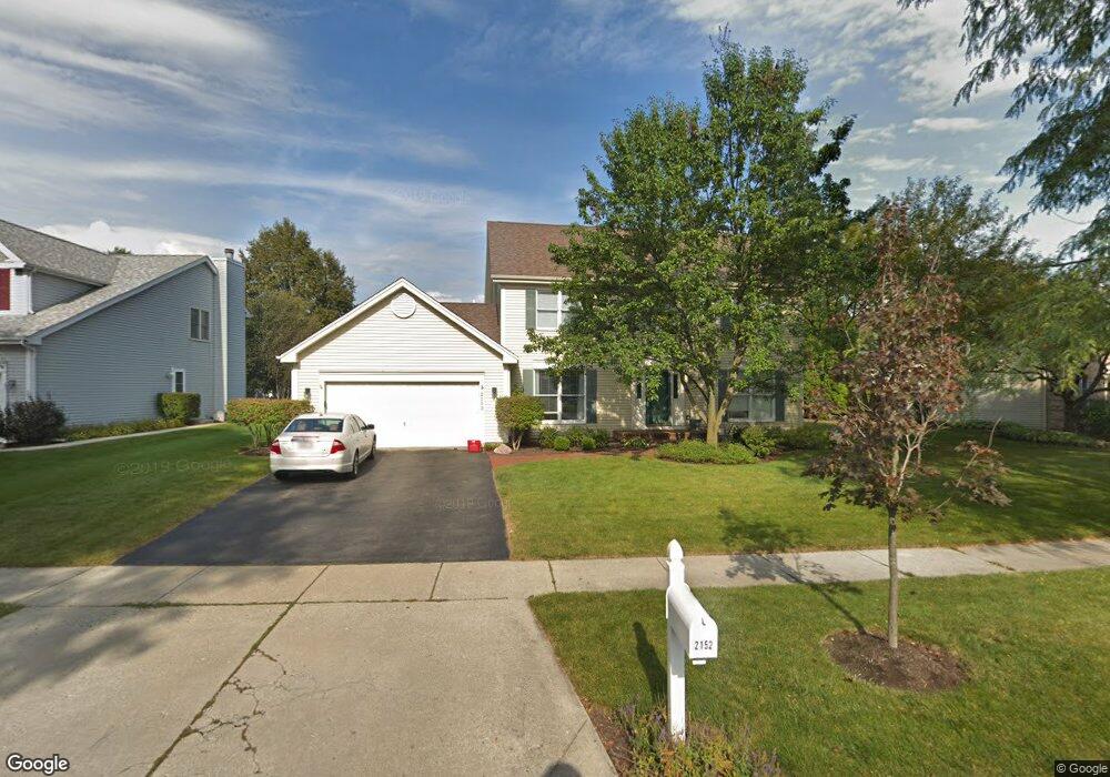
2152 Spaulding Ave West Dundee, IL 60118
Estimated Value: $418,362 - $474,000
4
Beds
--
Bath
2,346
Sq Ft
$192/Sq Ft
Est. Value
About This Home
This home is located at 2152 Spaulding Ave, West Dundee, IL 60118 and is currently estimated at $450,341, approximately $191 per square foot. 2152 Spaulding Ave is a home located in Kane County with nearby schools including Dundee Highlands Elementary School, Dundee Middle School, and Harry D Jacobs High School.
Ownership History
Date
Name
Owned For
Owner Type
Purchase Details
Closed on
May 2, 2023
Sold by
Jenkins Donald C and Jenkins Aster M
Bought by
Jenkins Donald C and Jenkins Aster M
Current Estimated Value
Purchase Details
Closed on
Mar 24, 2003
Sold by
Harris Cynthia K and Harris Gregory G
Bought by
Jenkins Donald C and Jenkins Aster M
Home Financials for this Owner
Home Financials are based on the most recent Mortgage that was taken out on this home.
Original Mortgage
$235,100
Interest Rate
5.76%
Mortgage Type
Purchase Money Mortgage
Purchase Details
Closed on
Jun 30, 1999
Sold by
Bloomberg Dennis and Bloomberg Mary
Bought by
Harris Gregory G and Harris Cynthia K
Home Financials for this Owner
Home Financials are based on the most recent Mortgage that was taken out on this home.
Original Mortgage
$188,350
Interest Rate
5.75%
Create a Home Valuation Report for This Property
The Home Valuation Report is an in-depth analysis detailing your home's value as well as a comparison with similar homes in the area
Home Values in the Area
Average Home Value in this Area
Purchase History
| Date | Buyer | Sale Price | Title Company |
|---|---|---|---|
| Jenkins Donald C | -- | None Listed On Document | |
| Jenkins Donald C | $294,000 | -- | |
| Harris Gregory G | $235,500 | -- |
Source: Public Records
Mortgage History
| Date | Status | Borrower | Loan Amount |
|---|---|---|---|
| Previous Owner | Jenkins Donald C | $235,100 | |
| Previous Owner | Harris Gregory G | $188,350 |
Source: Public Records
Tax History
| Year | Tax Paid | Tax Assessment Tax Assessment Total Assessment is a certain percentage of the fair market value that is determined by local assessors to be the total taxable value of land and additions on the property. | Land | Improvement |
|---|---|---|---|---|
| 2024 | $9,363 | $122,869 | $25,730 | $97,139 |
| 2023 | $8,776 | $110,553 | $23,151 | $87,402 |
| 2022 | $8,636 | $104,031 | $23,151 | $80,880 |
| 2021 | $8,334 | $98,226 | $21,859 | $76,367 |
| 2020 | $8,179 | $96,018 | $21,368 | $74,650 |
| 2019 | $7,915 | $91,151 | $20,285 | $70,866 |
| 2018 | $8,129 | $91,231 | $19,883 | $71,348 |
| 2017 | $7,740 | $85,343 | $18,600 | $66,743 |
| 2016 | $7,637 | $80,184 | $23,811 | $56,373 |
| 2015 | -- | $75,135 | $22,312 | $52,823 |
| 2014 | -- | $73,060 | $21,696 | $51,364 |
| 2013 | -- | $75,296 | $22,360 | $52,936 |
Source: Public Records
Map
Nearby Homes
- 817 Lindsay Ln
- 809 Lindsay Ln
- 815 Lindsay Ln
- 1107 Pember Cir Unit 2
- 850 Tartans Dr
- 1146 Pember Cir Unit 2
- 1601 Higgins Rd
- 1811 W Main St
- 822 Lindsay Ln
- 816 Lindsay Ln
- 818 Lindsay Ln
- 801 Lindsay Ln
- 820 Lindsay Ln
- 804 Lindsay Ln
- 808 Lindsay Ln
- 810 Lindsay Ln
- 821 Lindsay Ln
- 1023 Shagbark Ln
- 1031 Shagbark Ln
- 805 Lindsay Ln
- 2168 Spaulding Ave
- 2146 Spaulding Ave
- 978 Pember Cir
- 982 Pember Cir
- 2210 Spaulding Ave
- 2134 Spaulding Ave
- 2171 Spaulding Ave
- 964 Pember Cir
- 1006 Pember Cir
- 2173 Spaulding Ave
- 2153 Spaulding Ave
- 2218 Spaulding Ave
- 2128 Spaulding Ave Unit 2
- 2145 Spaulding Ave
- 2157 Spaulding Ave
- 1012 Pember Cir
- 2163 Spaulding Ave
- 2139 Spaulding Ave
- 956 Pember Cir
- 2213 Knowlton Dr
Your Personal Tour Guide
Ask me questions while you tour the home.