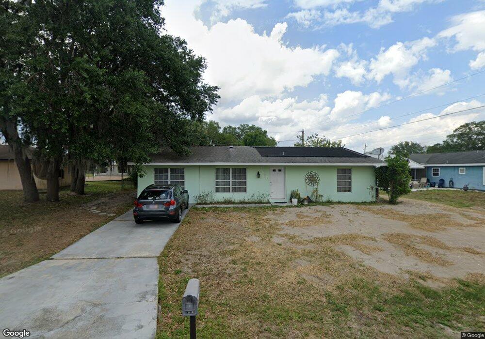
21520 Dranson Ave Port Charlotte, FL 33952
Estimated Value: $193,000 - $249,000
2
Beds
2
Baths
1,134
Sq Ft
$196/Sq Ft
Est. Value
About This Home
This home is located at 21520 Dranson Ave, Port Charlotte, FL 33952 and is currently estimated at $222,008, approximately $195 per square foot. 21520 Dranson Ave is a home located in Charlotte County with nearby schools including Neil Armstrong Elementary School, Port Charlotte Middle School, and Port Charlotte High School.
Ownership History
Date
Name
Owned For
Owner Type
Purchase Details
Closed on
Apr 23, 2015
Sold by
Us Bank Na
Bought by
Haynes Leona C
Current Estimated Value
Purchase Details
Closed on
Aug 28, 2014
Sold by
Dawes Doreen
Bought by
U S Bank Na
Purchase Details
Closed on
Oct 28, 2004
Sold by
Wooster Richard E and Wooster Dolores M
Bought by
Dawes Doreen
Home Financials for this Owner
Home Financials are based on the most recent Mortgage that was taken out on this home.
Original Mortgage
$103,900
Interest Rate
5.62%
Mortgage Type
Purchase Money Mortgage
Purchase Details
Closed on
Nov 21, 2001
Sold by
Brannon Agatha M
Bought by
Wooster Richard E and Wooster Dolores M
Home Financials for this Owner
Home Financials are based on the most recent Mortgage that was taken out on this home.
Original Mortgage
$38,920
Interest Rate
6.59%
Create a Home Valuation Report for This Property
The Home Valuation Report is an in-depth analysis detailing your home's value as well as a comparison with similar homes in the area
Home Values in the Area
Average Home Value in this Area
Purchase History
| Date | Buyer | Sale Price | Title Company |
|---|---|---|---|
| Haynes Leona C | $60,100 | Attorney | |
| U S Bank Na | $31,600 | Attorney | |
| Dawes Doreen | $129,900 | Title Partners Of Southwest | |
| Wooster Richard E | $58,000 | -- |
Source: Public Records
Mortgage History
| Date | Status | Borrower | Loan Amount |
|---|---|---|---|
| Previous Owner | Dawes Doreen | $103,900 | |
| Previous Owner | Wooster Richard E | $38,920 | |
| Closed | Dawes Doreen | $25,950 |
Source: Public Records
Tax History Compared to Growth
Tax History
| Year | Tax Paid | Tax Assessment Tax Assessment Total Assessment is a certain percentage of the fair market value that is determined by local assessors to be the total taxable value of land and additions on the property. | Land | Improvement |
|---|---|---|---|---|
| 2023 | $2,925 | $107,504 | $0 | $0 |
| 2022 | $2,727 | $169,301 | $14,450 | $154,851 |
| 2021 | $2,204 | $94,872 | $5,525 | $89,347 |
| 2020 | $2,093 | $93,334 | $4,675 | $88,659 |
| 2019 | $1,944 | $88,885 | $4,675 | $84,210 |
| 2018 | $1,705 | $80,567 | $4,250 | $76,317 |
| 2017 | $1,545 | $63,259 | $4,216 | $59,043 |
| 2016 | $1,458 | $56,417 | $0 | $0 |
| 2015 | $1,376 | $51,999 | $0 | $0 |
| 2014 | -- | $36,761 | $0 | $0 |
Source: Public Records
Map
Nearby Homes
- 21519 Fairway Ave
- 1299 Birchcrest Blvd
- 1346 Guild St
- 21503 Dranson Ave
- 489 Guild St
- 21487 Fairway Ave
- 21466 Quesada Ave
- 1282 Bounds St
- 21511 Carleton Ave
- 1402 Strasburg Dr
- 1050 Birchcrest Blvd
- 1329 Harbor Blvd
- 1178 Sultana St
- 1427 Noble Terrace
- 1425 Harbor Blvd
- 1228 Ardella St
- 21431 Circlewood Ave
- 21427 Sheldon Ave
- 21460 Sheldon Ave
- 1516 Birchcrest Blvd
- 21512 Dranson Ave
- 1331 Birchcrest Blvd
- 21511 Fairway Ave
- 21527 Fairway Ave
- 21504 Dranson Ave
- 21519 Dranson Ave
- 1341 Birchcrest Blvd
- 21496 Dranson Ave
- 1326 Birchcrest Blvd
- 21495 Fairway Ave
- 1316 Birchcrest Blvd
- 1342 Birchcrest Blvd
- 21512 Fairway Ave
- 21495 Dranson Ave
- 21520 Fairway Ave
- 21512 Eldred Ave
- 21528 Eldred Ave
- 1308 Birchcrest Blvd
- 21488 Dranson Ave
- 1350 Birchcrest Blvd