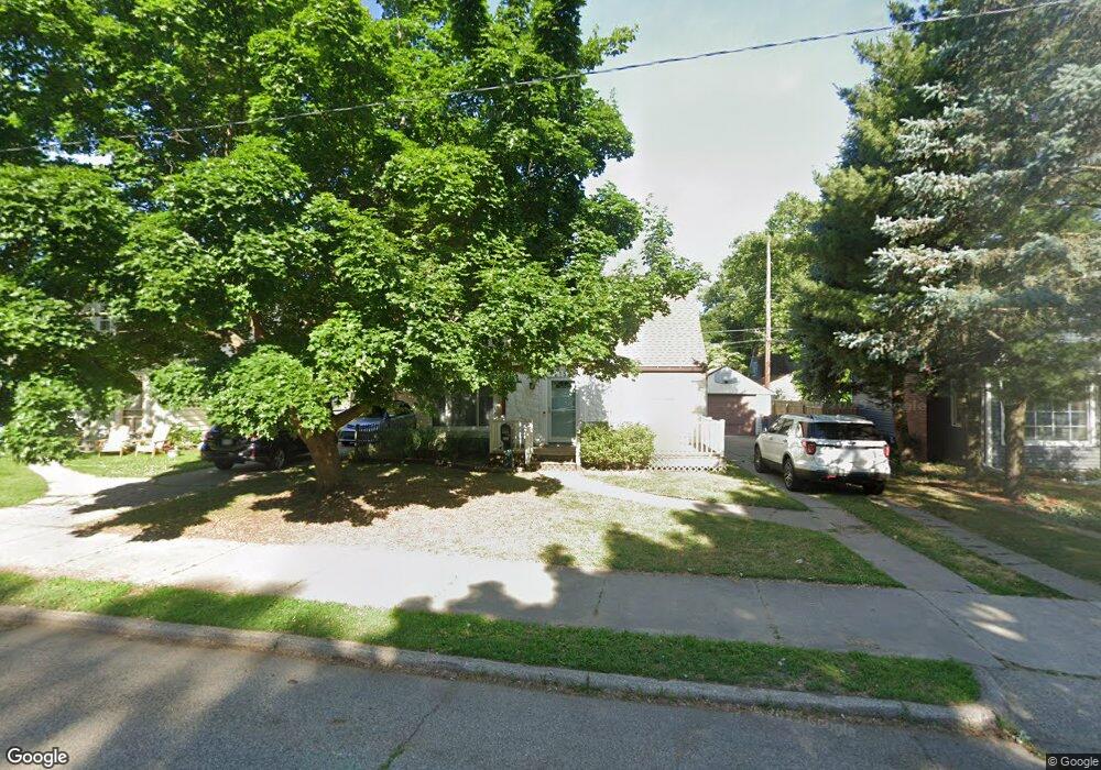
2153 Riverside Dr NE Grand Rapids, MI 49505
Creston NeighborhoodEstimated Value: $279,002 - $311,000
3
Beds
2
Baths
1,266
Sq Ft
$235/Sq Ft
Est. Value
About This Home
This home is located at 2153 Riverside Dr NE, Grand Rapids, MI 49505 and is currently estimated at $297,001, approximately $234 per square foot. 2153 Riverside Dr NE is a home located in Kent County with nearby schools including Riverside Middle School, Union High School, and ISJ Academy.
Ownership History
Date
Name
Owned For
Owner Type
Purchase Details
Closed on
Oct 4, 2018
Sold by
Adas Kythan N and Adas Kythan
Bought by
Adas Kythan N and Adas Ashley L
Current Estimated Value
Home Financials for this Owner
Home Financials are based on the most recent Mortgage that was taken out on this home.
Original Mortgage
$129,000
Outstanding Balance
$111,563
Interest Rate
4.5%
Mortgage Type
New Conventional
Estimated Equity
$185,438
Purchase Details
Closed on
Jun 17, 2009
Sold by
Ray Michael W and Ray Barbara
Bought by
The Bank Of New York Mellon and The Bank Of New York
Purchase Details
Closed on
Oct 29, 1993
Create a Home Valuation Report for This Property
The Home Valuation Report is an in-depth analysis detailing your home's value as well as a comparison with similar homes in the area
Home Values in the Area
Average Home Value in this Area
Purchase History
| Date | Buyer | Sale Price | Title Company |
|---|---|---|---|
| Adas Kythan N | -- | None Available | |
| The Bank Of New York Mellon | $21,600 | None Available | |
| -- | $69,900 | -- |
Source: Public Records
Mortgage History
| Date | Status | Borrower | Loan Amount |
|---|---|---|---|
| Open | Adas Kythan N | $129,000 |
Source: Public Records
Tax History
| Year | Tax Paid | Tax Assessment Tax Assessment Total Assessment is a certain percentage of the fair market value that is determined by local assessors to be the total taxable value of land and additions on the property. | Land | Improvement |
|---|---|---|---|---|
| 2025 | $1,491 | $130,600 | $0 | $0 |
| 2024 | $15 | $120,700 | $0 | $0 |
| 2023 | $1,513 | $103,200 | $0 | $0 |
| 2022 | $1,436 | $83,700 | $0 | $0 |
| 2021 | $1,405 | $78,400 | $0 | $0 |
| 2020 | $1,343 | $71,500 | $0 | $0 |
| 2019 | $1,406 | $68,300 | $0 | $0 |
| 2018 | $1,358 | $61,400 | $0 | $0 |
| 2017 | $1,322 | $53,300 | $0 | $0 |
| 2016 | $1,594 | $49,900 | $0 | $0 |
| 2015 | $1,244 | $49,900 | $0 | $0 |
| 2013 | -- | $36,600 | $0 | $0 |
Source: Public Records
Map
Nearby Homes
- 147 Montrose St NE
- 100 Knapp St NE
- 105 Dean St NE
- 20 Dean St NW
- 414 Cheshire Dr NE
- 160 Boltwood Dr NE
- 232 Dean St NE
- 177 Boltwood Dr NE
- 483 Kenwood St NE
- 707 Graceland St NE
- 2512 Union Ave NE
- 1559 Coit Ave NE
- 2509 Belknap Ave NE
- 2137 Eastern Ave NE
- 2536 Day Ave NW
- 1537 Broadway Ave NW
- 317 Quimby St NE
- 1420 Buffalo Ave NE
- 631 3 Mile Rd NE
- 301 Spencer St NE
- 2157 Riverside Dr NE
- 2147 Riverside Dr NE
- 2203 Riverside Dr NE
- 2156 Monroe Ave NW
- 2143 Riverside Dr NE
- 2152 Monroe Ave NW
- 2200 Monroe Ave NW
- 2146 Monroe Ave NW
- 2206 Monroe Ave NW
- 2206 Monroe Ave NW
- 2207 Riverside Dr NE
- 2150 Riverside Dr NE
- 2154 Riverside Dr NE
- 2137 Riverside Dr NE
- 2142 Monroe Ave NW
- 2142 Riverside Dr NE
- 2158 Riverside Dr NE
- 2210 Monroe Ave NW
- 2213 Riverside Dr NE
- 2202 Riverside Dr NE
Your Personal Tour Guide
Ask me questions while you tour the home.