Estimated Value: $74,000 - $265,000
3
Beds
1
Bath
840
Sq Ft
$166/Sq Ft
Est. Value
About This Home
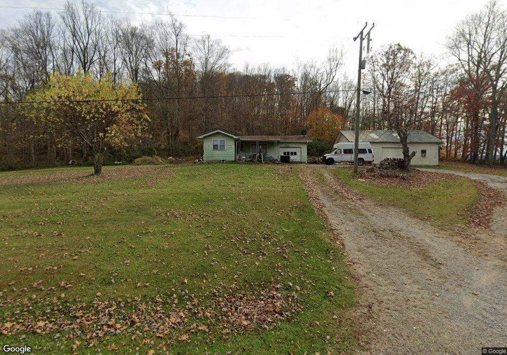
This home is located at 2154 State Route 348, Otway, OH 45657 and is currently estimated at $139,334, approximately $165 per square foot. 2154 State Route 348 is a home located in Scioto County with nearby schools including Northwest Elementary School, Northwest Middle School, and Northwest High School.
Ownership History
Date
Name
Owned For
Owner Type
Purchase Details
Closed on
Aug 19, 2025
Sold by
Obryant David
Bought by
Jones James E and Jones Shirley M
Current Estimated Value
Purchase Details
Closed on
Jan 23, 2023
Sold by
Stateline Rentals Llc
Bought by
Obryant David and Obryant Cheryl
Purchase Details
Closed on
Dec 21, 2020
Sold by
Wilson Presents Larry and Wilson Mary E
Bought by
Stateline Rentals Llc
Home Financials for this Owner
Home Financials are based on the most recent Mortgage that was taken out on this home.
Original Mortgage
$130,200
Interest Rate
2.71%
Mortgage Type
FHA
Purchase Details
Closed on
Apr 1, 2005
Bought by
Wilson Larry + Mary E J and Wilson S
Create a Home Valuation Report for This Property
The Home Valuation Report is an in-depth analysis detailing your home's value as well as a comparison with similar homes in the area
Purchase History
| Date | Buyer | Sale Price | Title Company |
|---|---|---|---|
| Jones James E | -- | None Listed On Document | |
| Obryant David | $48,000 | -- | |
| Stateline Rentals Llc | -- | None Listed On Document | |
| Stateline Rentals Llc | $22,000 | None Available | |
| Wilson Larry + Mary E J | $37,500 | -- |
Source: Public Records
Mortgage History
| Date | Status | Borrower | Loan Amount |
|---|---|---|---|
| Previous Owner | Stateline Rentals Llc | $130,200 | |
| Previous Owner | Stateline Rentals Llc | $0 |
Source: Public Records
Tax History
| Year | Tax Paid | Tax Assessment Tax Assessment Total Assessment is a certain percentage of the fair market value that is determined by local assessors to be the total taxable value of land and additions on the property. | Land | Improvement |
|---|---|---|---|---|
| 2024 | $888 | $31,270 | $6,090 | $25,180 |
| 2023 | $823 | $31,270 | $6,090 | $25,180 |
| 2022 | $1,212 | $31,270 | $6,090 | $25,180 |
| 2021 | $996 | $26,950 | $5,320 | $21,630 |
| 2020 | $663 | $26,950 | $5,320 | $21,630 |
| 2019 | $661 | $26,950 | $5,320 | $21,630 |
| 2018 | $596 | $24,870 | $4,840 | $20,030 |
| 2017 | $596 | $24,870 | $4,840 | $20,030 |
| 2016 | $302 | $23,990 | $4,440 | $19,550 |
| 2015 | $559 | $23,990 | $4,440 | $19,550 |
| 2013 | $529 | $23,990 | $4,440 | $19,550 |
Source: Public Records
Map
Nearby Homes
- Ohio 348
- 230 Newman Aly
- 2800 Beech Fork Rd
- 0 Oppy Hill Rd
- 0 Beech Fork Rd Unit 5157055
- 0 Beech Fork Rd Unit 225044315
- 4345 Mt Unger Rd
- 357 Enley Rd
- A Enley Rd
- 6421 Big Spruce-Little Bear Rd
- 2472 Rocky Fork Rd
- 0 St Rt 348 Unit 1855893
- 948 Big Bear Creek Rd
- 2314 White Oak Rd
- 170 Wrights Run Rd
- 0 Blue Creek Rd
- 525 Martin Cemetery Rd
- 2603 Cassel Run Rd
- 0 Bear Creek Rarden Rd
- 2030 Cedar Mills Rd
- 2154 Ohio 348
- 2187 State Route 348
- 2196 State Route 348
- 2098 State Route 348
- 2098 State Route 348
- 2057 State Route 348
- 2057 State Route 348
- 1970 State Route 348
- 1926 State Route 348
- 6597 Beech Fork Rd
- 2500 Ohio 348
- 2500 State Route 348
- 6420 Beech Fork Rd
- 2609 State Route 348
- 6376 Beech Fork Rd
- 6376 Beech Fork Rd
- 1589 State Route 348
- 6356 Beech Fork Rd
- 6301 Beech Fork Rd
- 6253 Beech Fork Rd
Your Personal Tour Guide
Ask me questions while you tour the home.