Estimated Value: $256,000 - $313,000
2
Beds
2
Baths
1,488
Sq Ft
$187/Sq Ft
Est. Value
About This Home
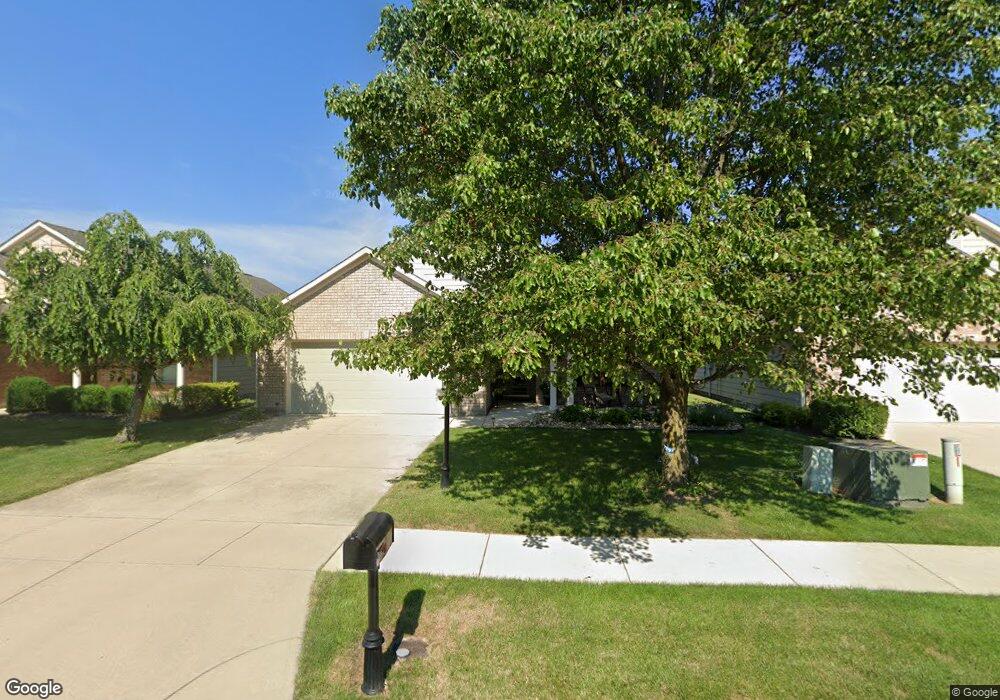
This home is located at 2154 Tandem Dr, Xenia, OH 45385 and is currently estimated at $278,478, approximately $187 per square foot. 2154 Tandem Dr is a home located in Greene County with nearby schools including Xenia High School, Summit Academy Community School for Alternative Learners - Xenia, and Legacy Christian Academy.
Ownership History
Date
Name
Owned For
Owner Type
Purchase Details
Closed on
Apr 10, 2019
Sold by
Calvert John J and Calvert James L
Bought by
Black David A and Black Deborah L
Current Estimated Value
Home Financials for this Owner
Home Financials are based on the most recent Mortgage that was taken out on this home.
Original Mortgage
$175,506
Outstanding Balance
$152,723
Interest Rate
4.4%
Mortgage Type
VA
Estimated Equity
$125,755
Purchase Details
Closed on
Sep 17, 2010
Sold by
Henson Nell F
Bought by
Calvert John J and Calvert Clara S
Purchase Details
Closed on
Aug 12, 2004
Sold by
Be Am Co Inc
Bought by
Henson Nell F and The Henson Revocable Living Trust
Create a Home Valuation Report for This Property
The Home Valuation Report is an in-depth analysis detailing your home's value as well as a comparison with similar homes in the area
Home Values in the Area
Average Home Value in this Area
Purchase History
| Date | Buyer | Sale Price | Title Company |
|---|---|---|---|
| Black David A | $169,900 | None Available | |
| Calvert John J | $148,000 | Attorney | |
| Henson Nell F | $154,000 | -- |
Source: Public Records
Mortgage History
| Date | Status | Borrower | Loan Amount |
|---|---|---|---|
| Open | Black David A | $175,506 |
Source: Public Records
Tax History
| Year | Tax Paid | Tax Assessment Tax Assessment Total Assessment is a certain percentage of the fair market value that is determined by local assessors to be the total taxable value of land and additions on the property. | Land | Improvement |
|---|---|---|---|---|
| 2025 | $3,141 | $72,120 | $12,600 | $59,520 |
| 2024 | $3,141 | $72,120 | $12,600 | $59,520 |
| 2023 | $3,086 | $72,120 | $12,600 | $59,520 |
| 2022 | $2,737 | $54,550 | $8,400 | $46,150 |
| 2021 | $2,773 | $54,550 | $8,400 | $46,150 |
| 2020 | $2,657 | $54,550 | $8,400 | $46,150 |
| 2019 | $1,901 | $46,480 | $7,880 | $38,600 |
| 2018 | $1,909 | $46,480 | $7,880 | $38,600 |
| 2017 | $1,765 | $46,480 | $7,880 | $38,600 |
| 2016 | $1,765 | $43,010 | $7,880 | $35,130 |
| 2015 | $1,770 | $43,010 | $7,880 | $35,130 |
| 2014 | $1,693 | $43,010 | $7,880 | $35,130 |
Source: Public Records
Map
Nearby Homes
- 1978 Lakeview Dr
- 2102 High Wheel Dr
- 920 Wright Cycle Blvd
- 926 Wright Cycle Blvd
- 2276 Tandem Dr
- 0 Lower Bellbrook Rd
- 2632 Ketki Ct
- 2516 Jenny Marie Dr
- 1955 Roxbury Dr
- 0 Berkshire Dr Unit 949217
- 2247 Dundee Dr
- 2216 Minnesota Dr
- 1816 Atkinson Dr
- 1321 Massachusetts Dr
- 1077 Glen Kegley Dr
- 1068 Hedges Rd
- 1001 Glen Kegley Dr
- 1329 Baybury Ave
- 1317 Baybury Ave
- 2953 Bristol Dr
- 2164 Tandem Dr
- 2134 Tandem Dr
- 2174 Tandem Dr
- 2159 Schwinn Ave
- 2153 Schwinn Ave
- 2165 Schwinn Ave
- 949 Cannondale Ave
- 2124 Tandem Dr
- 2184 Tandem Dr
- 2171 Schwinn Ave
- 948 Cannondale Ave
- 943 Cannondale Ave
- 2199 Schwinn Ave
- 2118 Tandem Dr
- 2194 Tandem Dr
- 2147 Schwinn Ave
- 2140 Schwinn Ave
- 942 Cannondale Ave
- 939 Cannondale Ave
- 2229 Schwinn Ave
Your Personal Tour Guide
Ask me questions while you tour the home.