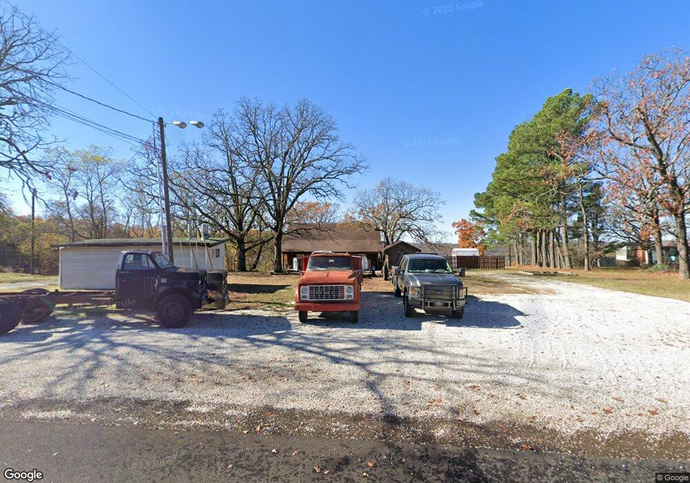
21545 S Highway 71 Winslow, AR 72959
Estimated Value: $176,000 - $386,000
--
Bed
1
Bath
1,200
Sq Ft
$218/Sq Ft
Est. Value
About This Home
This home is located at 21545 S Highway 71, Winslow, AR 72959 and is currently estimated at $261,888, approximately $218 per square foot. 21545 S Highway 71 is a home located in Washington County with nearby schools including Greenland Middle School, Greenland Elementary School, and Greenland High School.
Ownership History
Date
Name
Owned For
Owner Type
Purchase Details
Closed on
Oct 13, 1994
Bought by
Kraft James L
Current Estimated Value
Purchase Details
Closed on
May 3, 1994
Bought by
First National Bank , Spg.
Purchase Details
Closed on
Dec 22, 1989
Bought by
Mason Ruth Ann and 1701 So West End Street
Purchase Details
Closed on
Jul 24, 1989
Bought by
Gibson Earl W
Purchase Details
Closed on
May 1, 1989
Bought by
Johansen Francis E
Purchase Details
Closed on
Jan 1, 1985
Bought by
Stansbury Claude E
Create a Home Valuation Report for This Property
The Home Valuation Report is an in-depth analysis detailing your home's value as well as a comparison with similar homes in the area
Home Values in the Area
Average Home Value in this Area
Purchase History
| Date | Buyer | Sale Price | Title Company |
|---|---|---|---|
| Kraft James L | $30,000 | -- | |
| First National Bank , Spg. | -- | -- | |
| Mason Ruth Ann | $28,000 | -- | |
| Gibson Earl W | $27,000 | -- | |
| Johansen Francis E | $15,000 | -- | |
| Stansbury Claude E | -- | -- |
Source: Public Records
Tax History Compared to Growth
Tax History
| Year | Tax Paid | Tax Assessment Tax Assessment Total Assessment is a certain percentage of the fair market value that is determined by local assessors to be the total taxable value of land and additions on the property. | Land | Improvement |
|---|---|---|---|---|
| 2025 | $460 | $32,300 | $3,570 | $28,730 |
| 2024 | $514 | $32,300 | $3,570 | $28,730 |
| 2023 | $556 | $32,300 | $3,570 | $28,730 |
| 2022 | $624 | $21,880 | $2,550 | $19,330 |
| 2021 | $584 | $21,880 | $2,550 | $19,330 |
| 2020 | $478 | $21,880 | $2,550 | $19,330 |
| 2019 | $437 | $17,660 | $2,040 | $15,620 |
| 2018 | $462 | $17,660 | $2,040 | $15,620 |
| 2017 | $454 | $17,660 | $2,040 | $15,620 |
| 2016 | $454 | $17,660 | $2,040 | $15,620 |
| 2015 | $433 | $17,660 | $2,040 | $15,620 |
| 2014 | $395 | $16,380 | $1,840 | $14,540 |
Source: Public Records
Map
Nearby Homes
- 21588 S Highway 71
- 20845 U S 71
- 22764 Carter Lane Rd
- 20805 Pine Dr
- 610 Blueberry Hill Rd
- 21701 Mount Gaylor Point
- 47 Acres Wc 4275
- TBD N Devils Den Rd
- 156 Pinehaven Dr
- 20255 N Highway 71
- 1327 Copperhead Rd
- 18708 S Highway 71
- 10347 Devils Den Rd
- 21710 Wc 274
- 32 Chimney Field Rd
- 33 Chimney Field Rd
- 3 Chimney Field Rd
- 2 Chimney Field Rd
- 00 Chimney Field Rd
- 01 Chimney Field Rd
- 21545 U S 71
- 21569 S Highway 71
- 0 Hwy 71 S Tract A
- 0 Hwy 71 So Tract C
- 0 Hwy 71 So Tract D
- 0 Hwy 71 So Tract F
- 0 Hwy 71 So Tract G
- 0 Hwy 71 So Tract H
- 0 U S Hwy 71 Hwy Unit 555494
- Tract C S Hwy 71 S
- Tract D S Hwy 71 S
- Tract A S Hwy 71 S
- 21531 S Highway 71
- 21534 S Highway 71
- 21505 S Highway 71
- 21542 S Highway 71
- 21542 U S 71
- 21500 S Highway 71
- 21500 U S 71
- 21588 U S 71