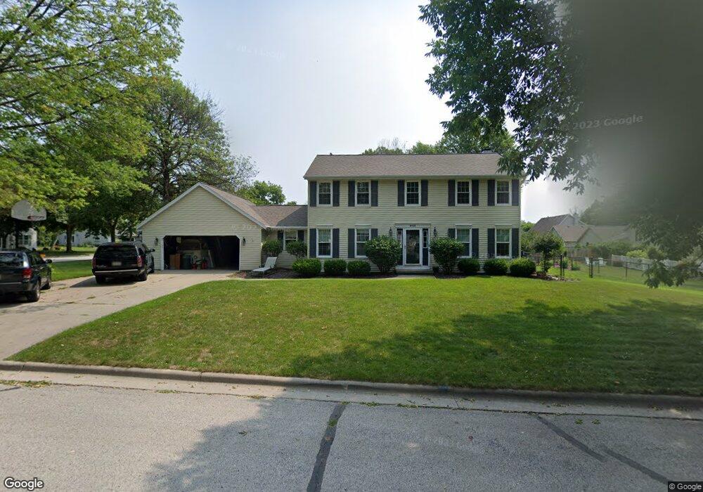
2155 Gloucester Dr Green Bay, WI 54304
Westside NeighborhoodEstimated Value: $380,000 - $458,000
4
Beds
3
Baths
3,062
Sq Ft
$139/Sq Ft
Est. Value
About This Home
This home is located at 2155 Gloucester Dr, Green Bay, WI 54304 and is currently estimated at $424,885, approximately $138 per square foot. 2155 Gloucester Dr is a home located in Brown County with nearby schools including King Elementary School, Lombardi Middle School, and Southwest High School.
Ownership History
Date
Name
Owned For
Owner Type
Purchase Details
Closed on
Nov 2, 2010
Sold by
Poels James R and Poels Kathleen M
Bought by
Fortney Scott L and Fortney Allison L
Current Estimated Value
Home Financials for this Owner
Home Financials are based on the most recent Mortgage that was taken out on this home.
Original Mortgage
$207,110
Outstanding Balance
$137,343
Interest Rate
4.37%
Mortgage Type
FHA
Estimated Equity
$287,542
Create a Home Valuation Report for This Property
The Home Valuation Report is an in-depth analysis detailing your home's value as well as a comparison with similar homes in the area
Home Values in the Area
Average Home Value in this Area
Purchase History
| Date | Buyer | Sale Price | Title Company |
|---|---|---|---|
| Fortney Scott L | $209,900 | Liberty Title |
Source: Public Records
Mortgage History
| Date | Status | Borrower | Loan Amount |
|---|---|---|---|
| Open | Fortney Scott L | $207,110 |
Source: Public Records
Tax History Compared to Growth
Tax History
| Year | Tax Paid | Tax Assessment Tax Assessment Total Assessment is a certain percentage of the fair market value that is determined by local assessors to be the total taxable value of land and additions on the property. | Land | Improvement |
|---|---|---|---|---|
| 2024 | $5,715 | $301,600 | $49,000 | $252,600 |
| 2023 | $5,481 | $301,600 | $49,000 | $252,600 |
| 2022 | $5,343 | $301,600 | $49,000 | $252,600 |
| 2021 | $5,317 | $226,800 | $37,100 | $189,700 |
| 2020 | $5,345 | $226,800 | $37,100 | $189,700 |
| 2019 | $5,193 | $226,800 | $37,100 | $189,700 |
| 2018 | $5,063 | $226,800 | $37,100 | $189,700 |
| 2017 | $5,028 | $226,800 | $37,100 | $189,700 |
| 2016 | $4,905 | $226,800 | $37,100 | $189,700 |
| 2015 | $4,989 | $226,800 | $37,100 | $189,700 |
| 2014 | $5,180 | $226,800 | $37,100 | $189,700 |
| 2013 | $5,180 | $226,800 | $37,100 | $189,700 |
Source: Public Records
Map
Nearby Homes
- 2768 Independence Dr
- 1680 Cormier Rd
- 2060 Wintergreen Ct
- 2044 Ann Ln
- 1570 Mesa Dr
- 2466 Parkwood Dr
- 1433 Baumgart Rd Unit 1435
- 2550 He Nis Ra Ln
- 3023 Crusade Ln
- 1445 Cormier Rd
- 2445 Basswood St
- 1439 Cormier Rd
- 2549 Babcock Rd Unit 2551
- 1940 Renaissance Ct
- 1514 Ashley Ct
- 1973 Knotty Pine Dr
- 2441 Matchwood Ln
- 2689 Clive St
- 1387 Cormier Rd
- 2031 Bradbury Ln
- 2775 Charleston Dr
- 2169 Gloucester Dr
- 2772 Independence Dr
- 2767 Charleston Dr
- 2160 Gloucester Dr
- 2776 Charleston Dr
- 2152 Gloucester Dr
- 2168 Gloucester Dr
- 2144 Gloucester Dr
- 2761 Charleston Dr
- 2768 Charleston Dr
- 2135 Gloucester Dr
- 2140 Gloucester Dr
- 2170 Gloucester Dr
- 2760 Independence Dr
- 2157 S Point Rd
- 2149 S Point Rd
- 2167 S Point Rd
- 2779 Independence Dr
- 2134 Gloucester Dr