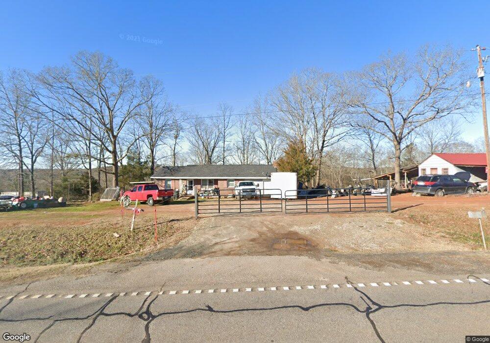
2155 Highway 145 Carnesville, GA 30521
Estimated Value: $138,803 - $400,000
2
Beds
1
Bath
1,392
Sq Ft
$198/Sq Ft
Est. Value
About This Home
This home is located at 2155 Highway 145, Carnesville, GA 30521 and is currently estimated at $275,951, approximately $198 per square foot. 2155 Highway 145 is a home located in Franklin County with nearby schools including Franklin County High School and Cornerstone Christian Academy.
Ownership History
Date
Name
Owned For
Owner Type
Purchase Details
Closed on
Jan 3, 2017
Sold by
Hart Peggy Diane B
Bought by
Gordon Roy
Current Estimated Value
Purchase Details
Closed on
Nov 28, 2008
Sold by
Not Provided
Bought by
Hart Peggy Diane
Purchase Details
Closed on
Aug 16, 1994
Bought by
Hart Peggy and Tony Le
Create a Home Valuation Report for This Property
The Home Valuation Report is an in-depth analysis detailing your home's value as well as a comparison with similar homes in the area
Home Values in the Area
Average Home Value in this Area
Purchase History
| Date | Buyer | Sale Price | Title Company |
|---|---|---|---|
| Gordon Roy | $16,001 | -- | |
| Hart Peggy Diane | -- | -- | |
| Hart Peggy Diane | -- | -- | |
| Hart Peggy | -- | -- |
Source: Public Records
Tax History Compared to Growth
Tax History
| Year | Tax Paid | Tax Assessment Tax Assessment Total Assessment is a certain percentage of the fair market value that is determined by local assessors to be the total taxable value of land and additions on the property. | Land | Improvement |
|---|---|---|---|---|
| 2024 | $743 | $31,200 | $2,725 | $28,475 |
| 2023 | $732 | $28,364 | $2,478 | $25,886 |
| 2022 | $657 | $25,466 | $1,919 | $23,547 |
| 2021 | $626 | $22,748 | $1,919 | $20,829 |
| 2020 | $632 | $22,748 | $1,919 | $20,829 |
| 2019 | $611 | $22,748 | $1,919 | $20,829 |
| 2018 | $553 | $20,601 | $2,476 | $18,125 |
| 2017 | $385 | $20,601 | $2,476 | $18,125 |
| 2016 | $413 | $21,106 | $4,464 | $16,642 |
| 2015 | -- | $21,106 | $4,464 | $16,642 |
| 2014 | -- | $21,106 | $4,464 | $16,642 |
| 2013 | -- | $21,420 | $4,464 | $16,956 |
Source: Public Records
Map
Nearby Homes
- 597 Meadow Brook Ln
- 1350 Noah Crow Rd
- 157 Riverbend Cir
- 2390 W Main St
- 329 Riverbend Dr
- 2521 Starrs Bridge Rd
- 249 Taylor St
- 206 College Heights
- 1687 E Main St
- 23 College Heights Place
- 41 College Heights Place
- 61 College Heights Place
- 155 Carey St
- 0 New Franklin Church Rd
- 6.98 ACRES New Franklin Church Rd
- 6602 New Franklin Church Rd
- 224 Brad St
- 1291 Brays Lake Rd
- 222 Reno Rd
- 2695 Brays Lake Rd
- 2051 Highway 145
- 2309 Highway 145
- 2284 Highway 145
- 2112 Highway 145
- 2112 Highway 145
- 2112 Highway 145
- 1869 Georgia 145
- 0 River Ridge Dr Unit 7373522
- 0 River Ridge Dr Unit 7170762
- 0 River Ridge Dr Unit 7548025
- 0 River Ridge Dr Unit 8155871
- 0 River Oaks Unit Lot 44 8538217
- 305 River Ridge Dr
- 20 River Ridge Rd
- 112 River Ridge Rd
- 1910 Highway 145
- 1561 Georgia 145
- 2401 Georgia 145
- 2400 Highway 145
- 2400 Highway 145