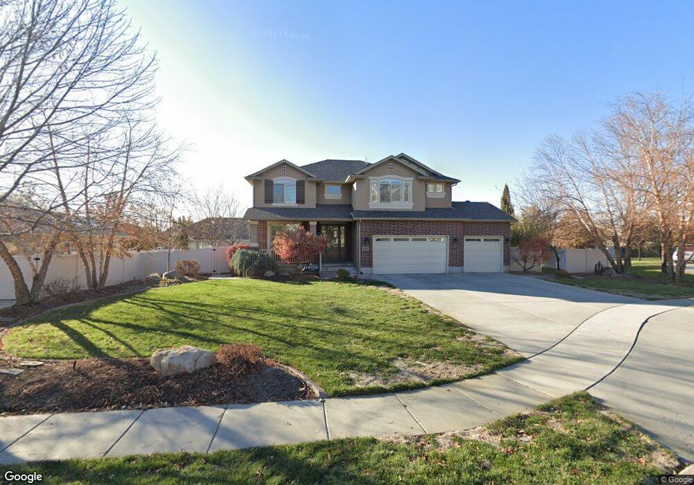
2156 S 175 E Kaysville, UT 84037
West Kaysville NeighborhoodEstimated Value: $776,000 - $959,000
5
Beds
4
Baths
3,085
Sq Ft
$287/Sq Ft
Est. Value
About This Home
This home is located at 2156 S 175 E, Kaysville, UT 84037 and is currently estimated at $884,137, approximately $286 per square foot. 2156 S 175 E is a home located in Davis County with nearby schools including Endeavour Elementary School, Farmington High, and Centennial Junior High School.
Ownership History
Date
Name
Owned For
Owner Type
Purchase Details
Closed on
May 29, 2024
Sold by
Halverson Clint P and Halverson Lisa C
Bought by
Clint And Lisa Halverson Trust and Halverson
Current Estimated Value
Purchase Details
Closed on
Aug 1, 2008
Sold by
Woodside Quail Crossing Llc
Bought by
Halverson Clint P and Halverson Lisa C
Home Financials for this Owner
Home Financials are based on the most recent Mortgage that was taken out on this home.
Original Mortgage
$250,000
Interest Rate
6.32%
Mortgage Type
Purchase Money Mortgage
Create a Home Valuation Report for This Property
The Home Valuation Report is an in-depth analysis detailing your home's value as well as a comparison with similar homes in the area
Home Values in the Area
Average Home Value in this Area
Purchase History
| Date | Buyer | Sale Price | Title Company |
|---|---|---|---|
| Clint And Lisa Halverson Trust | -- | None Listed On Document | |
| Halverson Clint P | -- | Us Title Company Of Utah |
Source: Public Records
Mortgage History
| Date | Status | Borrower | Loan Amount |
|---|---|---|---|
| Previous Owner | Halverson Clint P | $250,000 |
Source: Public Records
Tax History Compared to Growth
Tax History
| Year | Tax Paid | Tax Assessment Tax Assessment Total Assessment is a certain percentage of the fair market value that is determined by local assessors to be the total taxable value of land and additions on the property. | Land | Improvement |
|---|---|---|---|---|
| 2024 | $4,069 | $416,350 | $171,249 | $245,101 |
| 2023 | $4,158 | $753,000 | $314,704 | $438,296 |
| 2022 | $4,226 | $432,850 | $172,493 | $260,357 |
| 2021 | $3,842 | $589,000 | $195,359 | $393,641 |
| 2020 | $3,464 | $516,000 | $165,284 | $350,716 |
| 2019 | $3,391 | $496,000 | $172,841 | $323,159 |
| 2018 | $3,188 | $464,000 | $143,253 | $320,747 |
| 2016 | $3,019 | $230,120 | $64,908 | $165,212 |
| 2015 | $3,117 | $225,610 | $64,908 | $160,702 |
| 2014 | $2,867 | $211,129 | $59,841 | $151,288 |
| 2013 | -- | $205,356 | $41,296 | $164,060 |
Source: Public Records
Map
Nearby Homes
- 2261 S 50 E
- 278 E Shepard Ln
- 276 E 2200 S
- 2274 S 50 E
- 1566 W Pheasant Place
- 69 W 2200 S
- 2266 S Betsys Way
- 2226 S Betsys Way
- 2071 S 400 E
- 926 N 1875 W
- 1820 S Kerrybrook Dr
- 87 Baer Creek Dr
- 1332 N 1580 W
- 419 E 1700 S
- 1181 Set Ct Unit 2
- 1578 S 300 E
- 556 Innovator Dr Unit 158
- 1472 Via la Costa Way
- 1356 Fairway Cir
- 395 W Burton Ln
- 2156 S 175 E Unit 222
- 2170 S 175 E Unit 223
- 2145 S 100 E
- 2169 S 100 E
- 2169 S 100 E Unit 224
- 2142 S 175 E
- 2194 S 175 E
- 2159 S 175 E
- 2191 S 100 E
- 2173 S 175 E
- 2137 S 100 E
- 2137 S 100 E Unit 226
- 2145 S 175 E
- 2197 S 175 E
- 2164 S 100 E
- 2164 S 100 E Unit 228
- 2154 S 225 E
- 2154 S 225 E Unit 215
- 2188 S 100 E
- 2140 S 100 E