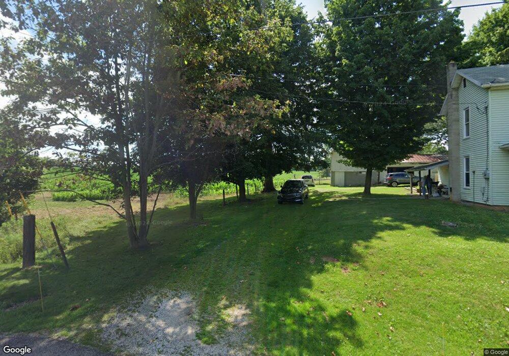
2156 State Route 511 Perrysville, OH 44864
Estimated Value: $165,825 - $205,000
3
Beds
1
Bath
1,344
Sq Ft
$140/Sq Ft
Est. Value
About This Home
This home is located at 2156 State Route 511, Perrysville, OH 44864 and is currently estimated at $188,706, approximately $140 per square foot. 2156 State Route 511 is a home with nearby schools including Hillsdale Elementary School, Hillsdale Middle School, and Hillsdale High School.
Ownership History
Date
Name
Owned For
Owner Type
Purchase Details
Closed on
Dec 11, 2007
Bought by
Sellers Thomas W
Current Estimated Value
Purchase Details
Closed on
Jul 25, 2007
Sold by
Bourassa Carl D
Purchase Details
Closed on
Aug 16, 2005
Sold by
Bourassa Carl D
Bought by
Bourassa Carl D
Purchase Details
Closed on
May 31, 1990
Bought by
Bourassa Carl D
Create a Home Valuation Report for This Property
The Home Valuation Report is an in-depth analysis detailing your home's value as well as a comparison with similar homes in the area
Purchase History
| Date | Buyer | Sale Price | Title Company |
|---|---|---|---|
| Sellers Thomas W | $58,000 | -- | |
| -- | $60,000 | -- | |
| Bourassa Carl D | -- | -- | |
| Bourassa Carl D | $65,800 | -- |
Source: Public Records
Tax History
| Year | Tax Paid | Tax Assessment Tax Assessment Total Assessment is a certain percentage of the fair market value that is determined by local assessors to be the total taxable value of land and additions on the property. | Land | Improvement |
|---|---|---|---|---|
| 2025 | $1,148 | $45,060 | $9,290 | $35,770 |
| 2024 | $1,148 | $45,060 | $9,290 | $35,770 |
| 2023 | $1,148 | $45,060 | $9,290 | $35,770 |
| 2022 | $920 | $31,080 | $6,410 | $24,670 |
| 2021 | $921 | $31,080 | $6,410 | $24,670 |
| 2020 | $863 | $31,080 | $6,410 | $24,670 |
| 2019 | $771 | $28,290 | $6,650 | $21,640 |
| 2018 | $766 | $28,290 | $6,650 | $21,640 |
| 2017 | $967 | $28,290 | $6,650 | $21,640 |
| 2016 | $967 | $24,600 | $5,780 | $18,820 |
| 2015 | $955 | $24,600 | $5,780 | $18,820 |
| 2013 | $1,039 | $26,190 | $5,790 | $20,400 |
Source: Public Records
Map
Nearby Homes
- 1117 County Road 2075
- 87 N Mechanic St
- 150 E Main St
- 1105 Township Road 1806
- 0 Mount Zion Rd Unit 226009674
- 0 Mount Zion Rd Unit 9072801
- 2119 County Road 2175
- 945 Pike Dr
- 0 County Road 1754
- 3390 Muskie Dr
- 609 Ohio 95
- 1727 1/2 State Route 60
- 754 Touby Ln
- 1727 1/2 Ohio 60
- 4281 Lucas Perrysville Rd
- 496 Township Road 2402
- 2732 Township Road 1087
- 3386 Trumpower Rd
- 1589 State Route 511
- 2472 Wedgewood Dr
- 2159 Ohio 511
- 2156 Ohio 511
- 2151 Ohio 511
- 2163A State Route 511
- 2159 State Route 511
- 2163 State Route 511
- 1005 County Road 2075
- 2173 State Route 511
- 1001 County Road 2075
- 2135 State Route 511
- 2185 State Route 511
- 2132 State Route 511
- 2185 Ohio 511
- 1018 County Road 2075
- 2189 State Route 511
- 1020 County Road 2075
- 2189 Ohio 511
- 2124 State Route 511
- 2124 State Route 511
- 2193 Ohio 511
Your Personal Tour Guide
Ask me questions while you tour the home.