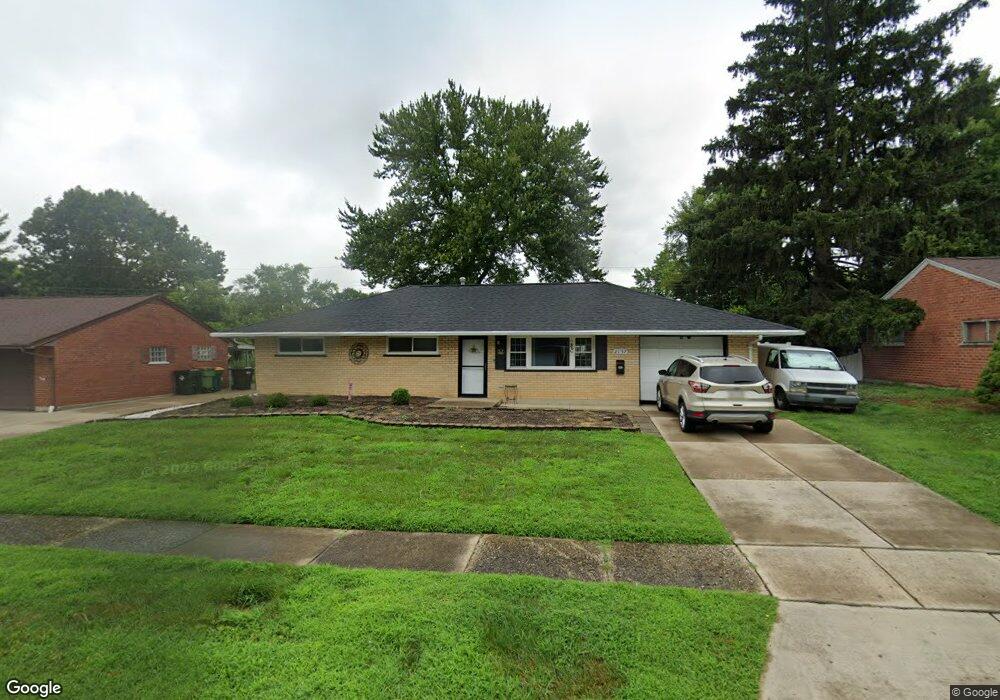
2157 Burnside Dr Dayton, OH 45439
Woodbourne-Hyde Park NeighborhoodEstimated Value: $173,249 - $190,000
3
Beds
1
Bath
1,080
Sq Ft
$167/Sq Ft
Est. Value
About This Home
This home is located at 2157 Burnside Dr, Dayton, OH 45439 and is currently estimated at $180,812, approximately $167 per square foot. 2157 Burnside Dr is a home located in Montgomery County with nearby schools including West Carrollton High School, Miami Valley Academies, and St. Albert the Great School.
Ownership History
Date
Name
Owned For
Owner Type
Purchase Details
Closed on
May 25, 2005
Sold by
Royal Oak Iii Family Lp
Bought by
Flitton William L and Flitton Vicky L
Current Estimated Value
Home Financials for this Owner
Home Financials are based on the most recent Mortgage that was taken out on this home.
Original Mortgage
$91,553
Outstanding Balance
$47,511
Interest Rate
6.07%
Mortgage Type
FHA
Estimated Equity
$133,301
Purchase Details
Closed on
Dec 23, 2003
Sold by
Theodore Taylor
Bought by
Royal Oak Iii Family Lp
Home Financials for this Owner
Home Financials are based on the most recent Mortgage that was taken out on this home.
Original Mortgage
$55,800
Interest Rate
5.94%
Mortgage Type
Purchase Money Mortgage
Create a Home Valuation Report for This Property
The Home Valuation Report is an in-depth analysis detailing your home's value as well as a comparison with similar homes in the area
Home Values in the Area
Average Home Value in this Area
Purchase History
| Date | Buyer | Sale Price | Title Company |
|---|---|---|---|
| Flitton William L | $93,000 | -- | |
| Royal Oak Iii Family Lp | $87,400 | -- |
Source: Public Records
Mortgage History
| Date | Status | Borrower | Loan Amount |
|---|---|---|---|
| Open | Flitton William L | $91,553 | |
| Closed | Royal Oak Iii Family Lp | $55,800 |
Source: Public Records
Tax History
| Year | Tax Paid | Tax Assessment Tax Assessment Total Assessment is a certain percentage of the fair market value that is determined by local assessors to be the total taxable value of land and additions on the property. | Land | Improvement |
|---|---|---|---|---|
| 2025 | $3,313 | $45,840 | $7,820 | $38,020 |
| 2024 | $3,223 | $45,840 | $7,820 | $38,020 |
| 2023 | $3,223 | $45,840 | $7,820 | $38,020 |
| 2022 | $2,807 | $30,770 | $5,250 | $25,520 |
| 2021 | $2,592 | $30,770 | $5,250 | $25,520 |
| 2020 | $2,592 | $30,770 | $5,250 | $25,520 |
| 2019 | $2,653 | $27,570 | $5,250 | $22,320 |
| 2018 | $2,482 | $27,570 | $5,250 | $22,320 |
| 2017 | $2,467 | $27,570 | $5,250 | $22,320 |
| 2016 | $2,500 | $27,030 | $5,250 | $21,780 |
| 2015 | $2,325 | $27,030 | $5,250 | $21,780 |
| 2014 | $2,325 | $27,030 | $5,250 | $21,780 |
| 2012 | -- | $27,460 | $7,000 | $20,460 |
Source: Public Records
Map
Nearby Homes
- 2218 Finland Dr
- 4304 Harbison St
- 4476 Hannaford St
- 1952 Tait Circle Rd
- 2090 Mattis Dr
- 2005 Owendale Dr
- 4518 Harbison St
- 4301 Tait Rd
- 2337 Ned Dr
- 5100 Oak Ave
- 1764 Lanbury Dr
- 4792 Loxley Dr
- 4207 S Dixie Dr
- 3865 Endover Rd
- 2087 Lehigh Place
- 4935 Cordell Dr
- 2501 Genoa Ave
- 4524 Royal Ridge Way
- 5048 Oak Manor Ct
- 3596 Tait Rd
- 2171 Burnside Dr
- 2145 Burnside Dr
- 2142 Finland Dr
- 2154 Finland Dr
- 2130 Finland Dr
- 2183 Burnside Dr
- 2131 Burnside Dr
- 2150 Burnside Dr
- 2168 Finland Dr
- 2176 Burnside Dr
- 2114 Finland Dr
- 2138 Burnside Dr
- 2199 Burnside Dr
- 2128 Burnside Dr
- 2117 Burnside Dr
- 2182 Finland Dr
- 2190 Burnside Dr
- 2102 Finland Dr
- 2122 Burnside Dr
- 2143 Finland Dr
Your Personal Tour Guide
Ask me questions while you tour the home.