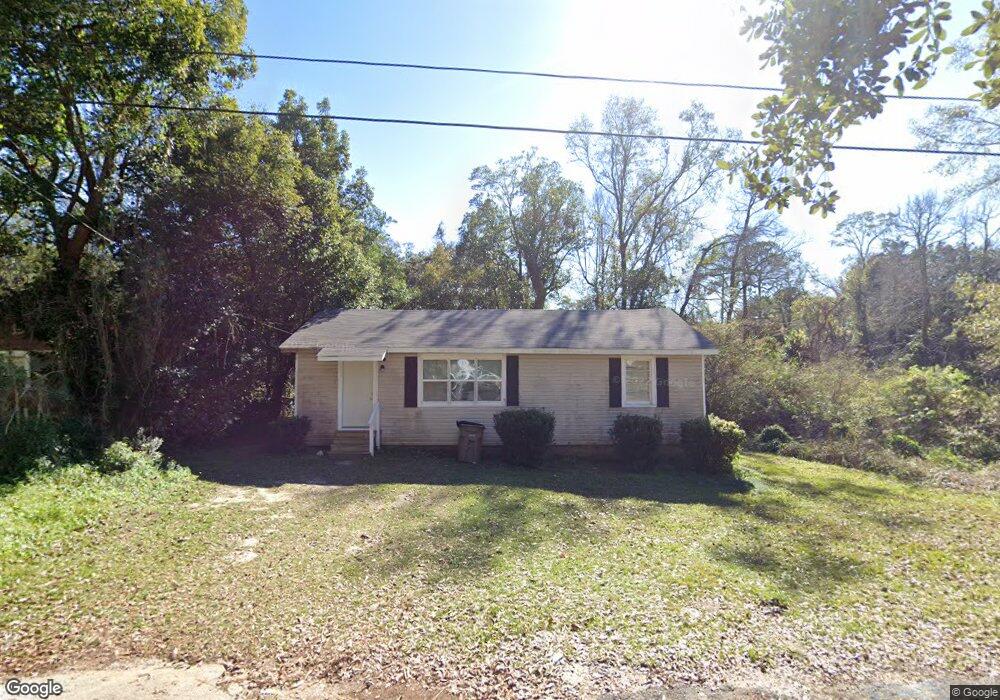
2157 Height St Mobile, AL 36605
Riviera NeighborhoodEstimated Value: $53,774 - $88,000
Studio
1
Bath
1,025
Sq Ft
$70/Sq Ft
Est. Value
About This Home
This home is located at 2157 Height St, Mobile, AL 36605 and is currently estimated at $72,194, approximately $70 per square foot. 2157 Height St is a home located in Mobile County with nearby schools including Maryvale Elementary School, Williamson High School, and Revelation Christian School.
Ownership History
Date
Name
Owned For
Owner Type
Purchase Details
Closed on
Nov 30, 2021
Sold by
Consumer Mortgage Co Inc
Bought by
Robinson Leandrea D
Current Estimated Value
Purchase Details
Closed on
Oct 11, 2018
Sold by
Thornton Anthony R and Carter Tiffany J
Bought by
Consumer Mortgage Co Inc
Purchase Details
Closed on
Mar 6, 2014
Sold by
Consummer Mortgage Co Inc
Bought by
Thornton Anthony R and Carter Tiffany J
Purchase Details
Closed on
Apr 16, 2008
Sold by
Massey Leantris
Bought by
Consumer Mortgage Co Inc
Purchase Details
Closed on
Oct 14, 2005
Sold by
D Bradley Investments Inc
Bought by
Massey Leantris
Home Financials for this Owner
Home Financials are based on the most recent Mortgage that was taken out on this home.
Original Mortgage
$45,900
Interest Rate
10.05%
Mortgage Type
Stand Alone First
Create a Home Valuation Report for This Property
The Home Valuation Report is an in-depth analysis detailing your home's value as well as a comparison with similar homes in the area
Home Values in the Area
Average Home Value in this Area
Purchase History
| Date | Buyer | Sale Price | Title Company |
|---|---|---|---|
| Robinson Leandrea D | $60,000 | None Listed On Document | |
| Consumer Mortgage Co Inc | $44,400 | None Available | |
| Thornton Anthony R | $5,000 | None Available | |
| Consumer Mortgage Co Inc | -- | None Available | |
| Massey Leantris | -- | -- |
Source: Public Records
Mortgage History
| Date | Status | Borrower | Loan Amount |
|---|---|---|---|
| Previous Owner | Massey Leantris | $45,900 |
Source: Public Records
Tax History
| Year | Tax Paid | Tax Assessment Tax Assessment Total Assessment is a certain percentage of the fair market value that is determined by local assessors to be the total taxable value of land and additions on the property. | Land | Improvement |
|---|---|---|---|---|
| 2025 | $543 | $4,210 | $800 | $3,410 |
| 2024 | $543 | $3,930 | $800 | $3,130 |
| 2023 | $509 | $7,440 | $1,600 | $5,840 |
| 2022 | $461 | $7,260 | $1,600 | $5,660 |
| 2021 | $461 | $7,260 | $1,600 | $5,660 |
| 2020 | $461 | $7,260 | $1,600 | $5,660 |
| 2019 | $495 | $7,800 | $1,600 | $6,200 |
| 2018 | $242 | $4,860 | $0 | $0 |
| 2017 | $242 | $4,860 | $0 | $0 |
| 2016 | $249 | $4,980 | $0 | $0 |
| 2013 | $533 | $8,240 | $0 | $0 |
Source: Public Records
Map
Nearby Homes
- 1301 Willow Ln
- 1300 Willow Ln
- 2375 S Buena Dr
- 1255 Horton Dr
- 1353 Brooke Ave
- 1411 Brooke Ave
- 2073 Foster Ln
- 1620 W Martin Dr
- 2450 Odette Ave
- 2450 Odette Ave Unit 19 & 20
- 1303 Greenwood Ave
- 1500 Navco Rd
- 1055 Bishop Wilmer Dr
- 1706 Bass Dr
- 2103 E Victory Dr
- 1000 Belvedere Cir E
- 903 Fairmont St
- 2001 Ostrom Dr
- 2516 Pleasant Valley Rd
- 1462 Darwood Dr
- 2155 Height St
- 1357 Ridge St
- 2153 Height St
- 1359 Ridge St
- 2151 Height St
- 2165 Robinson Dr
- 1358 Glenn St
- 2161 Robinson Dr
- 2152 Height St
- 2169 Robinson Dr
- 2203 Height St
- 1356 Ridge St
- 2159 Robinson Dr
- 1360 Glenn St
- 1360 Ridge St
- 2155 Robinson Dr
- 1365 Ridge St
- 2115 Height St
- 1362 Glenn St
- 2157 Robinson Dr
Your Personal Tour Guide
Ask me questions while you tour the home.