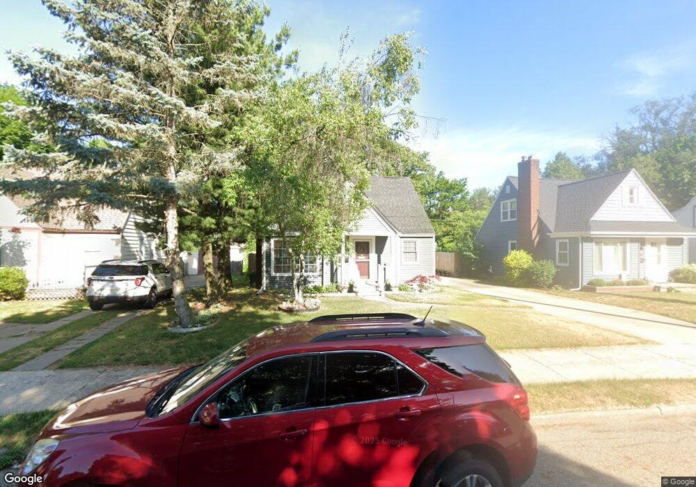
2157 Riverside Dr NE Grand Rapids, MI 49505
Creston NeighborhoodEstimated Value: $296,000 - $307,000
3
Beds
2
Baths
1
Sq Ft
$300,748/Sq Ft
Est. Value
About This Home
This home is located at 2157 Riverside Dr NE, Grand Rapids, MI 49505 and is currently estimated at $300,748, approximately $300,748 per square foot. 2157 Riverside Dr NE is a home located in Kent County with nearby schools including Riverside Middle School, Union High School, and ISJ Academy.
Ownership History
Date
Name
Owned For
Owner Type
Purchase Details
Closed on
Nov 20, 1997
Sold by
Reese Reese R R and Reese Lafave L
Bought by
Noel Lafave L and Noel Nancy E
Current Estimated Value
Purchase Details
Closed on
Mar 19, 1996
Sold by
Debuono Reese
Bought by
Noel Reese and Noel Nancy E
Purchase Details
Closed on
Feb 6, 1996
Sold by
Reese Reese R R
Bought by
Reese and Reese Devuon
Purchase Details
Closed on
Aug 16, 1995
Bought by
Noel Reese R and Noel Nancy E
Purchase Details
Closed on
Aug 11, 1995
Sold by
Reese Reese R R and Reese Devuono D
Bought by
Noel Devuono D and Noel Nancy E
Create a Home Valuation Report for This Property
The Home Valuation Report is an in-depth analysis detailing your home's value as well as a comparison with similar homes in the area
Home Values in the Area
Average Home Value in this Area
Purchase History
| Date | Buyer | Sale Price | Title Company |
|---|---|---|---|
| Noel Lafave L | $89,500 | -- | |
| Noel Reese | -- | -- | |
| Reese | -- | -- | |
| Noel Reese R | $59,000 | -- | |
| Noel Devuono D | -- | -- |
Source: Public Records
Tax History Compared to Growth
Tax History
| Year | Tax Paid | Tax Assessment Tax Assessment Total Assessment is a certain percentage of the fair market value that is determined by local assessors to be the total taxable value of land and additions on the property. | Land | Improvement |
|---|---|---|---|---|
| 2025 | $1,582 | $129,400 | $0 | $0 |
| 2024 | $1,582 | $119,200 | $0 | $0 |
| 2023 | $1,605 | $101,700 | $0 | $0 |
| 2022 | $1,524 | $82,800 | $0 | $0 |
| 2021 | $1,490 | $81,200 | $0 | $0 |
| 2020 | $1,425 | $75,300 | $0 | $0 |
| 2019 | $1,492 | $72,000 | $0 | $0 |
| 2018 | $1,441 | $65,000 | $0 | $0 |
| 2017 | $1,373 | $55,300 | $0 | $0 |
| 2016 | $1,389 | $51,500 | $0 | $0 |
| 2015 | $1,292 | $51,500 | $0 | $0 |
| 2013 | -- | $38,000 | $0 | $0 |
Source: Public Records
Map
Nearby Homes
- 68 Bowne St NE
- 16 Graceland St NE
- 122 Bowne St NE
- 22 Elmwood St NE
- 2060 Swensberg Ave NE
- 240 Eleanor St NE
- 2107 Prospect Ave NE
- 1922 Coit Ave NE
- 142 Burr Oak St NE
- 225 Burr Oak St NE
- 143 Dean St NE
- 2480 Lafayette Ave NE
- 30 Palmer St NW
- 155 Palmer St NE
- 2624 Monroe Ave NE
- 465 Kenwood St NE
- 483 Kenwood St NE
- 2630 Oakwood Ave NE
- 212 Saunders Ct NE
- 310 Sweet St NE
- 2203 Riverside Dr NE
- 2153 Riverside Dr NE
- 2207 Riverside Dr NE
- 2147 Riverside Dr NE
- 2200 Monroe Ave NW
- 2156 Monroe Ave NW
- 2206 Monroe Ave NW
- 2206 Monroe Ave NW
- 2152 Monroe Ave NW
- 2213 Riverside Dr NE
- 2210 Monroe Ave NW
- 2154 Riverside Dr NE
- 2143 Riverside Dr NE
- 2158 Riverside Dr NE
- 2150 Riverside Dr NE
- 2146 Monroe Ave NW
- 2202 Riverside Dr NE
- 2216 Monroe Ave NW
- 2217 Riverside Dr NE
- 2206 Riverside Dr NE