2157 Snyder Rd Butler, OH 44822
Estimated Value: $136,000 - $342,000
Highlights
- 20 Acre Lot
- Partially Wooded Lot
- Gentle Sloping Lot
- Meadow
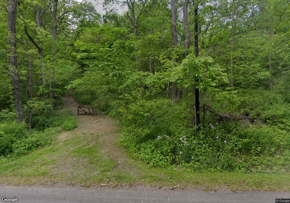
About This Lot
As of November 201520 Acres back long private drive. Partly wooded. Old home on property not habitable. Butler-Clear Fork schools. Would make great retreat or hunting land. No zoning.
Property Details
Property Type
- Land
Est. Annual Taxes
- $343
Lot Details
- 20 Acre Lot
- Gentle Sloping Lot
- Meadow
- Partially Wooded Lot
Listing and Financial Details
- Assessor Parcel Number 0491203713000
Ownership History
Purchase Details
Home Financials for this Owner
Home Financials are based on the most recent Mortgage that was taken out on this home.Home Values in the Area
Average Home Value in this Area
Purchase History
| Date | Buyer | Sale Price | Title Company |
|---|---|---|---|
| Wilson Michael D | $60,000 | Barrister Title Group |
Property History
| Date | Event | Price | List to Sale | Price per Sq Ft |
|---|---|---|---|---|
| 11/19/2015 11/19/15 | Sold | $60,000 | -20.0% | -- |
| 10/12/2015 10/12/15 | Pending | -- | -- | -- |
| 10/05/2015 10/05/15 | For Sale | $75,000 | -- | -- |
Tax History Compared to Growth
Tax History
| Year | Tax Paid | Tax Assessment Tax Assessment Total Assessment is a certain percentage of the fair market value that is determined by local assessors to be the total taxable value of land and additions on the property. | Land | Improvement |
|---|---|---|---|---|
| 2024 | $482 | $42,830 | $42,190 | $640 |
| 2023 | $482 | $42,830 | $42,190 | $640 |
| 2022 | $134 | $25,090 | $24,560 | $530 |
| 2021 | $145 | $25,090 | $24,560 | $530 |
| 2020 | $145 | $25,090 | $24,560 | $530 |
| 2019 | $239 | $21,000 | $20,470 | $530 |
| 2018 | $237 | $21,000 | $20,470 | $530 |
| 2017 | $438 | $30,710 | $23,450 | $7,260 |
| 2016 | $344 | $18,280 | $18,060 | $220 |
| 2015 | $344 | $18,280 | $18,060 | $220 |
| 2014 | $343 | $18,280 | $18,060 | $220 |
| 2012 | $149 | $15,270 | $15,050 | $220 |
Map
Source: Mansfield Association of REALTORS®
MLS Number: 9031397
APN: 049-12-037-13-000
Disclaimer: Certain information contained herein is derived from information provided by parties other than Homes.com. All information provided is deemed reliable, but is not guaranteed to be accurate and should be independently verified.
![]() IDX information is provided exclusively for personal, non-commercial use, and may not be used for any purpose other than to identify prospective properties consumers may be interested in purchasing. Information is deemed reliable but not guaranteed.
IDX information is provided exclusively for personal, non-commercial use, and may not be used for any purpose other than to identify prospective properties consumers may be interested in purchasing. Information is deemed reliable but not guaranteed.
- 2070 Riggle Rd
- 5449 Hagerman Rd
- 224 Blue Bird Dr
- 1259 State Route 97 E
- 1260 Ohio 97 Unit 115
- 128 College St
- 5042 Possum Run Rd
- 3898 Ohio 97
- 1169 State Route 97 E
- 4978 Bott Rd
- 4234 Swigart Rd
- 0 Kenton Rd
- 1302 Hathaway Rd
- 361 Honey Creek Rd E
- 3931 Hastings Newville Rd
- 0 Mill Rd
- 119 Yorkshire Rd
- 74 E Durbin Ave
- 6533 Durbin Rd
- 70 Betty Dr