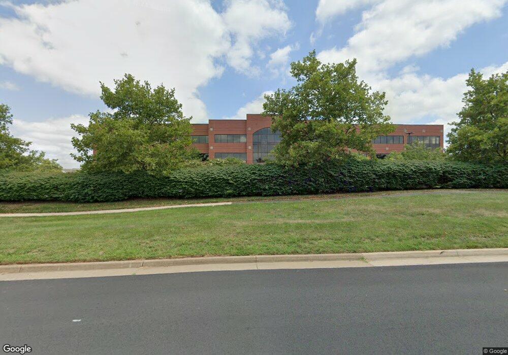
21575 Ridgetop Cir Sterling, VA 20166
Estimated Value: $8,967,372
--
Bed
--
Bath
94,719
Sq Ft
$95/Sq Ft
Est. Value
About This Home
This home is located at 21575 Ridgetop Cir, Sterling, VA 20166 and is currently estimated at $8,967,372, approximately $94 per square foot. 21575 Ridgetop Cir is a home located in Loudoun County with nearby schools including Countryside Elementary School, River Bend Middle School, and Potomac Falls High School.
Ownership History
Date
Name
Owned For
Owner Type
Purchase Details
Closed on
Sep 26, 2024
Sold by
Ridgetop Iii Llc
Bought by
Baps Sterling Llc
Current Estimated Value
Purchase Details
Closed on
Sep 30, 2016
Sold by
Ridgetop Three Llc A Maryland Limited Li
Bought by
Ridgetop Iii Llc A Virginia Limited Liab
Home Financials for this Owner
Home Financials are based on the most recent Mortgage that was taken out on this home.
Original Mortgage
$11,540,000
Interest Rate
3.43%
Mortgage Type
Commercial
Create a Home Valuation Report for This Property
The Home Valuation Report is an in-depth analysis detailing your home's value as well as a comparison with similar homes in the area
Home Values in the Area
Average Home Value in this Area
Purchase History
| Date | Buyer | Sale Price | Title Company |
|---|---|---|---|
| Baps Sterling Llc | $8,800,000 | None Listed On Document | |
| Ridgetop Iii Llc A Virginia Limited Liab | $13,312,500 | Residential Title & Esc Co |
Source: Public Records
Mortgage History
| Date | Status | Borrower | Loan Amount |
|---|---|---|---|
| Previous Owner | Ridgetop Iii Llc A Virginia Limited Liab | $11,540,000 |
Source: Public Records
Tax History Compared to Growth
Tax History
| Year | Tax Paid | Tax Assessment Tax Assessment Total Assessment is a certain percentage of the fair market value that is determined by local assessors to be the total taxable value of land and additions on the property. | Land | Improvement |
|---|---|---|---|---|
| 2025 | $63,470 | $6,861,600 | $2,846,200 | $4,015,400 |
| 2024 | $69,008 | $6,866,440 | $2,846,200 | $4,020,240 |
| 2023 | $85,753 | $6,880,010 | $2,587,500 | $4,292,510 |
| 2022 | $163,575 | $18,379,170 | $2,587,500 | $15,791,670 |
| 2021 | $178,476 | $18,211,800 | $2,587,500 | $15,624,300 |
| 2020 | $188,490 | $18,211,570 | $2,587,500 | $15,624,070 |
| 2019 | $189,390 | $18,123,440 | $2,328,700 | $15,794,740 |
| 2018 | $195,692 | $18,036,150 | $2,328,700 | $15,707,450 |
| 2017 | $202,909 | $18,036,350 | $2,328,700 | $15,707,650 |
| 2016 | $230,382 | $20,120,680 | $0 | $0 |
| 2015 | $241,017 | $18,906,300 | $0 | $18,906,300 |
| 2014 | $217,448 | $16,627,350 | $0 | $16,627,350 |
Source: Public Records
Map
Nearby Homes
- 0 Tbd Unit VALO2092290
- 46320 Mount Milstead Terrace Unit 301
- 21124 Angela Square
- 46330 Mount Kellogg Terrace
- 46134 Brisbane Square
- 46220 Walpole Terrace
- 46212 Wales Terrace
- 45928 Swallow Terrace
- 46186 Aisquith Terrace
- 113 Connemara Dr
- 21914 Hawksbill High Cir Unit 304
- 46434 Rose River Terrace
- 46440 Beartown Dr
- 20970 Promontory Square
- 805 N York Rd
- 25 Jefferson Dr
- 10 Crouch St
- 735 Brethour Ct Unit 4
- 21098 Fireside Ct
- 2 Berkeley Ct
- 21545 Ridgetop Cir
- 46100 Woodshire Dr
- 21525 Ridgetop Cir
- 21631 Ridgetop Cir Unit SECOND FLOOR
- 21260 Springlake Ct
- 21630 Ridgetop Cir
- 21331 Gentry Dr
- 46120 Woodshire Dr
- 21515 Ridgetop Cir
- 21290 Springlake Ct
- 21351 Gentry Dr Unit 145
- 21351 Gentry Dr Unit 270
- 21351 Gentry Dr Unit 110
- 21351 Gentry Dr Unit 245
- 21351 Gentry Dr Unit 200
- 21351 Gentry Dr Unit 125
- 21351 Gentry Dr Unit 210
- 21351 Gentry Dr Unit 205
- 21351 Gentry Dr Unit 255
- 21351 Gentry Dr Unit 255