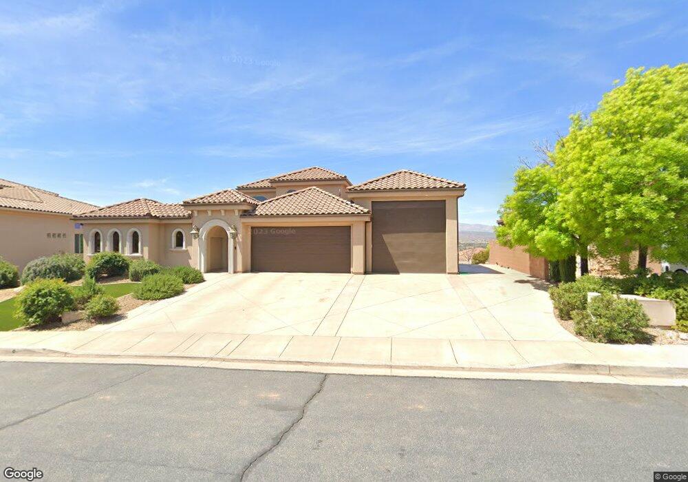
2159 Lone Rock Dr Saint George, UT 84770
Estimated Value: $906,000 - $1,398,000
7
Beds
4
Baths
4,700
Sq Ft
$223/Sq Ft
Est. Value
About This Home
This home is located at 2159 Lone Rock Dr, Saint George, UT 84770 and is currently estimated at $1,050,166, approximately $223 per square foot. 2159 Lone Rock Dr is a home located in Washington County with nearby schools including Snow Canyon Middle School, Diamond Valley School, and Lava Ridge Intermediate School.
Ownership History
Date
Name
Owned For
Owner Type
Purchase Details
Closed on
Apr 3, 2024
Sold by
Lewis Scott
Bought by
Scott And Jamie Lewis Trust and Lewis
Current Estimated Value
Purchase Details
Closed on
Jan 3, 2022
Sold by
David Morgan Michael
Bought by
Michael David Morgan Living Trust
Home Financials for this Owner
Home Financials are based on the most recent Mortgage that was taken out on this home.
Original Mortgage
$485,000
Interest Rate
3.11%
Mortgage Type
New Conventional
Purchase Details
Closed on
Dec 28, 2021
Sold by
Pomeroy Chad and The Michael David Morgan Livin
Bought by
Lewis Scott
Home Financials for this Owner
Home Financials are based on the most recent Mortgage that was taken out on this home.
Original Mortgage
$485,000
Interest Rate
3.11%
Mortgage Type
New Conventional
Purchase Details
Closed on
May 26, 2015
Sold by
Morgan Michael D
Bought by
Morgan Michael David and Michael David Morgan Living Tr
Purchase Details
Closed on
Aug 29, 2007
Sold by
Lloyd Richard D and Lloyd Shauna A
Bought by
Morgan Michael D
Create a Home Valuation Report for This Property
The Home Valuation Report is an in-depth analysis detailing your home's value as well as a comparison with similar homes in the area
Home Values in the Area
Average Home Value in this Area
Purchase History
| Date | Buyer | Sale Price | Title Company |
|---|---|---|---|
| Scott And Jamie Lewis Trust | -- | None Listed On Document | |
| Michael David Morgan Living Trust | -- | -- | |
| Lewis Scott | -- | Eagle Gate Ttl Ins Agcy Inc | |
| Michael David Morgan Living Trust | -- | -- | |
| Morgan Michael David | -- | None Available | |
| Morgan Michael D | -- | Southern Utah Title Co |
Source: Public Records
Mortgage History
| Date | Status | Borrower | Loan Amount |
|---|---|---|---|
| Previous Owner | Lewis Scott | $485,000 |
Source: Public Records
Tax History Compared to Growth
Tax History
| Year | Tax Paid | Tax Assessment Tax Assessment Total Assessment is a certain percentage of the fair market value that is determined by local assessors to be the total taxable value of land and additions on the property. | Land | Improvement |
|---|---|---|---|---|
| 2025 | $3,460 | $525,690 | $112,200 | $413,490 |
| 2023 | $3,210 | $479,600 | $105,600 | $374,000 |
| 2022 | $3,621 | $535,755 | $99,000 | $436,755 |
| 2021 | $3,562 | $746,300 | $150,000 | $596,300 |
| 2020 | $3,319 | $655,000 | $120,000 | $535,000 |
| 2019 | $3,353 | $646,400 | $120,000 | $526,400 |
| 2018 | $3,316 | $330,055 | $0 | $0 |
| 2017 | $3,280 | $317,020 | $0 | $0 |
| 2016 | $3,586 | $320,485 | $0 | $0 |
| 2015 | $3,454 | $296,175 | $0 | $0 |
| 2014 | -- | $281,600 | $0 | $0 |
Source: Public Records
Map
Nearby Homes
- 2294 N Gunsight Dr
- 1996 W 1940 N
- 2090 N Tuweap Dr Unit 13
- 2090 N Tuweap Dr Unit 9
- 2090 N Tuweap Dr Unit 15
- 2090 N Tuweap Dr Unit 56
- 2139 W Cougar Rock Cir Unit 192
- 2139 W Cougar Rock Cir
- 2139 W Cougar Rock Cir Unit 131
- 2139 W Cougar Rock Cir Unit 179
- 2139 W Cougar Rock Cir Unit 135
- 2139 W Cougar Rock Cir Unit 192
- 2139 W Cougar Rock Cir Unit 195
- 2139 W Cougar Rock Cir Unit 182
- 2195 W 1970 Cir N
- 1989 W 1800 N
- 2255 N Tuweap Dr Unit 14
- 2255 N Tuweap Dr Unit 58
- 2255 N Tuweap Dr Unit 54
- 2153 Lone Rock Dr
- 2159 N Lone Rock Dr
- 2141 N Lone Rock Dr Unit 64
- 2141 N Lone Rock Dr
- 2156 Lone Rock Dr
- 2156 N Lone Rock Dr
- 2171 Lone Rock Dr
- 2171 N Lone Rock Dr
- 2141 Lone Rock Dr
- 2152 N Gunsight Dr
- 2140 N Gunsight Dr
- 2134 Lone Rock Dr
- 2174 Lone Rock Dr
- 2134 N Lone Rock Dr
- 2164 N Gunsight Dr
- 2174 N Lone Rock Dr
- 2126 N Gunsight Dr
- 2126 N Gunsight Dr Unit Lot 87
- 2129 N Lone Rock Dr
- 2129 Lone Rock Dr