Estimated Value: $416,000 - $463,000
4
Beds
4
Baths
2,005
Sq Ft
$219/Sq Ft
Est. Value
About This Home
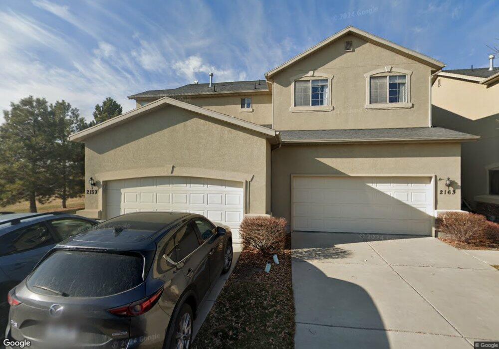
This home is located at 2159 N 2080 W, Lehi, UT 84043 and is currently estimated at $439,019, approximately $218 per square foot. 2159 N 2080 W is a home located in Utah County with nearby schools including Liberty Hills Elementary School, Skyridge High School, and Ascent Academies of Utah - Lehi Campus.
Ownership History
Date
Name
Owned For
Owner Type
Purchase Details
Closed on
Nov 23, 2020
Sold by
Ashby Spencer
Bought by
Ashby Spencer
Current Estimated Value
Home Financials for this Owner
Home Financials are based on the most recent Mortgage that was taken out on this home.
Original Mortgage
$273,780
Outstanding Balance
$243,625
Interest Rate
2.8%
Mortgage Type
New Conventional
Estimated Equity
$195,394
Purchase Details
Closed on
Jun 20, 2019
Sold by
Ashby Spencer
Bought by
Ashby Spencer and Ashby Emily Anne
Home Financials for this Owner
Home Financials are based on the most recent Mortgage that was taken out on this home.
Original Mortgage
$233,500
Interest Rate
4%
Mortgage Type
New Conventional
Purchase Details
Closed on
Mar 17, 2017
Sold by
Puurrington Daniel Lee and Puurrington Mandi
Bought by
Ashby Spencer and Smith Emily Anne
Home Financials for this Owner
Home Financials are based on the most recent Mortgage that was taken out on this home.
Original Mortgage
$220,924
Interest Rate
4.5%
Mortgage Type
FHA
Purchase Details
Closed on
Oct 26, 2015
Sold by
Purrington Daniel
Bought by
Purrington Daniel Lee and Purrington Mandi
Home Financials for this Owner
Home Financials are based on the most recent Mortgage that was taken out on this home.
Original Mortgage
$108,600
Interest Rate
3.87%
Mortgage Type
New Conventional
Purchase Details
Closed on
Nov 3, 2009
Sold by
The Secretary Of Housing & Urban Develop
Bought by
Purrington Daniel
Home Financials for this Owner
Home Financials are based on the most recent Mortgage that was taken out on this home.
Original Mortgage
$160,261
Interest Rate
5.02%
Mortgage Type
FHA
Purchase Details
Closed on
Apr 14, 2009
Sold by
Rios Christian and Quilaqueo Ingrid
Bought by
Wells Fargo Bank Na
Purchase Details
Closed on
Jan 19, 2009
Sold by
Wells Fargo Bank Na
Bought by
Secretary Of Housing & Urban Development
Purchase Details
Closed on
Apr 17, 2006
Sold by
Pointe Meadows Townhomes Llc
Bought by
Rios Christian and Quilaqueo Ingrid
Home Financials for this Owner
Home Financials are based on the most recent Mortgage that was taken out on this home.
Original Mortgage
$177,219
Interest Rate
6.29%
Mortgage Type
FHA
Create a Home Valuation Report for This Property
The Home Valuation Report is an in-depth analysis detailing your home's value as well as a comparison with similar homes in the area
Home Values in the Area
Average Home Value in this Area
Purchase History
| Date | Buyer | Sale Price | Title Company |
|---|---|---|---|
| Ashby Spencer | -- | Capstone Title & Escrow Inc | |
| Ashby Spencer | -- | Capstone Title & Escrow Inc | |
| Ashby Spencer | -- | Vanguard Title Ins Agcy Llc | |
| Ashby Spencer | -- | Vanguard Title Ins Agcy Llc | |
| Ashby Spencer | -- | First American | |
| Purrington Daniel Lee | -- | Accommodation | |
| Purrington Daniel | -- | Monument Title Insurance I | |
| Wells Fargo Bank Na | $193,923 | Etitle Insurance Agency | |
| Secretary Of Housing & Urban Development | -- | Etitle Insurance Agency | |
| Rios Christian | -- | Cottonwood Title Insurance |
Source: Public Records
Mortgage History
| Date | Status | Borrower | Loan Amount |
|---|---|---|---|
| Open | Ashby Spencer | $273,780 | |
| Closed | Ashby Spencer | $233,500 | |
| Previous Owner | Ashby Spencer | $220,924 | |
| Previous Owner | Purrington Daniel Lee | $108,600 | |
| Previous Owner | Purrington Daniel | $160,261 | |
| Previous Owner | Rios Christian | $177,219 |
Source: Public Records
Tax History Compared to Growth
Tax History
| Year | Tax Paid | Tax Assessment Tax Assessment Total Assessment is a certain percentage of the fair market value that is determined by local assessors to be the total taxable value of land and additions on the property. | Land | Improvement |
|---|---|---|---|---|
| 2025 | $1,951 | $223,685 | $59,800 | $346,900 |
| 2024 | $1,951 | $228,305 | $0 | $0 |
| 2023 | $1,721 | $218,680 | $0 | $0 |
| 2022 | $1,786 | $219,945 | $0 | $0 |
| 2021 | $1,615 | $300,700 | $45,100 | $255,600 |
| 2020 | $1,525 | $280,700 | $42,100 | $238,600 |
| 2019 | $1,302 | $249,100 | $37,400 | $211,700 |
| 2018 | $1,233 | $223,100 | $33,500 | $189,600 |
| 2017 | $1,116 | $107,305 | $0 | $0 |
| 2016 | $1,202 | $107,305 | $0 | $0 |
| 2015 | $1,266 | $107,250 | $0 | $0 |
| 2014 | $1,078 | $90,750 | $0 | $0 |
Source: Public Records
Map
Nearby Homes
- 1968 N 2040 W Unit 40
- 1969 N 2040 St W
- 2013 N 2040 W
- 1990 N 2040 W
- 1990 N 2040 W Unit 41
- 1912 W 2250 N
- 1898 W Pointe Meadow Loop
- 2196 N 2350 W
- 1970 N 2090 St W
- 1882 N 2230 St W Unit 24
- 2191 W Swift Fox Dr Unit 274
- 999 Empire St
- 2184 W Cape Fox Way N Unit 220
- 1920 N 2230 St W Unit 27
- 1060 N Canvasback Dr Unit 405
- 500 S Center St E
- 1672 S 70 W
- 2209 W Swift Fox Way Unit 271
- 2179 W Swift Fox Way Unit 276
- 2178 W Cape Fox Way Unit 221
- 2163 N 2080 W
- 2167 N 2080 W
- 2101 W 2180 N
- 2173 N 2080 W Unit 14D
- 2107 W 2180 N
- 2111 W 2180 N
- 2117 W 2180 N
- 2162 N 2080 W
- 2168 N 2080 W
- 2172 N 2080 W
- 2178 N 2080 W
- 2088 W 2180 N
- 2088 W 2180 N Unit 20A
- 2094 W 2180 N
- 2121 W 2180 N
- 2098 W 2180 N
- 2084 W 2180 N
- 2084 W 2180 N Unit 20B
- 2159 N 2040 W
- 2104 W 2180 N