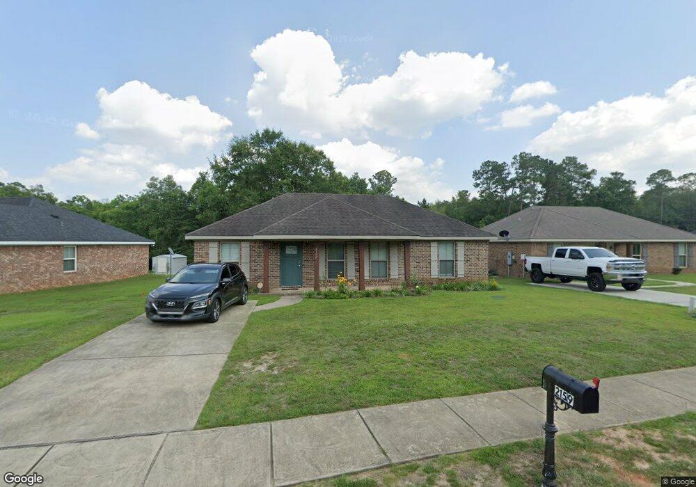
2159 Wolf Branch Dr N Unit 84 Mobile, AL 36608
Outer West Mobile NeighborhoodEstimated Value: $212,235 - $254,000
Studio
--
Bath
1,269
Sq Ft
$188/Sq Ft
Est. Value
About This Home
This home is located at 2159 Wolf Branch Dr N Unit 84, Mobile, AL 36608 and is currently estimated at $238,059, approximately $187 per square foot. 2159 Wolf Branch Dr N Unit 84 is a home located in Mobile County with nearby schools including Taylor White Elementary School, Bernice J Causey Middle School, and Baker High School.
Ownership History
Date
Name
Owned For
Owner Type
Purchase Details
Closed on
May 16, 2016
Sold by
M P Properties Llc
Bought by
Bryant R Clark R and Bryant Regina
Current Estimated Value
Home Financials for this Owner
Home Financials are based on the most recent Mortgage that was taken out on this home.
Original Mortgage
$124,337
Outstanding Balance
$98,340
Interest Rate
3.71%
Mortgage Type
VA
Estimated Equity
$139,719
Create a Home Valuation Report for This Property
The Home Valuation Report is an in-depth analysis detailing your home's value as well as a comparison with similar homes in the area
Home Values in the Area
Average Home Value in this Area
Purchase History
| Date | Buyer | Sale Price | Title Company |
|---|---|---|---|
| Bryant R Clark R | $132,500 | Surety Land Title Inc |
Source: Public Records
Mortgage History
| Date | Status | Borrower | Loan Amount |
|---|---|---|---|
| Open | Bryant R Clark R | $124,337 |
Source: Public Records
Tax History
| Year | Tax Paid | Tax Assessment Tax Assessment Total Assessment is a certain percentage of the fair market value that is determined by local assessors to be the total taxable value of land and additions on the property. | Land | Improvement |
|---|---|---|---|---|
| 2025 | -- | $18,720 | $4,000 | $14,720 |
| 2024 | -- | $17,950 | $4,000 | $13,950 |
| 2023 | $0 | $15,950 | $3,600 | $12,350 |
| 2022 | $0 | $13,940 | $2,990 | $10,950 |
| 2021 | $243 | $12,230 | $2,600 | $9,630 |
| 2020 | $243 | $12,330 | $2,600 | $9,730 |
| 2019 | $243 | $12,000 | $0 | $0 |
| 2018 | $0 | $10,980 | $0 | $0 |
| 2017 | $0 | $11,160 | $0 | $0 |
| 2016 | $243 | $5,000 | $0 | $0 |
| 2013 | $150 | $3,100 | $0 | $0 |
Source: Public Records
Map
Nearby Homes
- 2119 Lumpkin Grove Ln Unit 2
- 11900 Liberty Dr S
- 2201 Liberty Dr E
- 12171 Yancey Glen Dr
- 2978 Branson Park Ct
- 3137 Busby Rd
- 1778 Trail Side Way
- 1762 Trail Side Way
- 1734 Trail Side Way
- 1716 Trail Side Way
- 1688 Trail Side Way
- 1674 Trail Side Way
- 1658 Trail Side Way
- 0 Newman Rd Unit 25399577
- 0 Newman Rd Unit 7652668
- 0 Newman Rd Unit 7670125
- 0 Newman Rd Unit 25537843
- 13045 Oak Forge Dr
- 0 Deer Crest Dr Unit 4
- 0 Deer Crest Dr Unit 7552478
- 2159 Wolf Branch Dr N
- 2137 Wolf Branch Dr N Unit 83
- 2137 Wolf Branch Dr N
- 2181 Wolf Branch Dr N
- 2144 Wolf Branch Dr N
- 2131 Wolf Branch Dr N Unit 82
- 2131 Wolf Branch Dr N
- 2152 Wolf Branch Dr N
- 2144 Wolf Branch Dr N
- 2144 Lumpkin Grove Ln
- 2160 Wolf Branch Dr N Unit 65
- 2123 Wolf Branch Dr N
- 2168 Wolf Branch Dr N
- 2176 Wolf Branch Dr N
- 2185 Wolf Branch Dr S
- 2184 Wolf Branch Dr S
- 2202 Wolf Branch Dr S Unit 59
- 2115 Wolf Branch Dr N Unit 80
- 2115 Wolf Branch Dr N
- 2143 Lumpkin Grove Ln
Your Personal Tour Guide
Ask me questions while you tour the home.