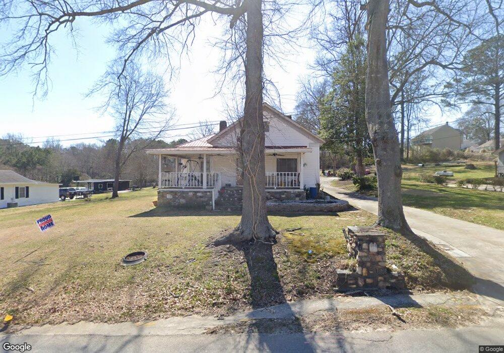
216 Anderson Rd Villa Rica, GA 30180
Estimated Value: $209,000 - $279,726
4
Beds
1
Bath
1,304
Sq Ft
$193/Sq Ft
Est. Value
About This Home
This home is located at 216 Anderson Rd, Villa Rica, GA 30180 and is currently estimated at $251,432, approximately $192 per square foot. 216 Anderson Rd is a home located in Carroll County with nearby schools including Glanton-Hindsman Elementary School, Villa Rica Middle School, and Villa Rica High School.
Ownership History
Date
Name
Owned For
Owner Type
Purchase Details
Closed on
Jun 15, 2024
Sold by
Dobbs Lester
Bought by
Dobbs Farmer Aleta and Lester Dobbs Lester
Current Estimated Value
Purchase Details
Closed on
May 14, 2003
Sold by
Dobbs Lester
Bought by
Dobbs Lester and Dobbs Ruth
Purchase Details
Closed on
May 8, 2003
Sold by
Dobbs Ruth
Bought by
Dobbs Lester
Purchase Details
Closed on
Oct 29, 2001
Sold by
Dobbs Ruth
Bought by
Dobbs Ruth and Dobbs Lester
Purchase Details
Closed on
Oct 26, 2001
Sold by
Brewer Betty
Bought by
Dobbs Ruth
Purchase Details
Closed on
Feb 24, 1999
Sold by
Bohanan Roy Est
Bought by
Brewer Betty and Brewer
Purchase Details
Closed on
Jul 11, 1994
Bought by
Bohanan Roy
Purchase Details
Closed on
Jun 1, 1981
Sold by
Bohanan Roy
Bought by
Brewer Betty and Brewer
Create a Home Valuation Report for This Property
The Home Valuation Report is an in-depth analysis detailing your home's value as well as a comparison with similar homes in the area
Home Values in the Area
Average Home Value in this Area
Purchase History
| Date | Buyer | Sale Price | Title Company |
|---|---|---|---|
| Dobbs Farmer Aleta | -- | -- | |
| Dobbs Lester | -- | -- | |
| Dobbs Lester | -- | -- | |
| Dobbs Ruth | -- | -- | |
| Dobbs Ruth | -- | -- | |
| Brewer Betty | -- | -- | |
| Bohanan Roy | -- | -- | |
| Brewer Betty | -- | -- |
Source: Public Records
Tax History Compared to Growth
Tax History
| Year | Tax Paid | Tax Assessment Tax Assessment Total Assessment is a certain percentage of the fair market value that is determined by local assessors to be the total taxable value of land and additions on the property. | Land | Improvement |
|---|---|---|---|---|
| 2024 | -- | $108,670 | $62,815 | $45,855 |
| 2023 | $557 | $104,558 | $62,816 | $41,742 |
| 2022 | $534 | $75,345 | $41,877 | $33,468 |
| 2021 | $437 | $59,739 | $31,020 | $28,719 |
| 2020 | $419 | $56,836 | $31,020 | $25,816 |
| 2019 | $384 | $54,398 | $31,020 | $23,378 |
| 2018 | $389 | $51,984 | $31,020 | $20,964 |
| 2017 | $321 | $30,889 | $9,925 | $20,964 |
| 2016 | $124 | $30,889 | $9,925 | $20,964 |
| 2015 | $125 | $32,792 | $17,680 | $15,112 |
| 2014 | $126 | $32,792 | $17,680 | $15,112 |
Source: Public Records
Map
Nearby Homes
- 113 W Gordon St
- 224 Crest Creek Way
- 0 Church Ln Unit 10633475
- 0 Church Ln Unit 7673213
- 0 Church Ln Unit 155
- 506 Northside Place
- 413 Dallas Hwy
- 1395 Georgia 61
- 1385 Georgia 61
- 162 Parkway Cir
- 212 Rockmart Rd
- 25 Stoneway Dr
- 208 N North Dogwood St
- 208 N Dogwood St
- 915 Sundown Point
- 913 Sundown Point
- 511 Punkintown Rd
- 0 Conners Rd Unit 10569546
- 0 White St
- 318 N Dogwood St
- 212 Anderson Rd
- 220 Anderson Rd
- 219 Anderson Rd
- 210 Anderson Rd
- 307 Anderson Rd
- 106 Pin Oak Trail
- 215 Anderson Rd
- 206 Anderson Rd
- 112 Pin Oak Trail
- 209 Anderson Rd
- 0 Pin Oak Trail Unit 20009509
- 0 Pin Oak Trail Unit 8300209
- 0 Pin Oak Trail Unit 9030435
- 0 Pin Oak Trail Unit 9038254
- 0 Pin Oak Trail Unit 6908803
- 0 Pin Oak Trail Unit 3177650
- 0 Pin Oak Trail Unit 3236228
- 0 Pin Oak Trail Unit 7033816
- 0 Pin Oak Trail Unit 7068671
- 0 Pin Oak Trail Unit 7147323