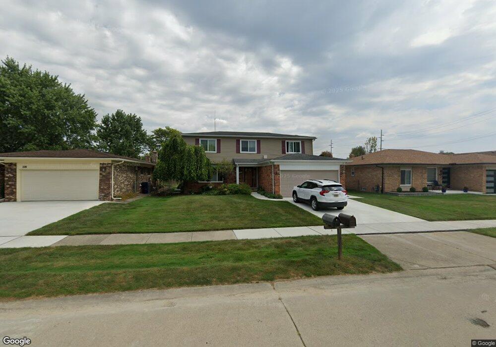
216 Brittany Dr Canton, MI 48187
Estimated Value: $369,000 - $418,000
--
Bed
2
Baths
2,000
Sq Ft
$193/Sq Ft
Est. Value
About This Home
This home is located at 216 Brittany Dr, Canton, MI 48187 and is currently estimated at $385,545, approximately $192 per square foot. 216 Brittany Dr is a home located in Wayne County with nearby schools including Canton High School, Discovery Middle School, and Salem High School.
Ownership History
Date
Name
Owned For
Owner Type
Purchase Details
Closed on
Jul 17, 2006
Sold by
Darby Robert A and Darby Carole
Bought by
Amilivia Dora
Current Estimated Value
Create a Home Valuation Report for This Property
The Home Valuation Report is an in-depth analysis detailing your home's value as well as a comparison with similar homes in the area
Home Values in the Area
Average Home Value in this Area
Purchase History
| Date | Buyer | Sale Price | Title Company |
|---|---|---|---|
| Amilivia Dora | $210,000 | Multiple |
Source: Public Records
Tax History Compared to Growth
Tax History
| Year | Tax Paid | Tax Assessment Tax Assessment Total Assessment is a certain percentage of the fair market value that is determined by local assessors to be the total taxable value of land and additions on the property. | Land | Improvement |
|---|---|---|---|---|
| 2025 | $1,501 | $163,100 | $0 | $0 |
| 2024 | $1,501 | $149,100 | $0 | $0 |
| 2023 | $1,431 | $132,900 | $0 | $0 |
| 2022 | $3,196 | $117,100 | $0 | $0 |
| 2021 | $3,101 | $115,500 | $0 | $0 |
| 2020 | $3,061 | $110,900 | $0 | $0 |
| 2019 | $3,005 | $101,220 | $0 | $0 |
| 2018 | $1,216 | $93,490 | $0 | $0 |
| 2017 | $3,122 | $92,800 | $0 | $0 |
| 2016 | $2,740 | $95,100 | $0 | $0 |
| 2015 | $6,681 | $85,340 | $0 | $0 |
| 2013 | $6,472 | $67,330 | $0 | $0 |
| 2010 | -- | $72,890 | $39,000 | $33,890 |
Source: Public Records
Map
Nearby Homes
- 437 Corinne Blvd
- 278 Cornell St
- 44150 Duchess Dr
- 1322 Saltz Ct
- 603 Concord Dr Unit 67
- 550 Concord Dr Unit 75
- 42771 Lilley Pointe Dr Unit 154
- 42789 Lilley Pointe Dr Unit 146
- 227 Edington Cir
- 44893 Fair Oaks Dr
- 42697 Redfern St
- 288 Edington Cir Unit 61
- 1494 Ranier Blvd
- 45030 Glengarry Rd
- 5887 Northford
- 43592 Champlain Ct
- 678 Kings Way
- 42481 Lilley Pointe Dr Unit 33
- 42479 Redfern St
- 1822 N Sheldon Rd
- 204 Brittany Dr
- 228 Brittany Dr
- 170 Brittany Dr
- 240 Brittany Dr
- 215 Nassau Ct
- 203 Nassau Ct
- 227 Nassau Ct
- 169 Nassau Ct
- 239 Nassau Ct
- 252 Brittany Dr
- 156 Brittany Dr
- 217 Brittany Dr
- 205 Brittany Dr
- 229 Brittany Dr
- 171 Brittany Dr
- 251 Nassau Ct
- 241 Brittany Dr
- 155 Nassau Ct
- 264 Brittany Dr
- 157 Brittany Dr